News Summary
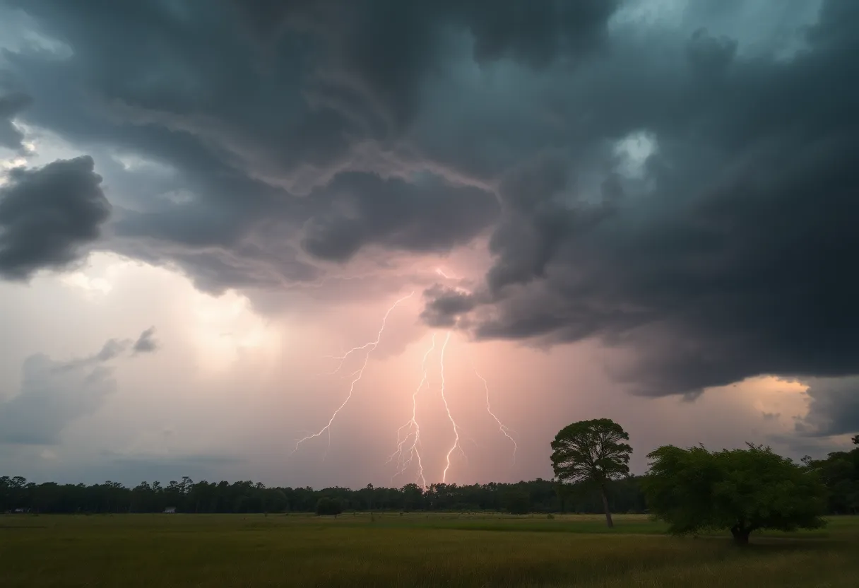
A severe thunderstorm warning has been issued for several counties in South Carolina, including Greenville, as high winds and hail are expected to impact residents. The National Weather Service reported gusts up to 60 mph and hail reaching 0.75 inches. Residents are advised to take shelter and remain alert for sudden weather changes. Coastal areas, including Wilmington, North Carolina, are also under storm predictions, with gale warnings for mariners in Southeast and Northeast South Carolina. Proper preparation and safety measures are emphasized as the severe weather approaches.
Greenville, SC – A severe thunderstorm warning has been issued for multiple counties in South Carolina, with significant weather conditions expected to affect residents in Elbert, Hart, Henderson, Polk, Transylvania, Abbeville, Anderson, Greenville, Oconee, and Pickens counties. The National Weather Service (NWS) reported the warning at 8:12 p.m. on June 17, amid forecasts of high winds and hail.
Forecasters anticipate wind gusts reaching up to 60 mph and hail measuring as large as 0.75 inches. As a safety precaution, residents are advised to take shelter in an interior room on the lowest floor of their homes or buildings to protect themselves from potential damage due to the severe weather.
At 8:49 p.m. EDT, severe thunderstorms have been detected along a line stretching from Hendersonville to Columbus, moving northeast at a speed of 50 mph. Key locations that may experience adverse weather include Greenville Downtown, Spartanburg, Shelby, Gaffney, and Laurens. Residents in these areas should remain alert and prepared for sudden weather changes.
In a related warning issued prior to the late evening alert, at 7:09 p.m. on June 7, the NWS alerted residents in Elbert, Franklin, Hart, Abbeville, and Anderson counties about similar threats. This earlier warning highlighted hazards such as 60 mph wind gusts, which pose risks of damaging trees and power lines across the region.
The NWS has also emphasized caution for those near Lake Hartwell, advising residents to stay away from the water during thunderstorms due to increasing risks. Powerful thunderstorms are expected to bring gusts that could exceed 60 mph, heightening the likelihood of power outages and fallen tree limbs as storm systems move through the area.
The severe weather does not end in South Carolina; forecasts indicate that Wilmington, North Carolina, is also preparing for storms on Wednesday. The NWS predicts that Wilmington may see a precipitation likelihood of 100 percent throughout the day, with strong winds from the south reaching speeds of 22 to 30 mph.
In conjunction with the storm warnings, mariners in Southeast and Northeast South Carolina coastal waters are under a gale warning effective from 7 a.m. to 7 p.m. on Wednesday. Coastal conditions are expected to be precarious, with south winds anticipated at 20 to 30 knots, and gusts could reach up to 40 knots. Sea swells between 7 and 11 feet are also likely.
Additionally, a high surf advisory has been issued for coastal Brunswick County, highlighting dangerously rough seas for swimming and surfing activities.
The NWS has warned that the severe weather brings a range of hazards, including large hail, the potential for tornadoes, frequent lightning, and minor flooding across the affected areas. Residents are encouraged to stay informed and vigilant as the situation develops and to report any occurrences of damaging winds, hail, or flooding to the NWS via their toll-free number or social media channels.
As the severe weather approaches, community members are urged to secure property, prepare emergency kits, and stay tuned for updates from local authorities. Proper preparation can mitigate the impact of the projected storms and ensure the safety of everyone in the path of these severe conditions.
Deeper Dive: News & Info About This Topic
HERE Resources
Severe Storms Alert for South Carolina Residents
Severe Thunderstorm Warnings Hit Charleston Area
Severe Thunderstorms and Flash Flooding Alert for York and Lancaster Counties
Oconee on Alert for Incoming Severe Thunderstorms
Severe Thunderstorm Alerts Issued for South Carolina Regions
Rock Hill First Responders Collect Cereal for Local Charity
Severe Thunderstorm Caution Issued for Chester and York Counties
Thunderstorm Warnings Issued for Greenville-Spartanburg Area
Severe Thunderstorm Warning in Cherokee and Spartanburg Counties
Severe Thunderstorm Warning Issued for Henderson County
Additional Resources
- Greenville Online
- Wikipedia: Severe thunderstorm warning
- Independent Mail
- Google Search: Severe thunderstorm Anderson County June 7
- Wavy
- Encyclopedia Britannica: Weather alert
- Star News Online
- Google News: Severe weather Wilmington North Carolina

Author: STAFF HERE ROCK HILL
The ROCK HILL STAFF WRITER represents the experienced team at HERERockHill.com, your go-to source for actionable local news and information in Rock Hill, York County, and beyond. Specializing in "news you can use," we cover essential topics like product reviews for personal and business needs, local business directories, politics, real estate trends, neighborhood insights, and state news affecting the area—with deep expertise drawn from years of dedicated reporting and strong community input, including local press releases and business updates. We deliver top reporting on high-value events such as the Come-See-Me Festival, Rock Hill Arts Festival, and motorsport events at the Rock Hill Velodrome. Our coverage extends to key organizations like the Rock Hill Chamber of Commerce and the Culture & Heritage Museums, plus leading businesses in manufacturing and technology that power the local economy such as 3D Systems and Comporium. As part of the broader HERE network, including HEREAiken.com, HEREBeaufort.com, HEREChapin.com, HERECharleston.com, HEREClinton.com, HEREColumbia.com, HEREGeorgetown.com, HEREGreenwood.com, HEREGreenville.com, HEREHiltonHead.com, HEREIrmo.com, HEREMyrtleBeach.com, HERENewberry.com, HERERockHill.com, and HERESpartanburg.com, we provide comprehensive, credible insights into South Carolina's dynamic landscape.


