News Summary
The National Weather Service has issued severe thunderstorm warnings for Laurens, Union, and Spartanburg counties until 5:30 p.m. Residents should prepare for strong storms with wind gusts up to 40 mph, along with potential localized flooding. Doppler radar indicates a line of thunderstorms advancing eastward. Residents are advised to seek shelter and avoid flooded roadways during this hazardous weather event.
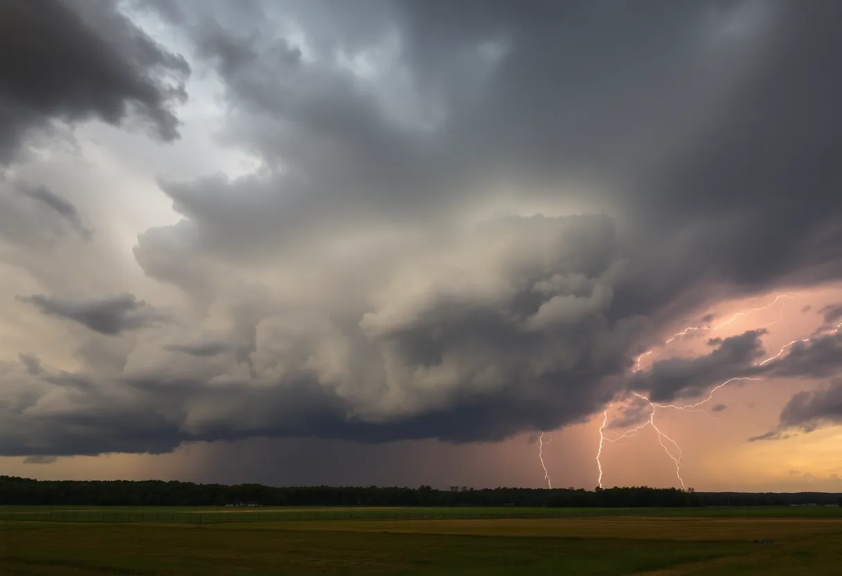
Spartanburg, SC – The National Weather Service (NWS) Greenville-Spartanburg has issued severe thunderstorm warnings for Laurens, Union, and Spartanburg counties, effective until 5:30 p.m. on Thursday. Residents in these areas should anticipate strong thunderstorms accompanied by wind gusts reaching speeds of up to 40 mph. The NWS has warned that these gusty winds may result in downed tree limbs and unsecured objects being blown around.
As of 4:23 p.m., Doppler radar indicated a line of strong thunderstorms stretching from approximately 17 miles south of Spartanburg to regions nearby Laurens and Greenwood, moving towards the east at a speed of 25 mph. The areas directly at risk include Laurens, Clinton, Woodruff, Joanna, Buffalo, Waterloo, Rose Hill State Park, Mountville, Kinards, and Enoree.
In addition to wind hazards, torrential rainfall associated with these storms poses a risk of localized flooding. Residents are cautioned against driving through any flooded roadways, as this can lead to dangerous situations.
In light of this severe weather warning, the NWS advises that residents take precautions by seeking shelter indoors if they are currently outside. With thunderstorms, the likelihood of lightning increases significantly as the storm approaches, peaking when directly overhead. It is important to stay away from open areas and tall, isolated trees, and to avoid using wired electronic devices during storms.
The occurrence of lightning in the United States totals around 25 million times annually, primarily in summer months, resulting in approximately 20 fatalities each year. Safety measures during thunderstorms include staying indoors and away from windows.
Recent Thunderstorm Warnings
A separate severe thunderstorm warning was also issued for Spartanburg County at 4:17 p.m. earlier this week, forecasting winds as strong as 60 mph and hail reaching up to 1 inch in size. This thunderstorm was observed six miles south of Spartanburg, moving southeast at approximately 15 mph. Expected impacts from this storm include minor hail damage to vehicles and wind damage to trees and power lines in nearby locations, including Roebuck, Moore, Pauline, Croft State Park, and Spartanburg.
This warning preceded the earlier alert, which was due to expire at 4:45 p.m. Additionally, a severe thunderstorm warning was issued for multiple counties, including Elbert, Hart, Henderson, Polk, Transylvania, Abbeville, Anderson, Greenville, Oconee, and Pickens at 8:12 p.m. on June 17, with similar hazards anticipated.
Staying Safe During Severe Weather
Drivers are reminded that hydroplaning, the loss of vehicle control on wet roads due to water accumulation, can occur during heavy rainfall. Key factors contributing to hydroplaning include tire conditions, vehicle speed, and water depth on roadways.
As storm conditions persist, meteorologists recommend that residents remain vigilant and report any damages to the National Weather Service using established contact methods. Safety and preparedness remain essential during such severe weather events.
Deeper Dive: News & Info About This Topic
HERE Resources
Books on Main Receives 4,000 DVDs to Support Local Libraries
Severe Thunderstorms Strike South Carolina and Missouri
Severe Thunderstorm Warnings for Upstate South Carolina and Western North Carolina
Severe Thunderstorm Warnings Sweep Through Greenville-Spartanburg Area
Rock Hill Man Critically Injured in Train Incident
Brace Yourselves, Sioux Falls – A Derecho is Coming!
Severe Heat and Thunderstorms Expected in Maryland and New York
Heat Advisory Issued for Upstate South Carolina
Extreme Heat Wave Hits the Northeastern U.S.
Rock Hill Schools Boosts Staffing for Upcoming School Year
Additional Resources
- GoUpstate: Spartanburg County Severe Thunderstorm Warning
- Wikipedia: Thunderstorm
- Myrtle Beach Online: Weather News
- Google Search: Severe Thunderstorm Warnings
- Greenville Online: Greenville County Severe Thunderstorm Warning
- Encyclopedia Britannica: Severe Weather
- The State: Weather News
- Google News: Thunderstorms in South Carolina

Author: STAFF HERE ROCK HILL
The ROCK HILL STAFF WRITER represents the experienced team at HERERockHill.com, your go-to source for actionable local news and information in Rock Hill, York County, and beyond. Specializing in "news you can use," we cover essential topics like product reviews for personal and business needs, local business directories, politics, real estate trends, neighborhood insights, and state news affecting the area—with deep expertise drawn from years of dedicated reporting and strong community input, including local press releases and business updates. We deliver top reporting on high-value events such as the Come-See-Me Festival, Rock Hill Arts Festival, and motorsport events at the Rock Hill Velodrome. Our coverage extends to key organizations like the Rock Hill Chamber of Commerce and the Culture & Heritage Museums, plus leading businesses in manufacturing and technology that power the local economy such as 3D Systems and Comporium. As part of the broader HERE network, including HEREAiken.com, HEREBeaufort.com, HEREChapin.com, HERECharleston.com, HEREClinton.com, HEREColumbia.com, HEREGeorgetown.com, HEREGreenwood.com, HEREGreenville.com, HEREHiltonHead.com, HEREIrmo.com, HEREMyrtleBeach.com, HERENewberry.com, HERERockHill.com, and HERESpartanburg.com, we provide comprehensive, credible insights into South Carolina's dynamic landscape.


