News Summary
Southcentral Pennsylvania is preparing for a winter storm as two weather systems are expected to hit the area on February 11-12, 2025. The first storm is anticipated to bring up to 5 inches of snow, along with potential travel disruptions due to slippery roads. A second storm will bring a mix of snow, sleet, and freezing rain. Local residents are advised to stay informed and prepare for winter conditions as temperatures drop significantly. PennDOT has also announced restrictions on Interstate 83 to ensure safety during the storms.
Snow in the Forecast: Southcentral Pennsylvania Prepares for Winter Storms
The good folks of Southcentral Pennsylvania are bracing themselves as two winter storms are set to sweep through the area on February 11-12, 2025. It’s time to dig out those snow shovels and stock up on hot chocolate, because we’re in for quite a ride!
What to Expect This Week
The first storm is making its grand entrance on Tuesday afternoon, likely arriving just in time for that evening rush hour. Snow is expected to begin falling after 5 p.m. and the National Weather Service predicts we could see between 2 to 4 inches of snow across York County, with some lucky spots possibly hitting 5 inches. So, keep those winter boots handy!
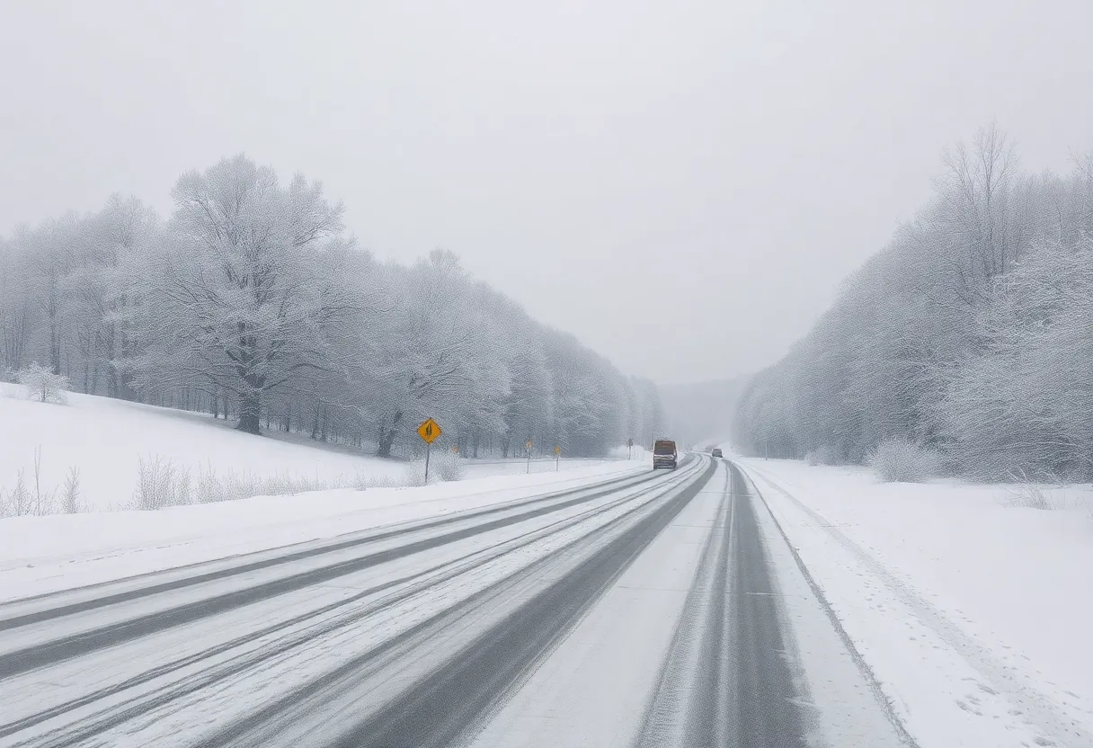
Parts of Southcentral Pennsylvania, including Adams and York counties, have already received a winter weather advisory. If you plan to travel on Tuesday, prepare for some slippery roads as conditions might get a tad dicey, particularly during evening commutes.
Stay Informed: What the Predictions Say
As we glide into Wednesday, hold onto your hats! The second storm rolls in Wednesday evening and stretches into Thursday morning. This time, we might see a chaotic mix involving snow, sleet, and even some freezing rain. Sounds delightful, doesn’t it?
Temperatures are taking a nosedive, dropping to the mid-20s Monday night, and not looking much better on Tuesday with highs only reaching the mid-30s. In true winter fashion, precipitation from the second storm is expected to change into rain shortly after midnight on Thursday, bringing relief from the icy grip of the snowstorm. By Thursday, we could be looking at highs nearing 50 degrees, which might just do the trick to melt away that snow accumulation.
Travel Heads-Up!
After the storms clear, residents should prepare for slippery road conditions and potential travel disruptions. Roads that aren’t treated may get quite snowpacked, so it’s best to take it easy if you need to head out. The National Weather Service has cautioned that road conditions might worsen during the evening commute on Tuesday, so it’s wise to plan ahead.
Interestingly, while we wrestle with the snow, meteorologists suggest that these winter storms may actually help relieve some moderate-to-severe drought conditions that have settled over the region. The upside to the white stuff, perhaps?
What Comes Next?
Once the chaos from the storms subsides, Friday greets us with a sunny sky and highs near 42 degrees, which could be a nice breather post-storm. However, keep your umbrellas handy; there is a 20% chance of wintry weather making a return Friday night into Saturday.
Looking a bit further ahead, forecasts hint at additional chances for snow and freezing rain in the coming days, so it seems like winter is going to stick around a little while longer in Southcentral Pennsylvania.
Be Prepared on the Roads
In anticipation of the incoming storms, PennDOT has implemented Tier 4 restrictions for Interstate 83 starting at 7 p.m. on Wednesday, prohibiting certain vehicles during the storm period. Stay safe out there!
In conclusion, as Southcentral Pennsylvania gears up for these winter storms, remember to check your supplies, travel wisely, and keep a watchful eye on the weather updates. Stay warm and safe, and embrace whatever winter throws our way!
Deeper Dive: News & Info About This Topic
HERE Resources
Winter Storm Alert: Prepare for Heavy Snow Over Super Bowl Weekend
Double Trouble: Winter Storms Poised to Hit Midwest and Northeast
Winter Storm Blair Set to Impact 1,500 Miles with Snow
Additional Resources
- York Dispatch: Two Different Snow Systems Expected in York County This Week
- Wikipedia: Weather
- York Daily Record: Snow Accumulations Expected for York, Adams, and Lebanon Counties
- Google Search: Winter Storms
- York Dispatch: York County Under Winter Weather Advisory
- Google Scholar: Winter Weather Advisory
- Herald Online: Local News on Weather
- Encyclopedia Britannica: Weather Forecast
- York Daily Record: Snow in the Forecast for Southcentral PA
- Google News: Winter Weather

Author: STAFF HERE ROCK HILL
The ROCK HILL STAFF WRITER represents the experienced team at HERERockHill.com, your go-to source for actionable local news and information in Rock Hill, York County, and beyond. Specializing in "news you can use," we cover essential topics like product reviews for personal and business needs, local business directories, politics, real estate trends, neighborhood insights, and state news affecting the area—with deep expertise drawn from years of dedicated reporting and strong community input, including local press releases and business updates. We deliver top reporting on high-value events such as the Come-See-Me Festival, Rock Hill Arts Festival, and motorsport events at the Rock Hill Velodrome. Our coverage extends to key organizations like the Rock Hill Chamber of Commerce and the Culture & Heritage Museums, plus leading businesses in manufacturing and technology that power the local economy such as 3D Systems and Comporium. As part of the broader HERE network, including HEREAiken.com, HEREBeaufort.com, HEREChapin.com, HERECharleston.com, HEREClinton.com, HEREColumbia.com, HEREGeorgetown.com, HEREGreenwood.com, HEREGreenville.com, HEREHiltonHead.com, HEREIrmo.com, HEREMyrtleBeach.com, HERENewberry.com, HERERockHill.com, and HERESpartanburg.com, we provide comprehensive, credible insights into South Carolina's dynamic landscape.


