News Summary
Severe thunderstorm warnings have been issued for Clarendon, Orangeburg, and Sumter Counties as the National Weather Service cautions residents about wind gusts reaching up to 60 mph. The warning was released Monday evening and is expected to last until 8:15 p.m. Residents are advised to take precautions, including moving to interior rooms and securing outdoor items. The storm poses potential hazards including lightning strikes and hydroplaning risks for drivers. Stay safe and monitor the situation as conditions change.
Severe Thunderstorm Warnings Hit Clarendon, Orangeburg, and Sumter Counties
As the sun began to set over the charming communities of Clarendon, Orangeburg, and Sumter Counties, a serious weather warning swept across the area. On Monday evening, the National Weather Service in Columbia, SC, released an updated severe thunderstorm warning that caught everyone’s attention. At precisely 7:46 p.m., residents were put on alert, with the warning running strong until 8:15 p.m.
What’s Coming Your Way?
Folks, prepare yourselves! Wind gusts of up to 60 mph are on the way, and they could be causing quite a stir! The heart of the storm was detected hovering over the Santee Cooper Regional Airport, which is about 7 miles south of Manning. This fierce weather is moving east at an impressive speed of 60 mph, leaving many wondering what could be next.
Potential Hazards
Given the expected power of this storm, the NWS has raised concerns about possible damage to trees and power lines. No one wants to wake up to a fallen tree on their car or a power outage, so it’s best to be prepared! Key locations that will feel the impact include Summerton, St. Paul, Manning, Alcolu, Brogdon, Vance, and many more across the counties. If you live along Interstate 95 between mile markers 102 and 145, you are also under the watchful eye of this storm.
Safety First
If you’re in the affected areas, it’s crucial to prioritise your safety. Residents are advised to move to an interior room on the lowest floor of your building. It’s a wise move as we brace ourselves for the thunder rolling in. Earlier in the evening, at around 6:01 p.m., another severe thunderstorm warning had already been issued for Clarendon and Orangeburg counties. That earlier warning gave residents a heads-up about possible quarter-sized hail (around 1 inch) alongside that fierce wind.
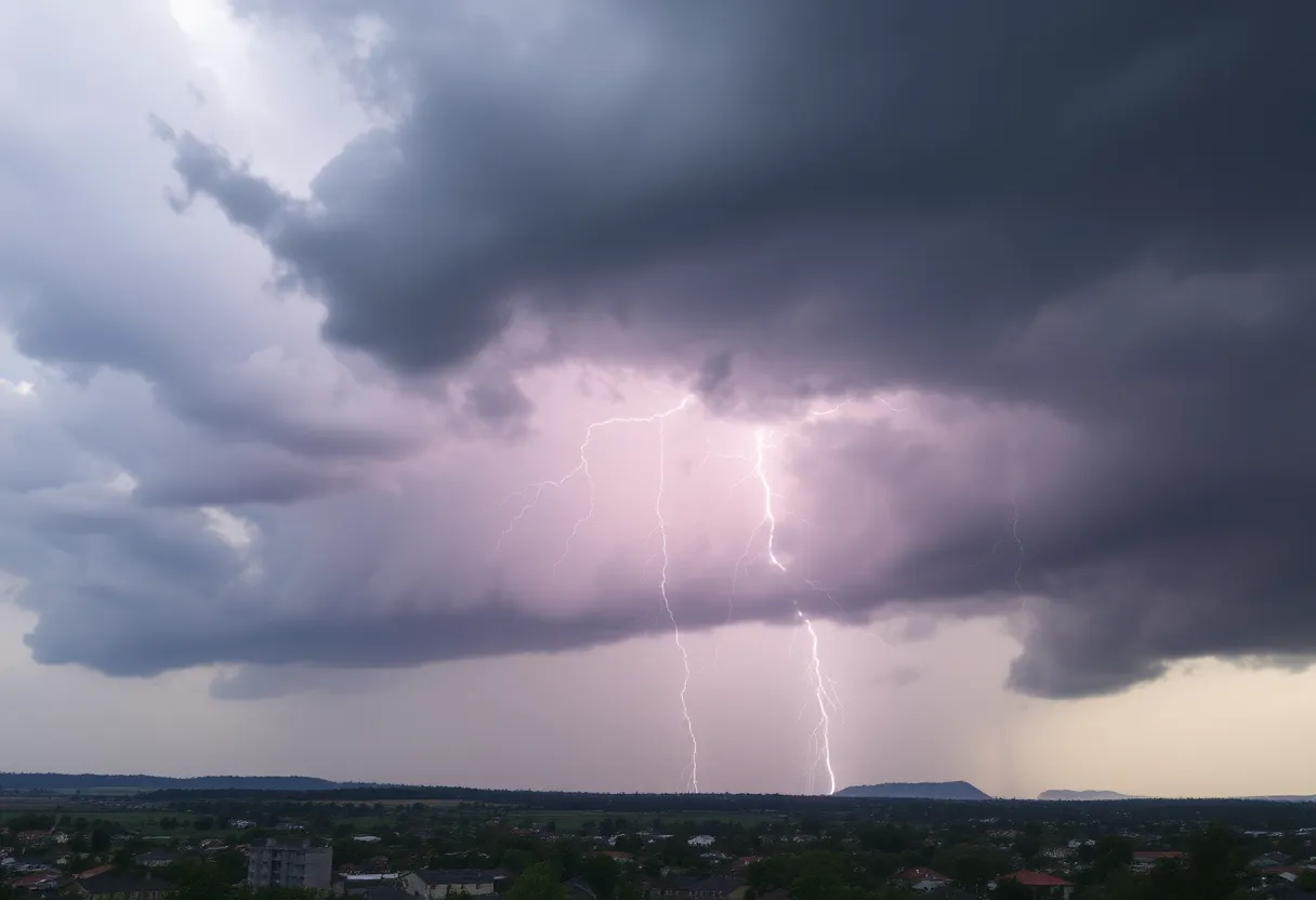
Lightning Strikes and More
During thunderstorms, the threat of lightning strikes becomes alarmingly high. Did you know that the U.S. sees about 25 million lightning strikes each year, which tragically causes around 20 fatalities annually? When thunderstorms brew, it’s crucial to take cover, as the likelihood of lightning striking increases dramatically when the storm is overhead.
Hydroplaning Warning
Drivers, listen up! Rain can lead to hazardous driving conditions. Hydroplaning can occur when your vehicle slides uncontrollably on wet roads due to pressure from water building up under your tires. During storms, staying alert and cautious behind the wheel is essential for keeping everyone safe.
Be Prepared
As this severe weather rolls in, don’t forget to prep your home! Charge your devices and secure outdoor items that could become projectiles in heavy winds. Taking these simple steps can make a big difference in ensuring your family stays safe during the storm.
In Summary
Now, let’s recap: Storm warnings are in effect until 8:15 p.m. tonight for Clarendon, Orangeburg, and Sumter Counties, with potential wind gusts hitting up to 60 mph. Stay safe, take cover, and look after your loved ones as this storm makes its way through the region.
Deeper Dive: News & Info About This Topic
HERE Resources
Stormy Weather on the Horizon for Charlotte Residents
Severe Thunderstorm Warnings Hit South Carolina
Severe Weather Alert: Thunderstorms Impact Upstate SC and Georgia
Severe Thunderstorm and Tornado Watches Hit South Carolina
Tragic Loss: Community Mourns 9-Year-Old Boy Swept Away by Floods
Severe Weather Hits Columbia: Tornado and Thunderstorm Warnings
Thunderstorm Warning for Western North Carolina
Progress Made in Table Rock Wildfire Containment After Rain
Tragic Incident in Greenville: Young Woman Shot by Deputies
Rock Hill Residents Brace for Severe Weather as Memories of Past Storm Resurface
Additional Resources
- Myrtle Beach Online
- Wikipedia: Severe Thunderstorm Warning
- WIS TV
- Google Search: Severe Weather Alerts
- Island Packet
- Encyclopedia Britannica: Thunderstorm
- ABC 7 Amarillo
- Google News: Storm Warnings
Author: STAFF HERE ROCK HILL
The ROCK HILL STAFF WRITER represents the experienced team at HERERockHill.com, your go-to source for actionable local news and information in Rock Hill, York County, and beyond. Specializing in "news you can use," we cover essential topics like product reviews for personal and business needs, local business directories, politics, real estate trends, neighborhood insights, and state news affecting the area—with deep expertise drawn from years of dedicated reporting and strong community input, including local press releases and business updates. We deliver top reporting on high-value events such as the Come-See-Me Festival, Rock Hill Arts Festival, and motorsport events at the Rock Hill Velodrome. Our coverage extends to key organizations like the Rock Hill Chamber of Commerce and the Culture & Heritage Museums, plus leading businesses in manufacturing and technology that power the local economy such as 3D Systems and Comporium. As part of the broader HERE network, including HEREAiken.com, HEREBeaufort.com, HEREChapin.com, HERECharleston.com, HEREClinton.com, HEREColumbia.com, HEREGeorgetown.com, HEREGreenwood.com, HEREGreenville.com, HEREHiltonHead.com, HEREIrmo.com, HEREMyrtleBeach.com, HERENewberry.com, HERERockHill.com, and HERESpartanburg.com, we provide comprehensive, credible insights into South Carolina's dynamic landscape.

