News Summary
Residents of Mecklenburg County are facing strong thunderstorms and severe weather conditions, including possible hail and lightning. The National Weather Service has issued an advisory warning that active storms could lead to minor damage and increase risks for outdoor activities. Local schools are closing due to anticipated weather hazards. Stay informed and prepared as the storms approach.
Severe Weather Hits Mecklenburg County: Thunderstorm Advisory Issued
Mecklenburg County residents, it seems that Mother Nature has decided to throw a little excitement into our day. An advisory from the National Weather Service (NWS) in Greenville-Spartanburg, SC, just came out, warning of strong thunderstorms expected to roll into our area. This alert is active until 3:45 PM—so, let’s get prepped and stay aware!
What To Expect
These thunderstorms aren’t just your average summer rain showers. Nickel-sized hail, measuring about 0.88 inches, is on the horizon. With Doppler radar painting a picture of strong thunderstorms stretching from 7 miles north of York to 8 miles north of Chester, these storms are advancing quickly at about 50 miles per hour.
Residents in areas such as Newport, York, Clover, Tega Cay, Fort Mill, Rock Hill, Steele Creek, Lesslie, Catawba, and McConnells should be particularly on guard. While the storms may result in minor hail damage to outdoor items, it’s best to err on the side of caution and seek shelter indoors if you find yourself outside when the thunder begins to roar.
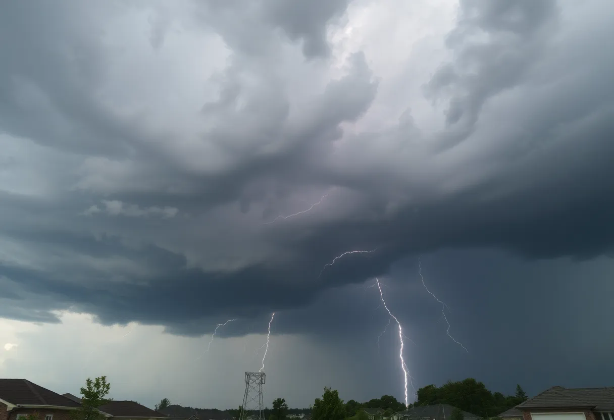
Lightning Risks
Speaking of the storms, it is essential to be aware of lightning risks. Did you know that roughly 25 million lightning strikes happen across the United States each year, predominantly during the summer months? What’s more alarming is that these strikes lead to about 20 fatalities annually. As storms approach, the likelihood of a lightning strike increases, peaks as the storm passes overhead, and then tapers off once the storm moves out.
Driving Safely
If you’re planning to hit the roads, stay alert! Hydroplaning can become a serious concern with wet roads. That’s when your vehicle slides uncontrollably on wet surfaces because of water pressure. Familiarize yourself with this dangerous situation—the three main causes are speeding, worn tires, and heavy rain conditions.
Storm Update: Past and Present
Just a couple of days ago, storms wreaked havoc, causing numerous issues, including power outages that affected hundreds of Duke Energy customers and fallen trees causing detours in Mecklenburg County. On Sunday, strong storms led to hazardous conditions that continued through Monday morning. During that wild weather event, about 20,000 power outages were recorded in the region!
Interestingly enough, on the bright side, no storm activity has been reported in Mecklenburg County today. However, potential tornado warnings were issued for areas from Union County in South Carolina to Mooresville in North Carolina. The NWS noted that at least 38 tornadoes were confirmed across six states this past weekend. Although the storm wreaked some havoc, it appears no major damage was done to public infrastructure in our area.
There was, however, a tragic incident reported in Iredell County, NC, where a tree fell on a pickup truck, resulting in a fatality. Furthermore, two storm-related fatalities occurred in Mississippi, and another incident was reported in Texas.
Looking Ahead
In preparation for whatever comes next, local schools are taking precautionary measures. Charlotte-Mecklenburg Schools announced there will be no classes on Wednesday, with activities canceled due to expected severe weather.
It doesn’t end there—strong wind gusts could reach up to 50 mph outside of thunderstorms, adding to the hazards that drivers may face while commuting. Given the circumstances, residents are encouraged to keep an eye on weather updates and utilize weather apps for real-time alerts.
So, buckle up, Mecklenburg! Keep safe, stay informed, and let’s get through this wild weather together!
Deeper Dive: News & Info About This Topic
HERE Resources
Charlotte Region Braces for Heavy Rain on Monday
Additional Resources
- WCNC: Severe Thunderstorm Warning
- Wikipedia: Severe Thunderstorm
- Charlotte Observer: Weather News
- Google Search: Thunderstorm Safety
- Axios: CMS Cancels School
- Google Scholar: Thunderstorm Impact
- WBTV: Schools Close Amid Storms
- Encyclopedia Britannica: Thunderstorm
- News Observer: Weather Update
- Google News: Severe Weather
Author: STAFF HERE ROCK HILL
The ROCK HILL STAFF WRITER represents the experienced team at HERERockHill.com, your go-to source for actionable local news and information in Rock Hill, York County, and beyond. Specializing in "news you can use," we cover essential topics like product reviews for personal and business needs, local business directories, politics, real estate trends, neighborhood insights, and state news affecting the area—with deep expertise drawn from years of dedicated reporting and strong community input, including local press releases and business updates. We deliver top reporting on high-value events such as the Come-See-Me Festival, Rock Hill Arts Festival, and motorsport events at the Rock Hill Velodrome. Our coverage extends to key organizations like the Rock Hill Chamber of Commerce and the Culture & Heritage Museums, plus leading businesses in manufacturing and technology that power the local economy such as 3D Systems and Comporium. As part of the broader HERE network, including HEREAiken.com, HEREBeaufort.com, HEREChapin.com, HERECharleston.com, HEREClinton.com, HEREColumbia.com, HEREGeorgetown.com, HEREGreenwood.com, HEREGreenville.com, HEREHiltonHead.com, HEREIrmo.com, HEREMyrtleBeach.com, HERENewberry.com, HERERockHill.com, and HERESpartanburg.com, we provide comprehensive, credible insights into South Carolina's dynamic landscape.


