News Summary
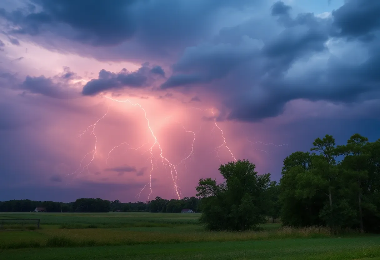
South Carolina residents are on high alert as severe thunderstorms and tornado watches sweep through several counties. With powerful winds, marble-sized hail, and the potential for tornadoes, safety precautions are essential. The National Weather Service has issued warnings for regions including Kershaw, Chesterfield, and Richland counties. Residents are urged to secure outdoor items and stay informed through reliable channels to ensure their safety as the situation develops.
South Carolina on Alert as Severe Thunderstorms and Tornado Watches Roll In!
As the clock strikes midnight, residents of South Carolina are keeping a vigilant eye on the skies. The National Weather Service (NWS) has issued an updated report announcing severe thunderstorm warnings for several counties, including Southern Lancaster, Chesterfield, and Kershaw. The stormy weather is expected to ramp up through Friday at midnight, making it essential for everyone to stay on alert!
What to Expect
The approaching thunderstorms are not just your run-of-the-mill rainfall. Expect marble-sized hail (around 0.5 inches) and powerful wind gusts reaching up to 50 mph. This means those outdoor items you have lying around might want to be secured before the wild weather kicks in. NWS has reported a particularly strong thunderstorm near Kershaw, located a mere 18 miles northeast of the Lake Wateree Dam, moving towards the east at a speed of 15 mph.
Key spots under the weather warning include Cheraw, Kershaw, and various local establishments such as the Carolina Sandhills Wildlife Refuge and Kershaw Correctional Institution. If you live in places like Mt Pisgah, McBee, Jefferson, and the Forty Acre Rock Preserve, it’s time to batten down the hatches.
Be Weather-Wise!
As the storms approach, it’s crucial to remember that gusty winds could potentially knock down tree limbs or blow around unsecured items, leading to minor damage. For your safety, the NWS highly advises residents to stay informed through local media and communications platforms for timely updates and warnings.
Did you know that lightning strikes the U.S. around 25 million times each year during the summer? It’s a startling statistic! These storms can be quite dangerous, leading to approximately 20 fatalities annually. So, if you hear thunder rumbling in the distance, that’s your cue to take cover.
The Situation Evolves
Fast forward to Friday at 8:50 p.m., and the storm’s grip on Kershaw, Richland, Lee, and Sumter counties has tightened with alerts extended until 9:30 p.m.. The radar has detected yet another cluster of fierce thunderstorms near Elgin, heading northeast at a brisk 30 mph.
This latest report continues to predict those pesky wind gusts around 50 mph and more of that dreaded marble-sized hail. Residents in Columbia, Camden, and the surrounding areas along Interstate 20 from mile markers 79 to 116 should be particularly cautious.
Stay Safe and Informed
Though one tornado watch has been canceled, a new one still remains in effect for Calhoun, Chesterfield, Clarendon, Kershaw, Lee, Orangeburg, and Sumter counties until 1 p.m.. While strong winds are the primary concern, those in certain areas should also remain cautious about the potential for tornadoes.
Residents are reminded to secure outdoor items as best as possible, avoid any outdoor burning, and stay updated through reliable local apps and news outlets. The last thing anyone wants is to be caught unprepared when Mother Nature comes knocking.
In Summary
As the weather situation unfolds, local residents are urged to prioritize their safety and comfort. The thunderstorms brewing could be severe, so it’s best to stay indoors when necessary. Keep an ear to the ground and follow updates on the conditions as the night progresses.
Stay safe, South Carolina!
Deeper Dive: News & Info About This Topic
HERE Resources
Severe Thunderstorm Warnings Roll into Charleston
Severe Thunderstorm Warning Issued for York County
Severe Thunderstorm Warnings Across South Carolina and Arkansas
Severe Thunderstorm Alert for Conway and Myrtle Beach
Myrtle Beach on Alert: Strong Thunderstorms Bring Hail and High Winds
Severe Thunderstorms Disrupt Lovin’ Life Music Fest
Severe Thunderstorm and Flood Watch for Upstate South Carolina
Severe Thunderstorms and Winds Hit Mecklenburg County
Severe Thunderstorm Alert Issued for Spartanburg County
Severe Thunderstorm Warning Issued for South Carolina
Additional Resources
- Island Packet
- The State
- WLTX
- ABC Columbia
- WIS TV
- Wikipedia: Thunderstorm
- Google Search: severe weather South Carolina
- Google Scholar: thunderstorm statistics
- Encyclopedia Britannica: thunderstorm
- Google News: South Carolina weather updates
Author: STAFF HERE ROCK HILL
The ROCK HILL STAFF WRITER represents the experienced team at HERERockHill.com, your go-to source for actionable local news and information in Rock Hill, York County, and beyond. Specializing in "news you can use," we cover essential topics like product reviews for personal and business needs, local business directories, politics, real estate trends, neighborhood insights, and state news affecting the area—with deep expertise drawn from years of dedicated reporting and strong community input, including local press releases and business updates. We deliver top reporting on high-value events such as the Come-See-Me Festival, Rock Hill Arts Festival, and motorsport events at the Rock Hill Velodrome. Our coverage extends to key organizations like the Rock Hill Chamber of Commerce and the Culture & Heritage Museums, plus leading businesses in manufacturing and technology that power the local economy such as 3D Systems and Comporium. As part of the broader HERE network, including HEREAiken.com, HEREBeaufort.com, HEREChapin.com, HERECharleston.com, HEREClinton.com, HEREColumbia.com, HEREGeorgetown.com, HEREGreenwood.com, HEREGreenville.com, HEREHiltonHead.com, HEREIrmo.com, HEREMyrtleBeach.com, HERENewberry.com, HERERockHill.com, and HERESpartanburg.com, we provide comprehensive, credible insights into South Carolina's dynamic landscape.