News Summary
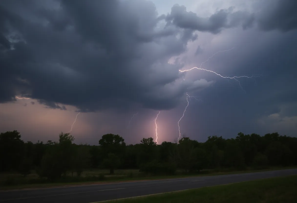
A thunderstorm alert has been issued for Beaufort and Jasper Counties, effective until 3:30 p.m. This storm brings the potential for penny-sized hail and strong winds. Notable areas affected include Bluffton, Hardeeville, and I-95. Residents are advised to stay informed via NOAA Weather Radio and ensure outdoor items are secure. While tornado warnings have been canceled, concerns regarding straight-line wind gusts reaching up to 70 mph persist. The Beaufort County School District has canceled classes in light of safety precautions.
Thunderstorm Alert Hits Beaufort and Jasper Counties!
Hey there! If you’re in Beaufort or Jasper Counties, you’ll want to pay attention because the National Weather Service has issued a thunderstorm alert that goes into effect until 3:30 p.m. later today. As of 3 p.m., Doppler radar picked up a strong storm currently making its way over Pritchardville, moving northeast at a brisk pace of 20 mph. Sounds intense, right?
What’s in Store?
So, here’s the scoop: this thunderstorm is expected to unleash some penny-sized hail and bring along some gusty winds that could knock around tree limbs and other unsecured items outside. If you have outdoor furniture or decorations, now would be a good time to ensure they’re not going to blow away!
Where Can You Expect Impact?
Areas that might get hit include popular spots like Bluffton, Hardeeville, Palmetto Bluff, and even schools like the Coastal Carolina Hospital. If you’re cruising along I-95, particularly between mile markers 5 and 11, it’s good to be extra vigilant. Other locations affected are Sun City, Rose Hill, Okatie, Jasper, and Calawassie Island. So basically, keep your eyes peeled if you’re in any of these areas!
Listen Up!
Residents are encouraged to stay tuned to NOAA Weather Radio All Hazards, television, or local news to keep updated on the storm’s developments. Remember, safety first!
Thunderstorm Safety Tips
Thunderstorms can be a bit unpredictable, and did you know that the U.S. gets hit by lightning approximately 25 million times annually? While lightning can be cool to watch, it’s also dangerous, often resulting in fatalities each year. When a storm approaches, ensure you’re indoors as soon as possible, and avoid using electrical appliances during the storm.
If you’re out driving, always be cautious—water buildup can lead to hydroplaning, making it tough to steer. Play it safe and reduce your speed when on wet roads!
Tornado Stuff
Earlier today, there was a tornado warning issued for the same counties, but it was canceled around 11:30 a.m. after radar showed the storm weakens. The warning had been in effect until 11:45 a.m., but thankfully, it appears things have calmed down. However, it’s worth noting that a strong weather system is still on the way to create some severe weather across the state.
Potential for Strong Winds
One of the main concerns is the chance of straight-line wind gusts that could reach up to 70 mph. That’s fierce enough to be comparable to winds from a category 1 hurricane, which starts at 74 mph. The Beaufort County School District has even made the call to cancel classes and activities, given the weather threats. Better safe than sorry!
Water Concerns
As for rainfall, it’s expected but might not be enough to alleviate the ongoing wildfire risks that have been a concern lately. Thankfully, there’s no significant flood risk tied to this weather system.
So there you have it! Stay safe, keep an eye on the skies, and remember: when thunder roars, head indoors!
Deeper Dive: News & Info About This Topic
HERE Resources
Severe Thunderstorm Warnings Roll into Charleston
Charleston Faces Challenges as Tropical Storm Debby Strikes
Additional Resources
- Island Packet
- Wikipedia: Thunderstorm
- Live 5 News
- Google Search: Thunderstorm Alerts
- Post and Courier
- Google Scholar: Tornado Warnings
- ABC News 4
- Encyclopedia Britannica: Storm Warnings
- JD News
- Google News: Tornado Damage Beaufort
- Myrtle Beach Online
Author: STAFF HERE ROCK HILL
The ROCK HILL STAFF WRITER represents the experienced team at HERERockHill.com, your go-to source for actionable local news and information in Rock Hill, York County, and beyond. Specializing in "news you can use," we cover essential topics like product reviews for personal and business needs, local business directories, politics, real estate trends, neighborhood insights, and state news affecting the area—with deep expertise drawn from years of dedicated reporting and strong community input, including local press releases and business updates. We deliver top reporting on high-value events such as the Come-See-Me Festival, Rock Hill Arts Festival, and motorsport events at the Rock Hill Velodrome. Our coverage extends to key organizations like the Rock Hill Chamber of Commerce and the Culture & Heritage Museums, plus leading businesses in manufacturing and technology that power the local economy such as 3D Systems and Comporium. As part of the broader HERE network, including HEREAiken.com, HEREBeaufort.com, HEREChapin.com, HERECharleston.com, HEREClinton.com, HEREColumbia.com, HEREGeorgetown.com, HEREGreenwood.com, HEREGreenville.com, HEREHiltonHead.com, HEREIrmo.com, HEREMyrtleBeach.com, HERENewberry.com, HERERockHill.com, and HERESpartanburg.com, we provide comprehensive, credible insights into South Carolina's dynamic landscape.


