News Summary
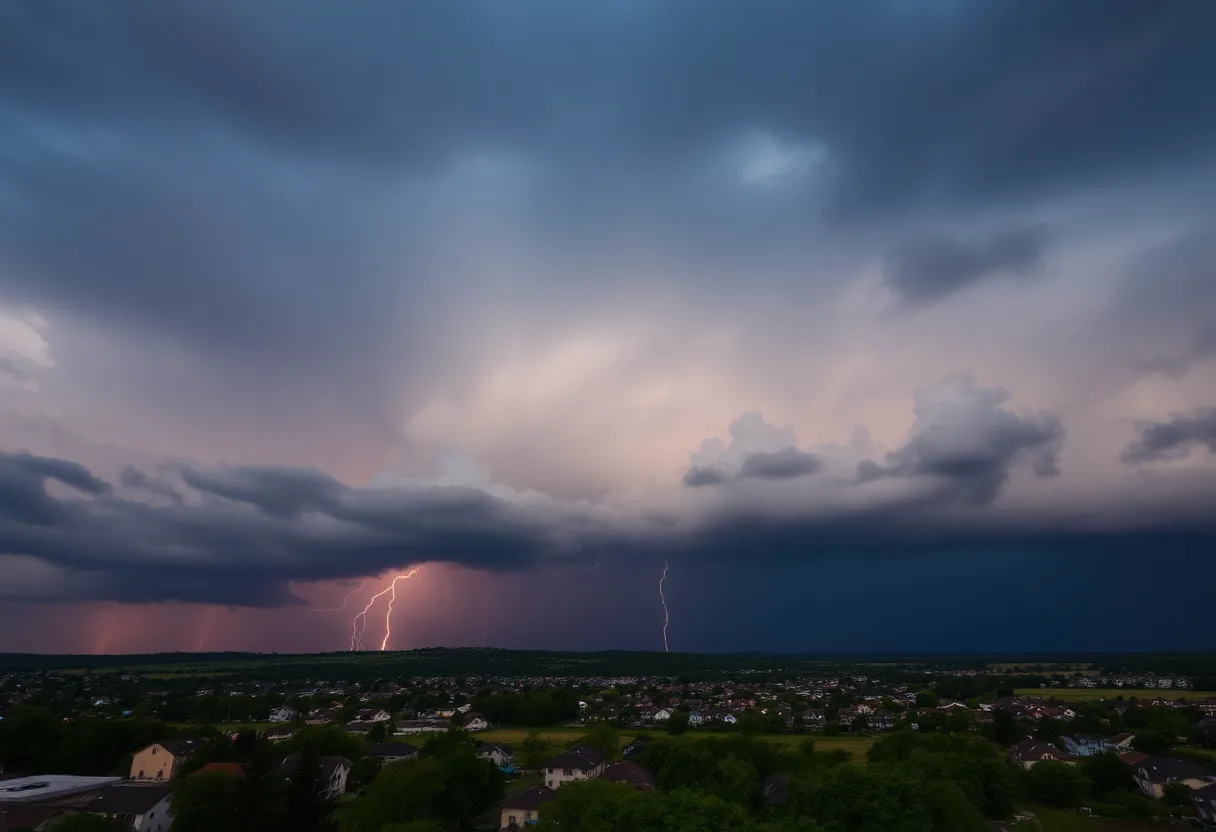
Residents of Spartanburg and Cherokee Counties in South Carolina should prepare for rough weather this evening as the National Weather Service has issued a severe thunderstorm warning. With the possibility of penny-sized hail and wind gusts up to 40 mph, it’s crucial to stay informed and seek shelter if necessary. The storm’s rapid movement towards communities like Gaffney and Blacksburg poses a significant risk, particularly concerning possible hail damage and lightning strikes. Safety is paramount during these weather events.
Severe Thunderstorm Warning for Cherokee and Spartanburg Counties
The folks in Spartanburg and Cherokee County, South Carolina, have been advised to brace themselves for some rough weather this evening. A severe thunderstorm warning was launched by the National Weather Service at around 6:28 p.m. and is expected to hang around until approximately 7:15 p.m. So, it might be a good time to get cozy indoors and keep an ear out for updates!
What’s Going On?
This isn’t just a light rain shower – the storm has the potential to pack some serious punch! With penny-sized hail (roughly 0.75 inches) and wind gusts hitting speeds of up to 40 mph, it’s best to take this warning seriously. Doppler radar has tracked the storm moving east at about 20 mph, currently located about 9 miles west of Gaffney and creeping toward various communities.
The areas directly under threat from this tumultuous weather include Cherokee Falls, Draytonville, Thicketty, Gaffney, Cowpens, Mayo, and Blacksburg. If you live in these towns or nearby, it may be a good time to check on your outdoor belongings. The storm could cause minor hail damage, especially to items outside that aren’t securely positioned.
Stay Safe!
The NWS is advising everyone to seek shelter inside a sturdy building if you find yourself outside as conditions could worsen rapidly. Remember, safety is key during these weather events! It’s a good idea to stay informed by keeping an eye on local radio and television stations for ongoing updates.
The Thunderstorm Potential
Now, let’s take a moment to remember how common thunderstorms are across the United States. Each year, the U.S. experiences about 25 million lightning strikes, especially during the summer. It’s a stark reminder that we’re not just dealing with rain – these storms can be deadly. About 20 fatalities occur each year due to lightning, so respect the power of nature!
As the storm approaches, the likelihood of experiencing lightning strikes will increase, usually peaking when the storm is situated directly overhead. Once it moves away, the threat starts to decrease, but this is not the time to take risks. If you can, stay indoors until the storm has fully passed.
Driving in Stormy Weather
If you must travel during the storm, be aware of the dangers of hydroplaning. Hydroplaning happens when your vehicle slides uncontrollably on wet roads because water builds up between the tires and the road surface, leading to a loss of control. Factors like your vehicle’s speed, tire condition, and the depth of water on the road all play into how likely hydroplaning could be.
If you ever find yourself hydroplaning, knowing how to regain control is essential! Reduce your speed, and steer into the direction you’re heading to get your vehicle back on track – but don’t slam on the brakes! Instead, gently lift your foot off the gas and steer smoothly.
Wrapping Up
In closing, keep an eye on the weather and take the necessary precautions to protect yourself and your property. The storm may be short-lived, but taking steps to be prepared is always a wise move. Stay safe out there, and don’t let the thunder and lightning ruin your evening!
Deeper Dive: News & Info About This Topic
HERE Resources
Rock Hill Man Arrested for Stabbing Pregnant Woman
Severe Thunderstorm Warning for Bamberg and Orangeburg Counties, SC
Severe Thunderstorm Alert for Rowan and Cabarrus Counties
Severe Thunderstorms Brewing in Upstate South Carolina
Severe Weather Alerts Issued for Columbia Residents
Tragedy Strikes Southern Kentucky: Tornado Claims Lives and Damages Communities
Severe Weather Disrupts Carolinas and Georgia
NC State Women’s Cross Country Team Wins Eighth Regional Title
Severe Thunderstorm Alert Shakes Up Chesterfield County
Coach Shane Beamer Provides Updates for South Carolina Football Program
Additional Resources
- Herald Online: Severe Weather Update
- Wikipedia
- KOAM News Now: Storm Alert
- Google Search: Severe Thunderstorm Warning
- Island Packet: Weather News
- Google Scholar: Thunderstorm Precautions
- News Observer: Weather Developments
- Encyclopedia Britannica: Thunderstorm
- Greenville Online: Power Outages
- Google News: Weather Alerts
Author: STAFF HERE ROCK HILL
The ROCK HILL STAFF WRITER represents the experienced team at HERERockHill.com, your go-to source for actionable local news and information in Rock Hill, York County, and beyond. Specializing in "news you can use," we cover essential topics like product reviews for personal and business needs, local business directories, politics, real estate trends, neighborhood insights, and state news affecting the area—with deep expertise drawn from years of dedicated reporting and strong community input, including local press releases and business updates. We deliver top reporting on high-value events such as the Come-See-Me Festival, Rock Hill Arts Festival, and motorsport events at the Rock Hill Velodrome. Our coverage extends to key organizations like the Rock Hill Chamber of Commerce and the Culture & Heritage Museums, plus leading businesses in manufacturing and technology that power the local economy such as 3D Systems and Comporium. As part of the broader HERE network, including HEREAiken.com, HEREBeaufort.com, HEREChapin.com, HERECharleston.com, HEREClinton.com, HEREColumbia.com, HEREGeorgetown.com, HEREGreenwood.com, HEREGreenville.com, HEREHiltonHead.com, HEREIrmo.com, HEREMyrtleBeach.com, HERENewberry.com, HERERockHill.com, and HERESpartanburg.com, we provide comprehensive, credible insights into South Carolina's dynamic landscape.


