News Summary
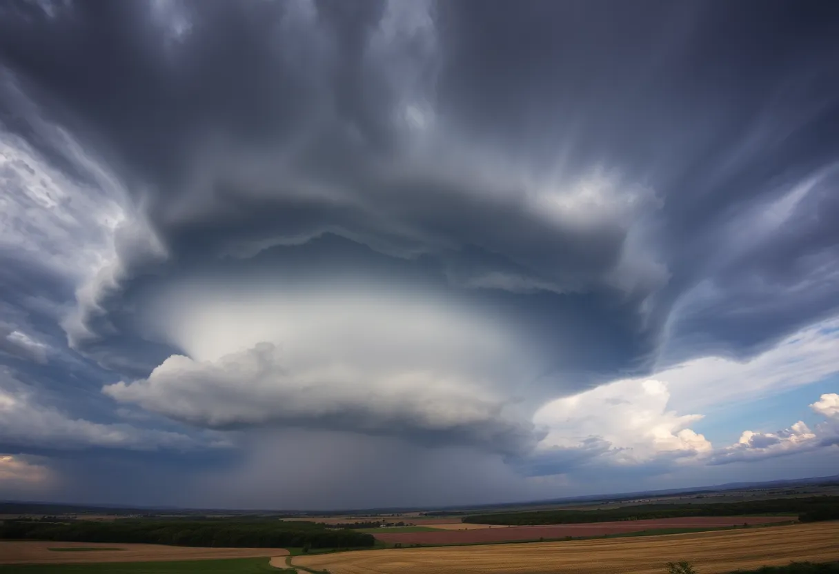
On Tuesday evening, York County, South Carolina, witnessed a spectacular supercell thunderstorm, captivating residents with its striking cloud formations reminiscent of sci-fi visuals. The storm, dubbed ‘mothership’ for its massive cloud base, demonstrated the raw power of nature and the conditions necessary for a supercell to form. While no tornado was produced, the storm raised safety concerns due to the potential risks of strong winds and hail. Residents were urged to remain vigilant while appreciating the stunning beauty of this weather anomaly.
York County, SC Sees Incredible Thunderstorm Formation
In a stunning display of nature’s power, York County, South Carolina was treated to a breathtaking supercell thunderstorm on Tuesday evening. This impressive storm made headlines not just for the severe weather it brought but also for its visually striking cloud formations that reminded many viewers of a sci-fi movie’s special effects.
A Mothership in the Sky
Thanks to some fantastic drone photography shared by a local resident, those who missed the action still got a taste of its wonders. The images, captured around Highway 324 in Rock Hill, showed the massive, layered cloud base that made the storm look like a giant, ominous spaceship—hence the nickname “mothership.” These dramatic clouds have a refreshing way of putting the sheer power of our weather systems into perspective.
What is a Supercell Thunderstorm?
So, what exactly is a supercell? Well, supercells are a particular kind of thunderstorm that are both awe-inspiring and a bit terrifying. Unlike your average thunderstorm, which might rain lightly and then pass, supercells bring heavy rain, strong winds, and even hail that’s larger than a golf ball. They are notorious for producing tornadoes, but they are relatively rare compared to other types of storms.
One of the key elements that makes a supercell different from the rest is its rotating updraft, a phenomenon known as a mesocyclone. This rotation occurs when strong winds change speed and direction with height. The combination of warm, moist air rising up and the tilting of horizontal rotation gives birth to this powerful storm structure.
Conditions for a Supercell
For a supercell to form, certain conditions must be just right. It requires:
- Strong wind shear: This is the change in wind speed and direction at different heights.
- Rising warm, moist air: This air doesn’t just float up; it tilts and spins, creating that impressive mesocyclone.
- Organization and maturity: A well-structured mesocyclone is necessary for developing serious weather.
In this latest storm, while there were clear signs of rotation, no tornado was produced. However, that didn’t mean the storm was harmless. Residents were still on high alert for damaging winds and large hail—the two main concerns with any supercell thunderstorm.
.Understanding Supercell Signs
So how do you identify a supercell if you see one? Here are some telltale signs:
- A dark, flat cloud base with a rounded lowering in the center.
- Visible rotation within the storm, which can be mesmerizing (and a little scary!) to watch.
- A stacked or layered appearance, much like a flying saucer hovering in the skies.
- Strong inflow winds: These winds pull warm, moist air into the storm, which can often be felt before the storm hits.
- A persistent, isolated structure that stands out from the other, more common thunderstorms.
Staying Safe Amidst the Drama
With the beauty of nature comes a certain level of danger. Safety alerts were issued for the area due to the potential risks associated with such powerful storms—even when tornadoes aren’t detected. The strong winds and hail can still cause significant damage, so residents were urged to stay cautious and keep an eye on the skies.
While the storm may have passed, the incredible visuals and the reminder of nature’s raw power linger on. York County certainly got a taste of an outstanding—yet dangerous—weather phenomenon that displayed both beauty and might in one spectacular evening.
Deeper Dive: News & Info About This Topic
HERE Resources
Severe Weather Alerts Across Central U.S. as Spring Storm Arrives
Additional Resources
- WLTX: Mothership Supercell Thunderstorm Explained
- Wikipedia: Thunderstorm
- Lucky Dog News: Severe Storm Threats
- Google Search: Severe Storm Threats
- WCNC: Rock Hill Storm Recovery Loans
- Google Scholar: Rock Hill Storm Recovery
- MSN: McMaster Calls for Federal Aid
- Encyclopedia Britannica: Tornado
- Fox Weather: Severe Storm Hail Damage
- Google News: Severe Storm Hail Damage
Author: STAFF HERE ROCK HILL
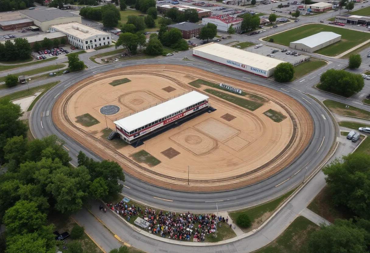
The ROCK HILL STAFF WRITER represents the experienced team at HERERockHill.com, your go-to source for actionable local news and information in Rock Hill, York County, and beyond. Specializing in "news you can use," we cover essential topics like product reviews for personal and business needs, local business directories, politics, real estate trends, neighborhood insights, and state news affecting the area—with deep expertise drawn from years of dedicated reporting and strong community input, including local press releases and business updates. We deliver top reporting on high-value events such as the Come-See-Me Festival, Rock Hill Arts Festival, and motorsport events at the Rock Hill Velodrome. Our coverage extends to key organizations like the Rock Hill Chamber of Commerce and the Culture & Heritage Museums, plus leading businesses in manufacturing and technology that power the local economy such as 3D Systems and Comporium. As part of the broader HERE network, including HEREAiken.com, HEREBeaufort.com, HEREChapin.com, HERECharleston.com, HEREClinton.com, HEREColumbia.com, HEREGeorgetown.com, HEREGreenwood.com, HEREGreenville.com, HEREHiltonHead.com, HEREIrmo.com, HEREMyrtleBeach.com, HERENewberry.com, HERERockHill.com, and HERESpartanburg.com, we provide comprehensive, credible insights into South Carolina's dynamic landscape.