


BREAKING NEWS

Great White Shark ‘Seaweed’ Spotted Near Myrtle Beach
Myrtle Beach, South Carolina, November 27, 2025 The sighting of a great white shark named ‘Seaweed’ off the coast of Myrtle Beach has thrilled marine researchers, shedding light on shark migration...

Rock Hill High School Football Playoffs Intensify with Semifinals
Rock Hill, South Carolina, November 27, 2025 As the South Carolina high school football playoffs progress to the semifinals, teams like the Northwestern Trojans, Dutch Fork Foxes, and South Pointe Stallions...

Gamecocks Secure Spot in Championship with Win Over Duke
Rock Hill, November 27, 2025 The South Carolina Gamecocks showcased their prowess by defeating the Duke Blue Devils 83-66 in the semifinals of the Players Era Championship. This victory highlights the...

Charlotte Loses Manufacturing Project to Piedmont Triad
Charlotte, NC, November 27, 2025 Charlotte’s economic landscape shifts as a pivotal manufacturing project is relocated to the Piedmont Triad, resulting in a loss of around 300 jobs. This decision comes...

Local Church and Non-Profit Distribute Thanksgiving Meals in Rock Hill
Rock Hill, SC, November 27, 2025 In a commendable show of community support, Illumine Church and Christians Who Feed the Hungry have joined forces to distribute around 1,500 Thanksgiving meals to...

Federal Immigration Crackdown Stirs Controversy in Charlotte
Charlotte, NC, November 26, 2025 Operation Charlotte’s Web has sparked significant unrest in Charlotte, NC, following federal immigration enforcement actions that resulted in over 370 arrests in five days. The operation...
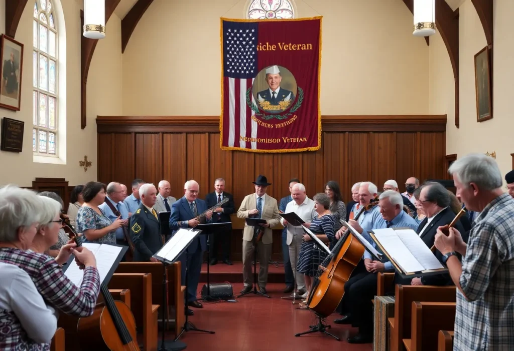
Rock Hill Remembers Bobby ‘B.S.’ Plair, Sr.
Rock Hill, South Carolina, November 26, 2025 The Rock Hill community gathers to honor the life and legacy of Bobby ‘B.S.’ Plair, Sr., a distinguished musician and WWII veteran, who recently...

Rock Hill’s $106 Million Interchange Upgrade
Rock Hill, South Carolina, November 26, 2025 Rock Hill, South Carolina, is planning a $106 million upgrade to Exit 82 on Interstate 77, aimed at improving traffic flow and safety. This...

Winthrop Poll Reveals Holiday Spending Forecast in South Carolina
South Carolina, November 26, 2025 As the holiday season approaches, the Winthrop Poll projects that South Carolinians will spend an average of $1,007 on gifts this year, a slight decrease from...
BUSINESS

Asheboro, North Carolina Expands with New EAS Facility
Asheboro, North Carolina, November 26, 2025 Environmental Air Systems (EAS) has announced a $20 million investment to build a new factory in Asheboro, North Carolina. The facility will create 300 jobs...

Rock Hill Vendor Mall’s New Owners Envision Local Hub
Rock Hill, South Carolina, November 25, 2025 The new owners of the Rock Hill vendor mall are reimagining the venue as a community hub, featuring coffee, art, and unique retail offerings....

York Technical College Launches Online Law School Course
Monroe, North Carolina, November 23, 2025 York Technical College introduces an online ‘Law School for Non-Lawyers’ course aimed at providing foundational legal knowledge to individuals without prior legal education. The course...
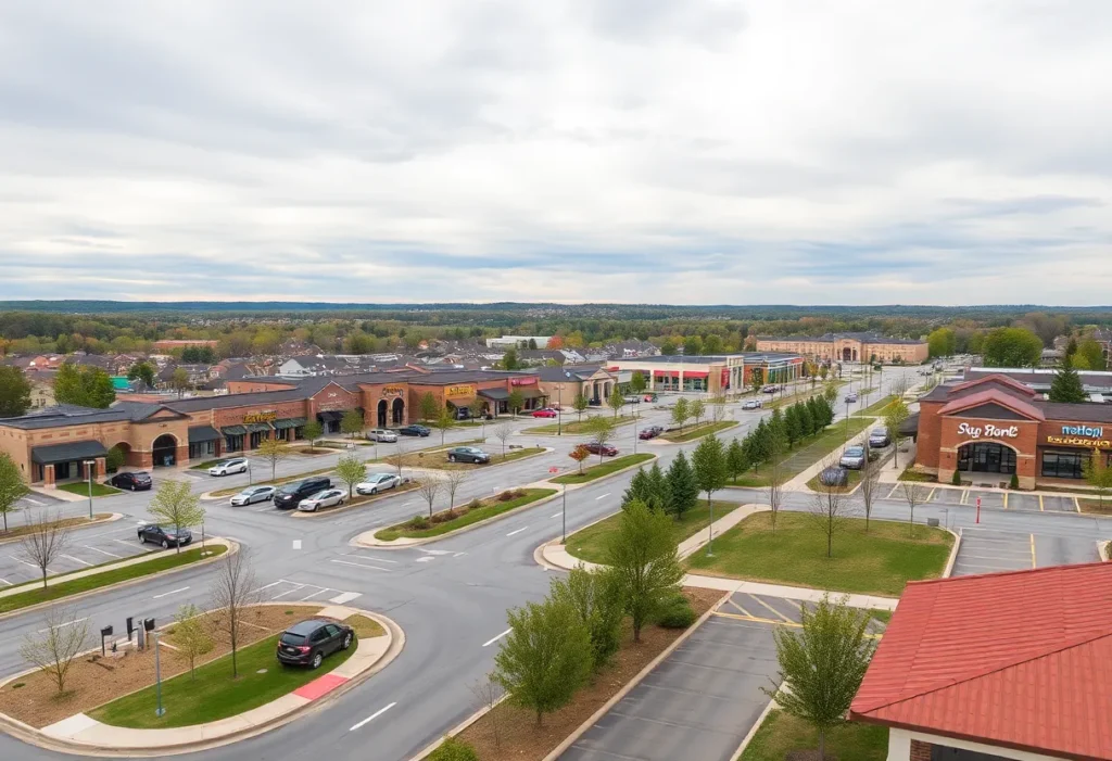
Lancaster County’s Retail Expansion Linked to New Homes
Lancaster County, South Carolina, November 22, 2025 Lancaster County, SC is planning a substantial new shopping center that depends on the ongoing residential growth in the area. With several communities under...

York County Considers Impact Fee to Address Clover School District Growth
York County, South Carolina, November 20, 2025 York County, South Carolina, is set to vote on a proposed $7,000 impact fee for new homes in the Clover School District. This initiative,...

Lawsuit Against MESA for Billing Unrequested EMS Services
Columbia, Pennsylvania, October 27, 2025 News Summary Municipalities in Pennsylvania have filed a lawsuit against the Municipal Emergency Services Authority (MESA), alleging improper charges for emergency medical services (EMS) they did...
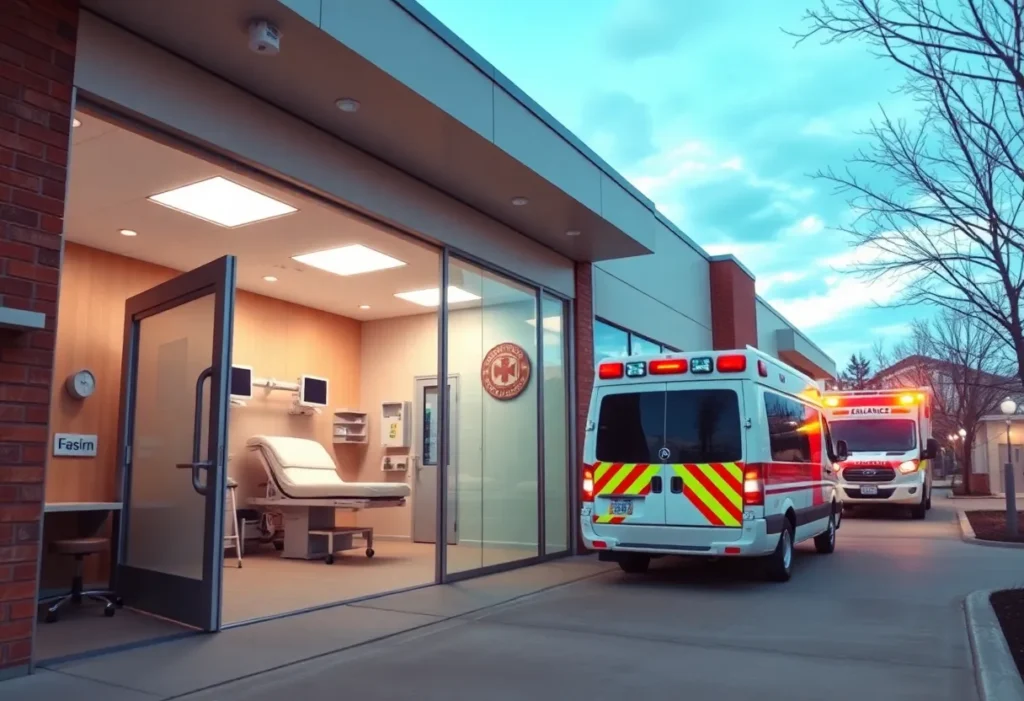
Piedmont Medical Center to Open Emergency Facility in Indian Land
Indian Land, October 25, 2025 News Summary Piedmont Medical Center is set to open the first emergency facility in Indian Land, South Carolina, by spring 2026, enhancing local healthcare access. The...

Costco Plans $240 Million Distribution Center in Rock Hill
Rock Hill, South Carolina, October 24, 2025 News Summary Costco is considering a $240 million distribution center in Rock Hill, South Carolina, which could create 165 jobs at an average wage...

Rock Hill Plans Redevelopment for Historic Storefront
Rock Hill, October 18, 2025 News Summary Rock Hill is considering the redevelopment of an abandoned storefront that has been vacant for five years. Southern Street Development purchased the property for...
Events/What's Happening

Experience ‘The Music of The Band’ With Professor Louie
North Haven, CT, November 26, 2025 Join Professor Louie & The Crowmatix for a unique concert featuring the music of The Band at Small Batch Cellars in North Haven, CT. This...

Macy Gray to Perform at Infinity Music Hall in Hartford
Hartford, Connecticut, November 26, 2025 Macy Gray, the Grammy Award-winning artist, will be performing in Hartford, Connecticut, as part of her ‘On How Life Is’ 25th Anniversary Tour. The concert, taking...

How the ‘Country On Deck’ Event Celebrates Local Talent
New Haven, Connecticut, November 26, 2025 The ‘Country On Deck’ Songwriter Round in New Haven, Connecticut showcased local country artists Jason Ingriselli and Jason Solo. This intimate event highlighted the richness...

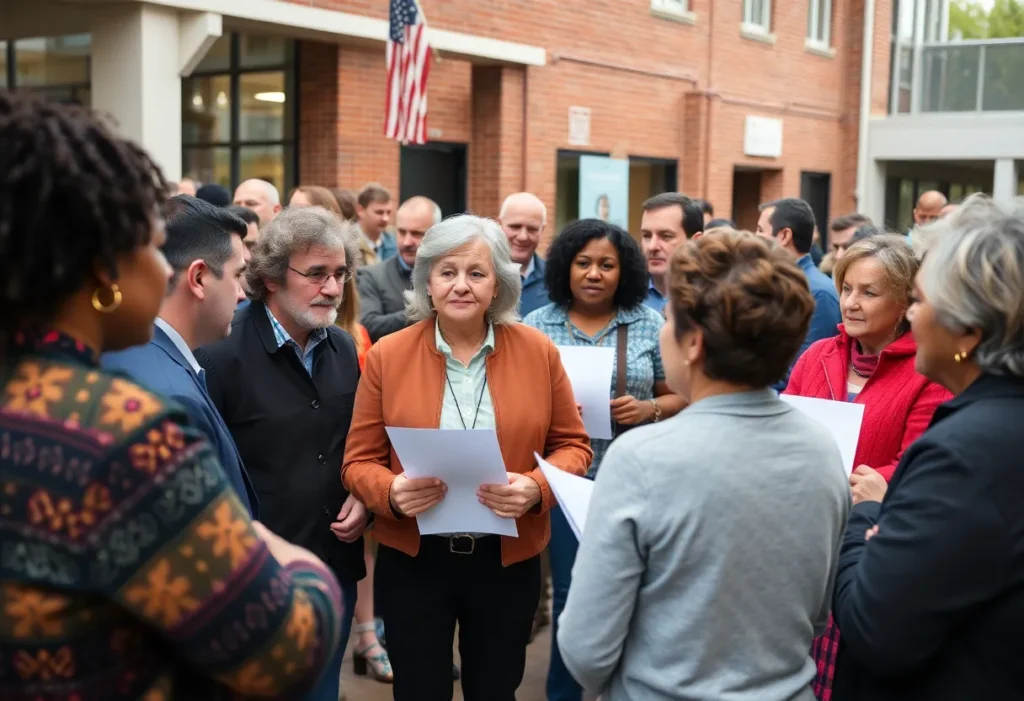
Jefferson Hosts Event to Empower Consumers Against Scams
Jefferson, South Carolina, November 26, 2025 The Jefferson-Pageland Ministerial Alliance organized a Consumer Protection Information event in Jefferson, South Carolina, aimed at educating community members about consumer rights and scam avoidance....

I-77 South Express Lanes Transforming Traffic Flow
Charlotte, North Carolina, November 25, 2025 The North Carolina Department of Transportation has unveiled plans for a $3.2 billion project to add express lanes along 11 miles of Interstate 77, from...

Rudolph’s Revenge: A Christmas in July Night Run
Rock Hill, South Carolina, November 25, 2025 Join the festivities in Rock Hill, South Carolina, with the Rudolph’s Revenge: A Christmas in July Night Run on July 18. This community event...

Uncasville, Connecticut Welcomes ‘Dancing with the Stars: Live!’
Uncasville, Connecticut, November 24, 2025 ‘Dancing with the Stars: Live!’ will delight fans with live performances in Uncasville, Connecticut at Mohegan Sun Arena. The shows are scheduled for two nights, featuring...

The Mercantile: Rock Hill’s Best Boutique Shop
Rock Hill, November 24, 2025 The Mercantile, a modern general store and coffee shop in the historic Coca-Cola Factory in Rock Hill, has been awarded the title of Best Boutique Shop....

Candlelight: Tribute to Queen Concert Enriches Community
Westchester County, NY, November 23, 2025 The recent Candlelight: Tribute to Queen concert in Westchester County showcased the power of live music to foster community pride and connection. Featuring a string...
CRIME

Two Toddlers Injured in Newberry Shooting; Parents Arrested
Newberry, South Carolina, November 25, 2025 In Newberry, South Carolina, two toddlers aged 2 and 3 sustained gunshot wounds during a shooting incident in their home. The Newberry County Sheriff’s Department...

Fatal Two-Car Crash on I-77 in York County
York County, November 25, 2025 A tragic two-car collision on Interstate 77 in York County has resulted in one fatality and four hospitalizations. The crash occurred on Sunday night near mile...

Fort Mill Police Launch Homicide Investigation at Lakeview Apartments
Fort Mill, South Carolina, November 25, 2025 Authorities in Fort Mill, South Carolina, are investigating a homicide following a deadly shooting incident at the Lakeview Apartments. On November 23, deputies responded...

Rock Hill Police Department Closes US-21 Bridge After Grenade Found
Rock Hill, South Carolina, November 23, 2025 The Rock Hill Police Department responded swiftly by closing the US-21 bridge after a live military-style grenade was found in a vehicle involved in...

20-Year-Old Woman Arrested for Attempted Murder in Rock Hill
Rock Hill, South Carolina, November 21, 2025 A 20-year-old woman, Jocelyn Byrum, has been arrested on charges of attempted murder and unlawful neglect of a child after allegedly inducing labor at...

Dispute Between Acquaintances Leads to Shooting in Rock Hill
Rock Hill, South Carolina, November 21, 2025 A disagreement between two acquaintances escalated into a shooting in Rock Hill, South Carolina, resulting in one injured and another arrested. The incident occurred...

Teen Killed in Richland County; Two Arrested
Richland County, November 20, 2025 On November 11, 2025, a tragic shooting occurred in Richland County, resulting in the death of 18-year-old Dion Briggs. Authorities arrested Semieon Helton-Hill in connection with...

20-Year-Old Faces Charges for Attempted Feticide in South Carolina
Rock Hill, South Carolina, November 20, 2025 Jocelyn Byrum, a 20-year-old from Rock Hill, South Carolina, has been charged with attempted murder and unlawful neglect after allegedly trying to self-terminate her...

Winthrop University Launches New Aviation Program
Rock Hill, South Carolina, November 20, 2025 Winthrop University will launch a new aviation program in collaboration with Aviation Career Education Services and Rock Hill airport, beginning in the fall of...
POLITICS
Charlotte Loses Manufacturing Project to Piedmont Triad
Charlotte, NC, November 27, 2025 Charlotte’s economic landscape shifts as a pivotal manufacturing project is relocated to the Piedmont Triad, resulting in a loss of around 300 jobs. This decision comes...
Federal Immigration Crackdown Stirs Controversy in Charlotte
Charlotte, NC, November 26, 2025 Operation Charlotte’s Web has sparked significant unrest in Charlotte, NC, following federal immigration enforcement actions that resulted in over 370 arrests in five days. The operation...
Rock Hill Remembers Bobby ‘B.S.’ Plair, Sr.
Rock Hill, South Carolina, November 26, 2025 The Rock Hill community gathers to honor the life and legacy of Bobby ‘B.S.’ Plair, Sr., a distinguished musician and WWII veteran, who recently...

Local Law Firm Distributes Free Thanksgiving Meal Kits
Rock Hill, South Carolina, November 22, 2025 McGowan, Hood, Felder & Phillips in Rock Hill is giving back this holiday season by providing 500 free Thanksgiving meal kits to families in...

Rock Hill, SC Welcomes New Downtown Venue for Craft Beer and Artisan Eats
Rock Hill, SC, November 22, 2025 A new establishment has opened in downtown Rock Hill, enhancing the local dining and entertainment scene with a vibrant space for craft beer, wine, live...

Winthrop University Launches New Aviation Program to Support Local Workforce
Rock Hill, South Carolina, November 20, 2025 Winthrop University has announced a new aviation program set to commence in fall 2026. In partnership with Aviation Career Education Services Flight School and...

Arafan Diané Commits to University of Houston Basketball
Rock Hill, SC, November 20, 2025 Arafan Diané, the top center prospect from the 2026 recruiting class, has committed to the University of Houston for men’s basketball. At 7-foot-1 and 290...
Karen Dalton Announces Candidacy Against Scott Perry
Carlisle, Pennsylvania, October 26, 2025 News Summary Karen Dalton, a Republican from Carlisle, has declared her intention to run against U.S. Representative Scott Perry in the 2026 primary for Pennsylvania’s 10th...

York County Woman Charged in Voter Registration Fraud
York County, October 25, 2025 News Summary Samantha Szukiewicz, 36, is one of seven individuals charged in a fraudulent voter registration investigation in York County. The Pennsylvania Attorney General’s Office filed...
SPORTS
Rudolph’s Revenge: A Christmas in July Night Run
Rock Hill, South Carolina, November 25, 2025 Join the festivities in Rock Hill, South Carolina, with the Rudolph’s Revenge: A Christmas in July Night Run on July 18. This community event...

Major League Soccer Playoff Faceoff: NYCFC vs. Philadelphia Union
Chester, Pennsylvania, November 23, 2025 The Eastern Conference Semifinals of the MLS Cup Playoffs will feature a thrilling match between New York City FC and the Philadelphia Union. Taking place at...

Rock Hill High School Football Team Aims for Playoffs
Rock Hill, South Carolina, October 26, 2025 News Summary Rock Hill High School’s football team is fighting for a playoff spot as Week 10 approaches, currently holding a record of 4-3...

Greensboro Swarm Signs DJ Burns for Upcoming G League Season
Greensboro, NC, October 26, 2025 News Summary The Greensboro Swarm has officially signed 25-year-old center DJ Burns, a former NC State standout, in preparation for the G League season. Acquired from...

Winthrop Volleyball Defeats Radford to Extend Winning Streak
Rock Hill, South Carolina, October 25, 2025 News Summary The Winthrop University volleyball team achieved a solid victory against Radford, winning 3-1 in a conference match. Paige Bennett led with 17...

Indian Land Football Team Aims to Extend Undefeated Streak Against Fort Mill
Indian Land, SC, October 24, 2025 News Summary The Indian Land football team is set for a crucial matchup against Fort Mill this Friday, boasting an impressive undefeated record of 8-0....

Northwestern Trojans Dominate Rock Hill Bearcats in Rivalry Match
Rock Hill SC, October 23, 2025 News Summary The Northwestern Trojans triumphed over the Rock Hill Bearcats with a score of 45-14, marking their sixth consecutive victory in the historic rivalry....

Winthrop University Volleyball Dominates Charleston Southern
Rock Hill, October 18, 2025 News Summary The Winthrop University volleyball team triumphed over Charleston Southern, sweeping the match with set scores of 25-20, 25-20, and 25-18. This victory marks Winthrop’s...

Northwestern Trojans Secure Dominant Win Over Rock Hill Bearcats
District 3 Stadium, October 18, 2025 News Summary The Northwestern Trojans triumphed over the Rock Hill Bearcats with a commanding 45-14 victory at District 3 Stadium. This win extends their streak...