News Summary
Severe thunderstorms are impacting Anderson and Abbeville counties with warnings issued by the National Weather Service. Expect strong winds up to 40 mph and frequent lightning strikes. Various nearby towns, including Hartwell and Lavonia, should remain alert and take precautions. A tornado watch is also in effect, further increasing safety concerns. Stay indoors and keep informed with updates during this stormy weather.
Thunderstorms Rock Anderson and Abbeville: What You Need to Know
Hey there, folks! If you’re living in or around Anderson or Abbeville counties, it’s time to pay attention because the weather is taking a wild turn. The National Weather Service has issued a **strong thunderstorm warning** that kicked off at about 10:58 p.m. on Friday and is expected to last until 11:45 p.m. So, gather the family and settle in, because things are about to get a little stormy!
What to Expect
First off, keep an eye out for winds gusting up to 40 mph. This isn’t just a light breeze. The storm, tracked by Doppler radar, was chugging along at 50 mph, located just 5 miles west of Hartwell and about 4 miles southeast of Bowersville. That’s some serious speed for a storm!
It’s essential to be cautious, especially for those in areas like Hartwell, Carnesville, Homeland Park, Royston, Reed Creek, Lavonia, Iva, Bowman, Lake Secession, and Canon. All these spots can expect significant weather changes, so make a note of that.
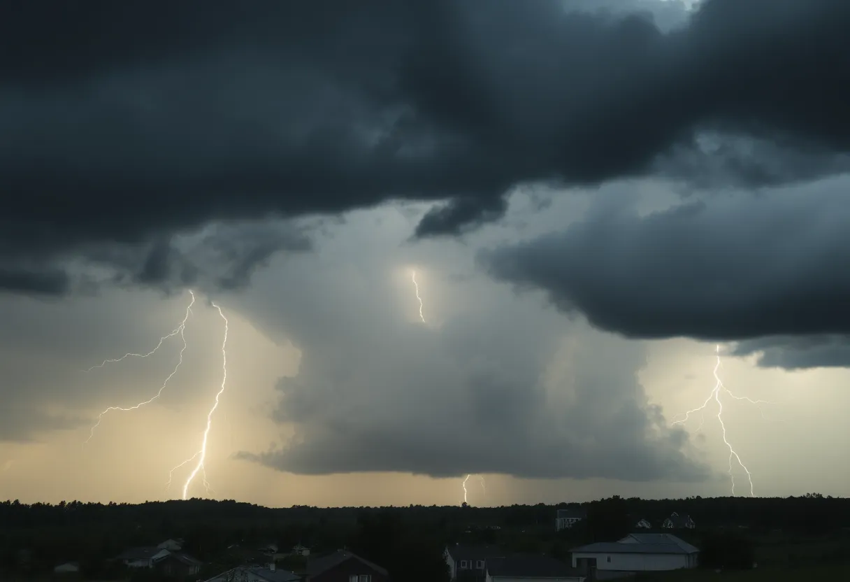
Watch Out for Lightning!
One of the biggest culprits during these thunderstorms is lightning. With frequent cloud-to-ground strikes happening, it’s crucial to seek shelter indoors if you’re outside. Did you know that about **25 million lightning strikes** hit the U.S. each year, sadly causing around 20 fatalities? As the storm rolls in, the risk of getting zapped goes up, peaking when the storm is directly overhead. Better safe than sorry, right?
Safety First!
The National Weather Service is advising everyone to stay safe by moving indoors during the storm. Nobody wants any flying tree limbs or unsecured objects turning into deadly projectiles! And let’s not forget about the **previous storm warnings** issued on May 15, where residents faced wind gusts of 60 mph and quarter-size hail. This latest warning, however, indicates winds could reach up to 58 mph or higher.
Stay Informed
There’s more storm activity expected, with a **70% chance of thunderstorms** continuing throughout the night. It’s wise to stay informed and prepared for anything. Keep your phone handy because the NWS is also encouraging residents to report any signs of damaging winds, hail, or flooding via a toll-free number or through social media. Your report might help your neighbors stay safe!
Tornado Watch
Oh, and if you thought that was all, there’s a **tornado warning** currently in effect for Knox, Anderson, Loudon, and Roane counties, following reports of a tornado sighting over Oak Ridge. This severe weather system is proving it’s not messing around, capable of generating tornadoes, high winds, and flooding across various areas.
Final Thoughts
In conclusion, keep an alert eye on the weather updates. Your safety is the priority! Make sure your family is tucked away safely, free from any storm hazards. Remember the wisdom: “It’s always better to be safe than sorry!” So grab a snack, find a cozy spot, and wait out this wild weather. Stay safe and dry!
Deeper Dive: News & Info About This Topic
HERE Resources
Thunderstorm Chaos Strikes Myrtle Beach
Rock Hill, South Carolina Reports EF0 Tornado Without Injuries
Rock Hill, SC, Faces Short but Intense EF0 Tornado
Chesterfield County Faces Strong Thunderstorm Warnings
Brief Tornado Strikes Rock Hill, SC, Causes Damage
Severe Thunderstorm Alert Hits Coastal Georgia and South Carolina!
Severe Thunderstorm Warnings in York County
Rock Hill Tornado Causes Damage and Concern
Severe Thunderstorm Warning Hits South Carolina
Severe Thunderstorm Watch Issued for South Carolina Counties
Additional Resources
- Independent Mail
- Wikipedia: Thunderstorm
- MSN Weather
- Google Search: Thunderstorm Warnings
- 3B Media News
- Encyclopedia Britannica: Lightning
- Knox News
- Google News: Tornado Warnings
Author: STAFF HERE ROCK HILL
The ROCK HILL STAFF WRITER represents the experienced team at HERERockHill.com, your go-to source for actionable local news and information in Rock Hill, York County, and beyond. Specializing in "news you can use," we cover essential topics like product reviews for personal and business needs, local business directories, politics, real estate trends, neighborhood insights, and state news affecting the area—with deep expertise drawn from years of dedicated reporting and strong community input, including local press releases and business updates. We deliver top reporting on high-value events such as the Come-See-Me Festival, Rock Hill Arts Festival, and motorsport events at the Rock Hill Velodrome. Our coverage extends to key organizations like the Rock Hill Chamber of Commerce and the Culture & Heritage Museums, plus leading businesses in manufacturing and technology that power the local economy such as 3D Systems and Comporium. As part of the broader HERE network, including HEREAiken.com, HEREBeaufort.com, HEREChapin.com, HERECharleston.com, HEREClinton.com, HEREColumbia.com, HEREGeorgetown.com, HEREGreenwood.com, HEREGreenville.com, HEREHiltonHead.com, HEREIrmo.com, HEREMyrtleBeach.com, HERENewberry.com, HERERockHill.com, and HERESpartanburg.com, we provide comprehensive, credible insights into South Carolina's dynamic landscape.


