News Summary
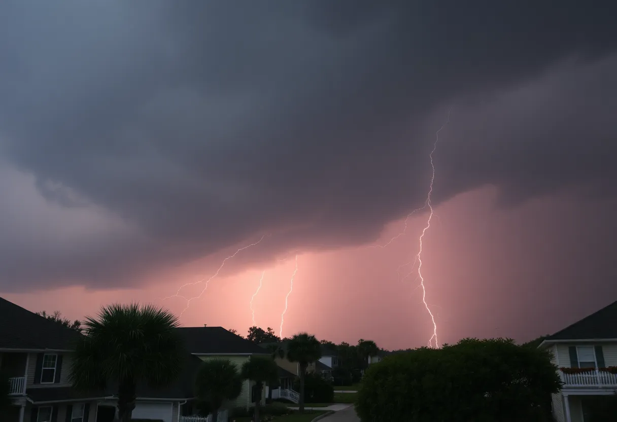
Charleston is currently under a severe thunderstorm alert issued by the National Weather Service. Powerful storms are expected with wind gusts reaching up to 50 mph and potential flash flooding. Key areas like North Charleston, Summerville, and Dorchester County are in the storm’s path. Residents and travelers on I-26 should exercise caution due to hazardous driving conditions. Staying informed through local weather updates is crucial for safety. It’s important to remember the dangers of lightning and the risks associated with heavy rains. Safety should be the top priority as the storm unfolds.
Severe Thunderstorm Alert Rocks Charleston Area!
Charleston is on high alert as the National Weather Service (NWS) issued an urgent weather warning on Wednesday evening. If you thought your plans for a breezy day were safe, think again! The powerful storms are rolling in with gusty winds reaching up to 50 mph and the possibility of some dangerous weather until about 6:45 p.m.
Where’s the Storm Heading?
Residents in Inland Berkeley, Tidal Berkeley, Dorchester, and Charleston counties should pay particular attention. The Doppler radar spotted a strong storm near Crowfield Plantation just before 6:16 p.m., and it’s moving southeast at around 10 mph. Areas like North Charleston, Summerville, Goose Creek, Hanahan, Ladson, Naval Weapons Station Charleston, West Ashley, College Park, and Sangaree are right in the line of fire for this stormy upheaval.
Heads Up for I-26 Travelers
If you’re driving on I-26, be cautious! The storm’s effects stretch between mile markers 198 and 212. With wind gusts like these, you might see tree limbs snapping and loose items flying around, so it’s wise to keep your eyes peeled and your hands on the wheel.
Heavy Rain and Flash Flood Warnings
Torrential rain is also part of the storm’s offer, which may lead to *flash flooding*. So, if you’re tempted to make a quick dash through a flooded roadway, think again! That water can be deceptive, and it’s better to wait than risk getting stuck or worse. Safety first, folks!
Stay Tuned and Stay Safe
As this storm progresses, stay informed by tuning in to your local weather forecasts via NOAA Weather Radio All Hazards, television, or local news outlets. The National Weather Service reminds us that *lightning* is a serious concern during thunderstorms. Across the U.S., lightning strikes occur about 25 million times a year, primarily during summer months, and it leads to an average of 20 fatalities each year. When thunder roars, it’s wise to head indoors, as the risk of lightning is highest when the storm is overhead.
Driving in Wet Conditions – What to Remember
While everyone loves a summer storm, it’s no fun dealing with the aftermath if you’re driving. Cars can hydroplane, meaning they slide uncontrollably on wet surfaces—yikes! Be careful out there, as water buildup in front of vehicle tires can lead to this slippery situation. Keep your speed down, maintain a safe following distance, and remember: it’s *better to arrive late than to risk a dangerous drive*.
In Closing
As this storm continues to churn through Charleston, stay vigilant and look out for one another. Enjoy the cozy feeling of a thunderstorm from your living room, but make sure you and your loved ones are safe as nature puts on its dramatic show. With possible flooding, intense winds, and all that *raucous thunder*, this is a weather event you don’t want to underestimate.
Sure, summer storms can be thrilling, but respecting their power and keeping safety as a priority is the best way to ride out the storm. Stay safe, Charleston!
Deeper Dive: News & Info About This Topic
HERE Resources
Severe Thunderstorm Warning Issued for Orangeburg, Lexington, and Aiken Counties
Severe Thunderstorm Warnings Issued for Upstate South Carolina
Columbia Braces for Severe Thunderstorm Warnings
Severe Thunderstorm Warnings in Upstate South Carolina
Severe Thunderstorm Warnings Issued for South Carolina Counties
Severe Thunderstorm Warnings Sweep South Carolina: Stay Alert!
Severe Thunderstorms Sweep Through South Carolina
Severe Weather Action in Texas as Emergency Resources Mobilized
Severe Thunderstorm Warning Issued for Upstate South Carolina
Severe Thunderstorm Warnings Sweep Across Upstate South Carolina
Additional Resources
- Island Packet: Severe Thunderstorm Update
- Wikipedia: Thunderstorm
- Live 5 News: Tornado Warning
- Google Search: Thunderstorm Safety
- Count on 2 News: Tornado Warning Issued
- Google Scholar: Thunderstorm Warnings
- ABC News 4: Severe Thunderstorm Warning
- Encyclopedia Britannica: Thunderstorm
- Island Packet: Weather Alert Update
- Google News: Tornado Alert Lowcountry
Author: STAFF HERE ROCK HILL
The ROCK HILL STAFF WRITER represents the experienced team at HERERockHill.com, your go-to source for actionable local news and information in Rock Hill, York County, and beyond. Specializing in "news you can use," we cover essential topics like product reviews for personal and business needs, local business directories, politics, real estate trends, neighborhood insights, and state news affecting the area—with deep expertise drawn from years of dedicated reporting and strong community input, including local press releases and business updates. We deliver top reporting on high-value events such as the Come-See-Me Festival, Rock Hill Arts Festival, and motorsport events at the Rock Hill Velodrome. Our coverage extends to key organizations like the Rock Hill Chamber of Commerce and the Culture & Heritage Museums, plus leading businesses in manufacturing and technology that power the local economy such as 3D Systems and Comporium. As part of the broader HERE network, including HEREAiken.com, HEREBeaufort.com, HEREChapin.com, HERECharleston.com, HEREClinton.com, HEREColumbia.com, HEREGeorgetown.com, HEREGreenwood.com, HEREGreenville.com, HEREHiltonHead.com, HEREIrmo.com, HEREMyrtleBeach.com, HERENewberry.com, HERERockHill.com, and HERESpartanburg.com, we provide comprehensive, credible insights into South Carolina's dynamic landscape.


