News Summary
Severe thunderstorm warnings have been issued for Charleston and Berkeley Counties, with strong storms predicted to bring penny-sized hail and gusty winds. Residents in areas like Moncks Corner and Saint Stephen should prepare for potential hazards, including lightning and hydroplaning risk. Staying informed through local news sources is crucial for safety as these storms approach.
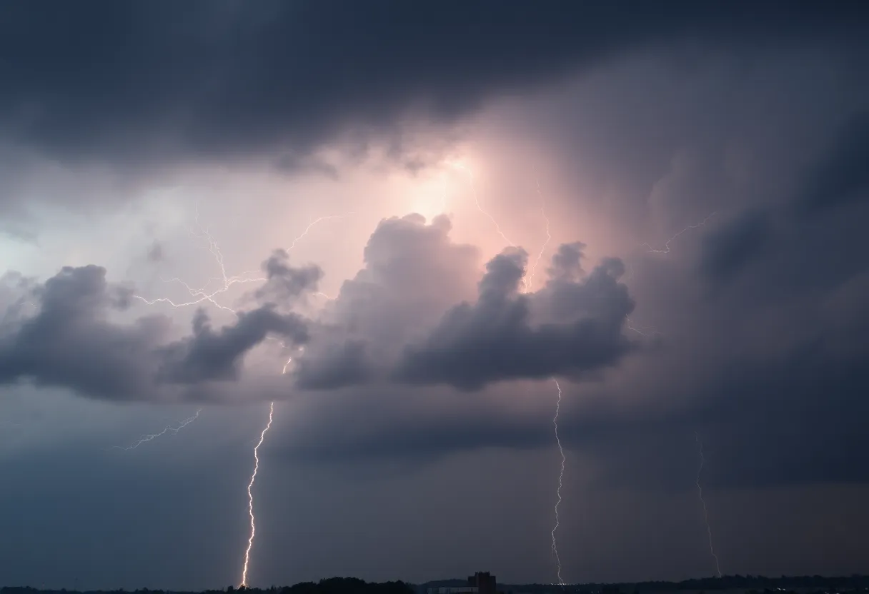
Strong Thunderstorms Expected in Charleston and Berkeley Counties
Hey there, Charleston! It looks like we’re in for some wild weather this Saturday. The National Weather Service (NWS) has issued severe thunderstorm warnings for Charleston and Berkeley Counties, and it’s important that everyone pays attention. As of 3:24 p.m., there are strong thunderstorms headed our way, predicted to last until 4:15 p.m. especially for areas in Inland Berkeley!
What to Expect
These storms could bring some penny-sized hail, measuring about 0.75 inches, primarily affecting areas such as Moncks Corner, Saint Stephen, Bonneau, Jamestown, Old Santee Canal State Park, Pinopolis, Calestown, Old Cordesville, Wadboo, and Bethera. A strong thunderstorm was spotted by Doppler radar about 6 miles east of Old Santee Canal State Park, moving northwest at a slow but steady pace of 5 mph.
Potential Hazards on the Horizon
One of the biggest concerns with these storms is the risk of gusty winds that can knock down tree limbs and blow around unsecured items. This could lead to minor damage to outdoor furniture or equipment. If you’ve got some loose decorations or tools lying around, it might be a good idea to secure them before the storm rolls in.
Safety First!
If you’re out on southern Lake Moultrie, it’s crucial to make your way to safety! With the threat of lightning, finding shelter indoors or hopping into a vehicle is recommended. Remember, lightning can strike as far as 10 miles from the main thunderstorm, so if you hear thunder, you’re close enough to be affected!
The statistics paint a concerning picture: approximately 25 million lightning strikes occur in the U.S. each year, and they result in an average of 20 fatalities. As these thunderstorms approach, the likelihood of lightning strikes increases, peaking when the storm is overhead—so be sure to stay alert!
Driving Safety Tips
One additional risk during these thunderstorms is related to driving. Heavy rainfall can lead to hydroplaning, which happens when your vehicle slides uncontrollably on wet roads due to a buildup of water in front of the tires. If you’re on the road and the rain starts to pour, remember to slow down and give yourself plenty of stopping distance. If you feel your car start to skid, steer into the direction you want the front of the car to go!
Stay Informed!
It’s super important to stay tuned in for the most current updates. Whether it’s through NOAA Weather Radio All Hazards, TV, or your favorite local news sources, make sure you get the latest information from the NWS. Alarming weather can sometimes be unexpected, but being prepared can help you stay safe.
Final Thoughts
As we brace ourselves for these thunderstorms this afternoon, let’s remember to take the necessary precautions. Make sure you are prepared, stay informed, and keep an eye on those warnings. It’s all about staying safe out there, folks! Let’s weather this storm together, Charleston!
Deeper Dive: News & Info About This Topic
HERE Resources
Student Activism Against Trump’s Policies in South Carolina
Thousands Rally in Columbia Against Trump Administration
Severe Thunderstorm Warnings Issued for Southeastern North Carolina
Thunderstorm Watch in Greenville and Spartanburg: Prepare Now!
Severe Thunderstorm Alert in South Carolina
Severe Weather Wreaks Havoc in Columbia, South Carolina
Severe Thunderstorm Alerts Issued for South Carolina
Severe Thunderstorm and Tornado Alerts Cause Concern in the CSRA
Myrtle Beach Faces Severe Thunderstorm Warnings
Severe Thunderstorm Alert Rocks Charleston Area
Additional Resources
- The State
- Wikipedia: Thunderstorm
- Herald Online
- Google Search: Thunderstorm Safety
- News 2
- Google Scholar: Thunderstorm Warnings
- Myrtle Beach Online
- Encyclopedia Britannica: Thunderstorm
- Post and Courier
- Google News: Thunderstorm News
- Live 5 News
Author: STAFF HERE ROCK HILL
The ROCK HILL STAFF WRITER represents the experienced team at HERERockHill.com, your go-to source for actionable local news and information in Rock Hill, York County, and beyond. Specializing in "news you can use," we cover essential topics like product reviews for personal and business needs, local business directories, politics, real estate trends, neighborhood insights, and state news affecting the area—with deep expertise drawn from years of dedicated reporting and strong community input, including local press releases and business updates. We deliver top reporting on high-value events such as the Come-See-Me Festival, Rock Hill Arts Festival, and motorsport events at the Rock Hill Velodrome. Our coverage extends to key organizations like the Rock Hill Chamber of Commerce and the Culture & Heritage Museums, plus leading businesses in manufacturing and technology that power the local economy such as 3D Systems and Comporium. As part of the broader HERE network, including HEREAiken.com, HEREBeaufort.com, HEREChapin.com, HERECharleston.com, HEREClinton.com, HEREColumbia.com, HEREGeorgetown.com, HEREGreenwood.com, HEREGreenville.com, HEREHiltonHead.com, HEREIrmo.com, HEREMyrtleBeach.com, HERENewberry.com, HERERockHill.com, and HERESpartanburg.com, we provide comprehensive, credible insights into South Carolina's dynamic landscape.

