News Summary
Residents in Oconee and Pickens Counties are on alert as the National Weather Service warns of severe thunderstorms rolling into the area. With wind gusts reaching up to 40 mph, residents are advised to secure outdoor items and find shelter indoors. The storms are moving eastward, bringing risks of lightning and localized flooding. Safety tips are shared as the weather poses heightened risks in the region, particularly for outdoor activities around lakes and on roadways.
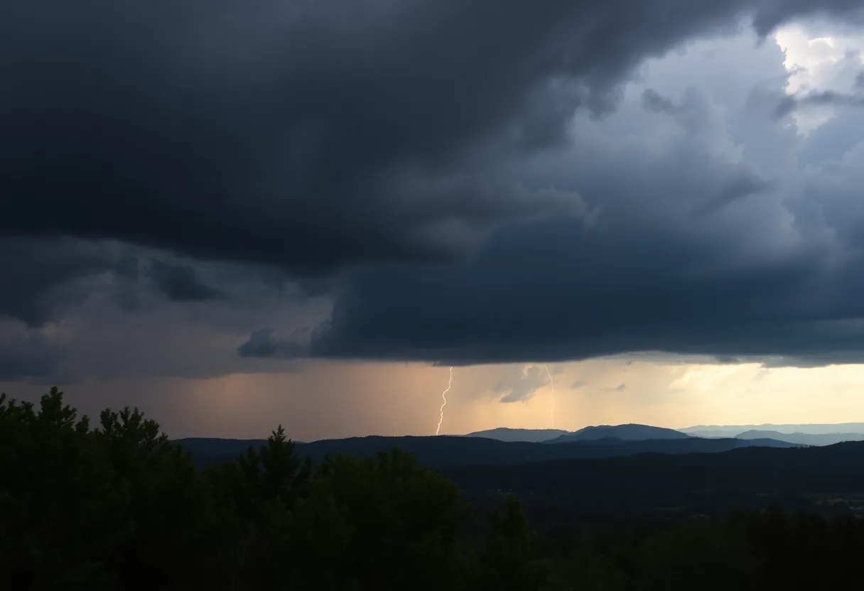
Oconee on Alert: Severe Thunderstorms Rolling Into Town!
Residents of Oconee and Pickens Counties, get ready to batten down the hatches! The National Weather Service has issued a weather alert warning for some pretty intense thunderstorms expected to hit the area. The alert was sent out on Tuesday at 3:58 p.m. and is in effect until 4:30 p.m., so it’s time to take these warnings seriously.
Storms in the Forecast
The thunderstorms are making their way through the regions encompassing the Oconee Mountains, Pickens Mountains, and the surrounding areas including the Greater Oconee and Greater Pickens. If you’re in or near towns like Toccoa, Seneca, Walhalla, Westminster, Avalon, Salem, and the scenic beauty of Lake Keowee and Jocassee Gorges, keep an eye on the sky!
As the storm rolls in, residents can expect wind gusts of up to a brisk 40 mph. This could lead to some exciting but concerning scenarios, like tree limbs getting knocked down and scattered items flying around. So, if you’ve got any outdoor decor you care about, you might want to take it inside before strong winds have their way!
Stay Indoors!
The thunderstorm activity is moving eastward at about 15 mph, tracked as of 3:57 p.m. by Doppler radar. The storms range from 19 miles northwest of Pickens to areas 5 miles northwest of Walhalla and 3 miles northwest of Toccoa. With the frequent cloud-to-ground lightning that often accompanies such a storm, residents are strongly advised to find shelter indoors if they’re outdoors.
If you happen to be near Lake Keowee or Lake Jocassee, it’s best to exit the water and seek refuge indoors or at least inside your vehicle. Remember that lightning can strike as far as 10 miles away from a storm, so even if the thunder seems a bit distant, you’re still within reach!
Prepare for Possible Flooding
We could also see some torrential rainfall that might lead to localized flooding! If you’re out and about, take care to avoid driving through any flooded roads, as this can be super dangerous.
In the U.S., lightning strikes around 25 million times a year, primarily during the summer months. Sadly, this leads to about 20 fatalities annually. With thunderstorms nearing, the likelihood of a lightning strike only increases, peaking as the storm is directly above.
Safety Tips Galore!
In light of the warnings, the NWS has put out some important safety recommendations for handling thunderstorms. If you can find shelter indoors – do it! If not, there are ways to protect yourself that can really help during these particularly energetic weather events.
Additionally, watch out for hydroplaning! That’s when your vehicle starts to slide uncontrollably on wet roads because of too much water in front of the tires. It’s good to be wise about how to drive in wet conditions, especially now with storms imminent.
More Warnings Ahead
If you think you’ve seen the last of this wild weather, think again! Just this past Sunday and again on Wednesday, we’ve had warnings of wind gusts hitting up to 60 mph, with hail the size of walnuts (that’s about 1.5 inches). Areas like Clarkesville, Cornelia, and Baldwin are also in the line of fire, so it’s a tense time for many of our neighbors!
Remember to stay informed and report any damaging winds, hail, or flooding. The weather can turn on a dime, but keeping an eye on updates will help everyone stay safe during this stormy season!
Deeper Dive: News & Info About This Topic
HERE Resources
Severe Thunderstorm Alerts Issued for South Carolina Regions
Severe Thunderstorm Caution Issued for Chester and York Counties
Thunderstorm Warnings Issued for Greenville-Spartanburg Area
Severe Thunderstorm Warning in Cherokee and Spartanburg Counties
Severe Thunderstorm Warning Issued for Henderson County
Severe Thunderstorm Alert for Laurens County
Severe Thunderstorm Warnings Issued for York County
Severe Thunderstorm Warnings Hit York County
Severe Thunderstorm Warning Issued for Oconee County
Heat Advisory Issued for Greenville, South Carolina
Additional Resources
- Greenville Online: Severe Thunderstorm Warning for Oconee County
- Independent Mail: Severe Thunderstorm Warning for Anderson County
- Island Packet: Weather News
- Encyclopedia Britannica: Thunderstorms
- Google Search: Severe Thunderstorm Warning