News Summary
Residents of Dillon, Florence, and Marion counties are under a severe thunderstorm alert until 5 p.m. today. The National Weather Service warns of strong winds, hail, and localized flooding. Drivers are advised to be cautious as road conditions may be hazardous due to heavy rain and lightning. Safety remains paramount as residents are encouraged to seek shelter during the storm and avoid driving through flooded areas.
Severe Thunderstorm Alert for Dillon, Florence, and Marion Counties
Attention residents of Dillon, Florence, and Marion counties! Buckle up and stay safe, as the National Weather Service has issued a severe thunderstorm alert set to last until 5 p.m. this evening. The storm is already brewing up some excitement, with radar detecting a strong thunderstorm just over Sellers, located 9 miles northwest of Marion.
What’s on the Weather Menu?
This storm isn’t messing around! Expect to see pea-sized hail (that’s about 0.25 inches in size) and fierce wind gusts reaching up to 50 mph. That’s definitely not your average summer shower! The storm is currently moving eastward at 15 mph, so it’s picking up speed.
Areas likely to be affected include popular spots such as Dillon, Latta, Sellers, Floydale, Fork, Zion, Blue Brick, Smithboro, Mars Bluff, Oak Grove, Francis Marion University, and even Mcleod Medical Center.
A Word to the Wise—Be Prepared!
Residents are advised to take cover and stay indoors as much as possible. Why? Well, with this storm comes torrential rainfall that could potentially lead to localized flooding. If you find yourself outdoors, it’s best to seek shelter inside a building right away!
For those hitting the roads, be alert! Interstate 95 is affected between mile markers 171 and 174, and also between mile markers 176 and 186. Absolutely avoid driving through flooded areas, as they can be treacherous. Remember, you may not know how deep the water is, but your car might!
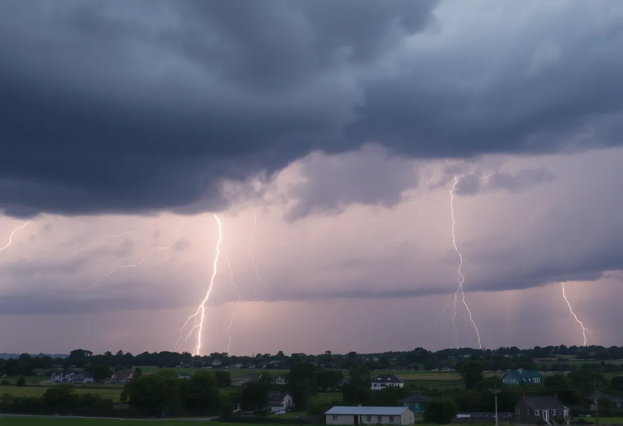
Lightning—A Silent Danger
Another aspect to be aware of is the constant cloud-to-ground lightning occurring alongside the storm. Lightning is, unfortunately, one of nature’s leading killers, causing around 20 fatalities each year. With around 25 million lightning strikes happening annually in the U.S., the chance of getting struck goes up dramatically as a storm nears, peaking when the storm is directly overhead. So, if you hear rumbling thunder, that’s your cue that it’s time to get in!
Understanding Hydroplaning
Rain can make roads slick and lead to a dangerous situation known as hydroplaning. This happens when your vehicle loses traction because water builds up in front of the tires. The top three culprits of hydroplaning are speed, tires with insufficient tread, and, of course, standing water on the roads. If you’re driving, make sure you slow down and keep your tires in good shape!
Stay Safe Out There!
Safety should always be your top priority during a storm. To keep everyone safe, follow these handy recommendations: seek shelter immediately, stay indoors, and resist any temptation to drive through flooding. Remember that a little precaution can go a long way in keeping you and your loved ones safe from the unpredictable fury of Mother Nature!
So hang in there, folks! Stay tuned to the latest updates and keep an eye on the sky— and the road! With a bit of luck and common sense, you’ll navigate this stormy weather just fine!
Deeper Dive: News & Info About This Topic
HERE Resources
Severe Thunderstorm Warning Issued for Berkeley and Dorchester County
Severe Thunderstorm Warning Issued in South Carolina
South Carolina Prepares for Rainy Independence Day Weekend
Severe Storms Alert for South Carolina Residents
Severe Thunderstorm Warnings Hit Charleston Area
Severe Thunderstorms and Flash Flooding Alert for York and Lancaster Counties
Oconee on Alert for Incoming Severe Thunderstorms
Severe Thunderstorm Alerts Issued for South Carolina Regions
Rock Hill First Responders Collect Cereal for Local Charity
Severe Thunderstorm Caution Issued for Chester and York Counties
Additional Resources
- Herald Online: Weather News
- Wikipedia: Severe Thunderstorm
- Post Bulletin: Weather Updates
- Google Search: Thunderstorm Safety Tips
- Fox 13 Memphis: Weather Threats
- Google Scholar: Hydroplaning in Weather
- KTVH: Severe Storms in Montana
- Encyclopedia Britannica: Thunderstorm