News Summary
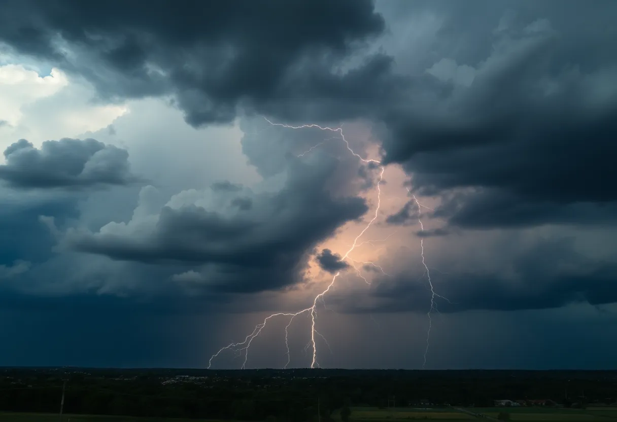
A severe thunderstorm alert has been issued for Kershaw, Lee, and Sumter counties, warning residents to secure outdoor items and seek shelter if necessary. The storm, moving at 10 mph, brings the potential for marble-sized hail and gusty winds up to 50 mph. Areas like Sumter, Shaw Air Base, and more are expected to feel its impact. Residents are advised to stay updated on the storm’s progress and practice safe driving to avoid hydroplaning. Safety is paramount as summer storms can bring dangerous conditions.
Thunderstorm Alert Hits Kershaw, Lee, and Sumter Counties
Good evening, folks in Kershaw, Lee, and Sumter counties! If you’re gearing up for a cozy Saturday night in front of the TV, you might want to pause for a moment. The National Weather Service has issued an alert for some serious thunderstorms pushing through our area, bringing some potentially wild weather. Let’s break it down so you can stay informed and safe!
What’s Happening?
As of 7:21 p.m. tonight, the radar is lighting up with reports of a strong thunderstorm brewing just 7 miles north of Oakland and around 8 miles north of Shaw Air Base. This storm is moving southeast at a leisurely pace of about 10 mph, but don’t let that fool you; it packs a punch! The thunderstorm alert is expected to stick around until 8 p.m., so be on your toes.
Thunderstorm Features
So, what does this mean for you? We’re looking at the potential for marble-sized hail—we’re talking about approximately 0.5 inches—and gusty winds reaching speeds up to 50 mph! If you’ve got outdoor furniture, be sure to secure those items, as the wind could send them flying or even bring down a few tree limbs. It’s a good idea to check on your garden gnomes and patio chairs!
Where Is This Storm Headed?
The storm isn’t picky about where it impacts. Locations expected to feel the brunt of it include Sumter, South Sumter, Shaw Air Base, Mulberry, Oakland, and so many more. Whether you’re in Millwood, Mayesville, Cane Savannah, or even Wateree River Correctional Institution, keep an eye on the skies and head indoors if you can.
Stay Safe!
For those who find themselves caught outdoors, the best advice is to get inside. Your living room is the safest bet! If headed home isn’t an option, try to find a sturdy structure nearby. And remember, lightning is no joke. Every year, roughly 25 million lightning strikes occur in the U.S. during the summer, resulting in about 20 fatalities. The odds of a lightning strike increase significantly as the storm gets closer, peaking right when it’s overhead.
A Word on Hydroplaning
As the rain comes down, it’s essential to talk about safe driving. Have you heard about hydroplaning? It’s that alarming feeling of your car sliding uncontrollably on a wet road. This happens when water builds up in front of your tire faster than your vehicle can push it away, creating a slippery layer of water. If you’re driving tonight, keep your speed down to avoid that scary moment!
Final Thoughts
So, as we sit back and watch the skies tonight, keep these tips in mind to ensure your safety. Whether you’re cuddled up with a good movie or munching on some snacks, don’t forget to check in on the storm’s progress. You might just have the perfect excuse to stay in and enjoy a little family time, even if it’s under the wraps of some thunderclouds!
Stay safe everyone, and remember, these storms are just a blip in the weather—sunshine and clear skies will return before we know it!
Deeper Dive: News & Info About This Topic
HERE Resources
Severe Thunderstorm Warning Issued for South Carolina
Severe Thunderstorm Warnings Impact Bamberg, Calhoun, and Orangeburg Counties
Lightning Strike Injures 20 People at Lake Murray Public Park
Severe Weather Alert in Abbeville County
Severe Weather Alert for Chester County and Delaware Valley
Severe Thunderstorms Strike Calhoun and Surrounding Counties
Severe Thunderstorm Warnings Issued for Chester, York, and Aiken Counties
Severe Thunderstorm Warning for Pickens County
Severe Thunderstorm Alert Issued for Dillon, Florence, and Marion Counties
Shooting Incident Involving Law Enforcement in Rock Hill
Additional Resources
- Herald Online: Thunderstorm Alert
- Wikipedia: Thunderstorm
- ABC Columbia: Storms in the Midlands
- Google Search: Thunderstorm Safety
- WLTX: Severe Weather Forecast
- Google Scholar: Thunderstorm Forecasting
- Finger Lakes Daily News: Canandaigua Storms
- Encyclopedia Britannica: Thunderstorm