News Summary
The National Weather Service has issued a severe thunderstorm warning for several counties in South Carolina, including Lancaster and Chesterfield. The warning is effective until 7:15 p.m. and includes potential wind gusts up to 60 mph and torrential rainfall, raising concerns of localized flooding. Residents are advised to seek shelter and stay informed as conditions can rapidly change. The storm, identified near the Carolina Sandhills Wildlife Refuge, poses risks of damaging winds, lightning, and hydroplaning on roads.
Severe Thunderstorm Alert Issued in South Carolina
Columbia, SC – A severe thunderstorm warning has been issued for multiple counties in South Carolina, effective until 7:15 p.m. Sunday. The National Weather Service (NWS) Columbia office announced the warning at 6:15 p.m., affecting areas including Southern Lancaster, Chesterfield, Kershaw, and Lee counties. Residents in these regions should remain alert for wind gusts that could reach up to 60 mph.
Doppler radar has detected a strong thunderstorm near the Carolina Sandhills Wildlife Refuge, approximately 17 miles west of Cheraw. This storm is advancing southwest at about 20 mph, accompanied by intense winds that could blow down tree limbs and move unsecured objects. Areas that may experience these severe weather conditions include Cheraw, Bishopville, Pageland, Kershaw, Chesterfield, and several educational institutions such as Northeastern Technical College and various high schools.
In addition to high winds, the severe thunderstorm warning also raises concerns over torrential rainfall that could lead to localized flooding. Residents are reminded that driving through flooded roadways is particularly dangerous, as conditions can change rapidly during severe weather events. Hydrological conditions are exacerbated by the summer humidity, which is prevalent in the region. The NWS advises individuals to seek refuge in an interior room on the lowest floor of their homes for safety during the storm.
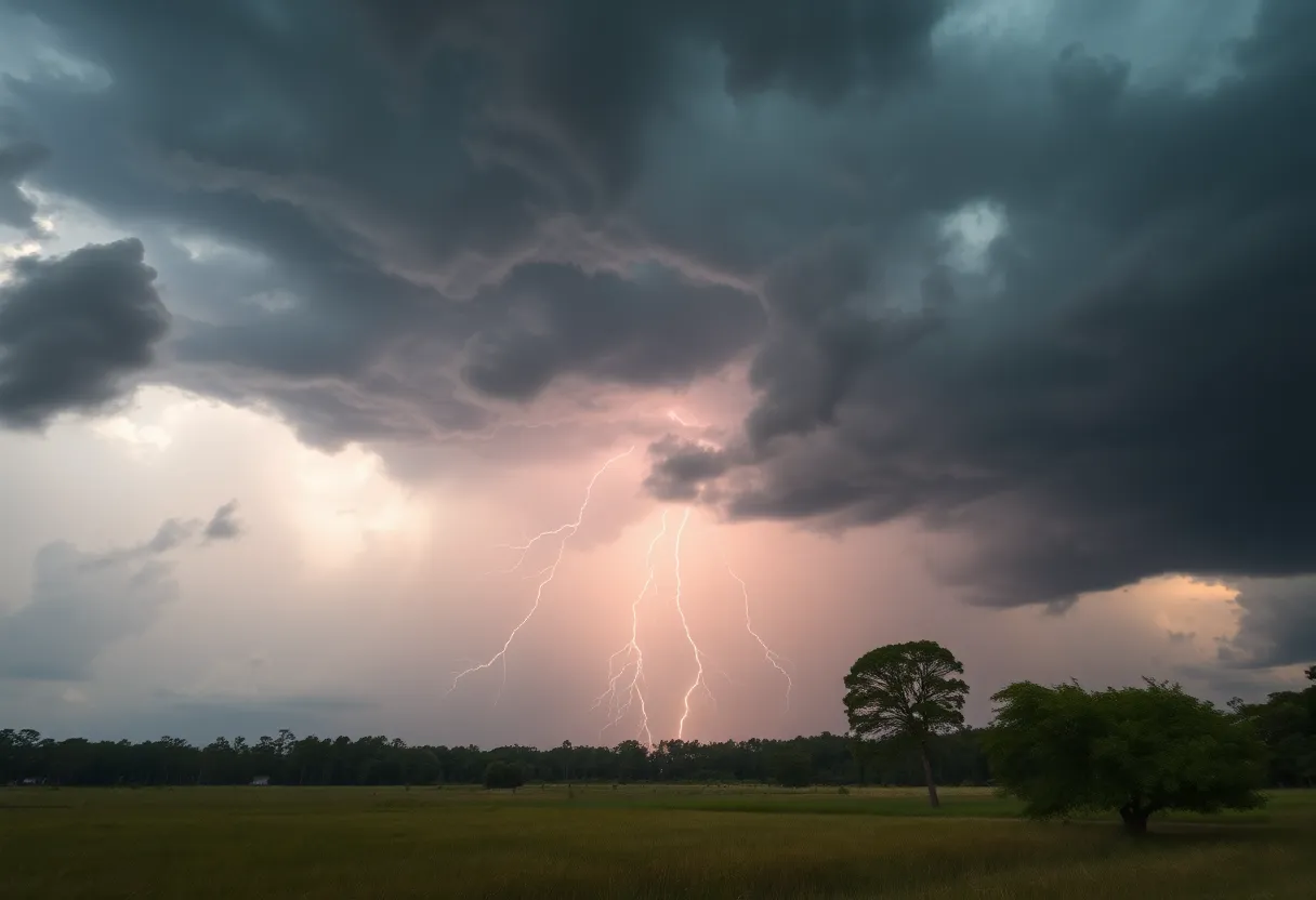
Lightning and Other Hazards
The thunderstorm is also producing frequent cloud-to-ground lightning, which can potentially strike up to 10 miles away from the storm’s center. Statistics indicate that approximately 25 million lightning strikes occur throughout the United States each year, with an average of 20 fatalities resulting from lightning strikes annually. The risk of lightning increases significantly as the storm approaches and peaks when the storm is directly overhead.
Motorists are cautioned about the risk of hydroplaning, which occurs when a vehicle loses traction due to water accumulation on the roadway. This phenomenon can be influenced by various factors, including vehicle speed, tire condition, and road surface. The public should exercise extreme caution while driving during these severe weather conditions.
Expired and Updated Warnings
Prior to this alert, a severe thunderstorm warning for Bamberg, Calhoun, and Orangeburg counties has expired as the storm in those areas weakened. However, the updated severe thunderstorm warnings have been issued for Manning, Holly Hill, Summerton, and other locations, including major highways like Interstate 26 and Interstate 95, where wind gust potentials of up to 60 mph are noted, alongside risks for damage to trees and power lines.
The Storm Prediction Center previously identified a slight risk for severe weather across South Carolina during the weekend, with environmental conditions favorable for thunderstorms driven by elevated temperatures in the low 90s and humid air. Residents are cautioned about the possibility of severe weather watches or warnings, including potential tornado watches, which may be issued as the situation evolves.
Stay Informed
As severe weather systems continue to develop, residents are encouraged to stay informed through local news outlets and weather notifications concerning ongoing weather conditions. Awareness and preparedness can greatly reduce the risks associated with severe thunderstorms and help individuals to remain safe during severe weather events.
Deeper Dive: News & Info About This Topic
HERE Resources
Severe Thunderstorm & Lightning Warnings for Charleston Area
Thunderstorm Alerts Sweep Through South Carolina
Thunderstorm Alert Hits Kershaw, Lee, and Sumter Counties
Severe Thunderstorm Warning Issued for South Carolina
Severe Thunderstorm Warnings Impact Bamberg, Calhoun, and Orangeburg Counties
Severe Weather Alert in Abbeville County
Severe Weather Alert for Chester County and Delaware Valley
Severe Thunderstorms Strike Calhoun and Surrounding Counties
Severe Thunderstorm Warnings Issued for Chester, York, and Aiken Counties
Severe Thunderstorm Warning for Pickens County
Additional Resources
- Herald Online: Severe Thunderstorm Alert
- Wikipedia: Severe Thunderstorm
- The State: Weather News
- Google Search: Severe Weather in South Carolina
- Island Packet: Weather News Update
- Google Scholar: Severe Weather Safety
- WIS TV: First Alert Weather Day
- Encyclopedia Britannica: Thunderstorm
- WLTX: Weather Impact Alert
- Google News: Thunderstorm Warnings South Carolina