News Summary
Charleston is currently experiencing severe thunderstorm warnings as the National Weather Service alerts residents to prepare for intense storms. Winds reaching up to 60 mph and heavy rainfall are expected, with the possibility of flash flooding. Residents are advised to stay informed through local weather channels and to take safety precautions, including finding shelter and avoiding flooded roads. The storm is moving swiftly through the region, causing significant concern for residents as they brace for turbulent weather.
Severe Thunderstorm Warnings Rock Charleston, SC!
Hey there, Charleston! Grab your umbrellas and hunker down because our fabulous coastal city is bracing for some serious soup! The National Weather Service (NWS) has issued severe thunderstorm warnings for multiple areas, and it looks like things are about to get a bit wild. Buckle up, as we’re diving into all the details right here!
Stormy Sunday Screams!
It all began on Sunday at 5:53 p.m., when the first warning dropped for Coastal Jasper and Beaufort counties. This intense storm was making its way over Lemon Island, moving southeast at a brisk 15 mph. The heavy rain and gusty winds were forecasted to whip through the area, potentially knocking down tree limbs and sending unsecured items flying. If you were anywhere near Hilton Head Island, Beaufort, Port Royal, Clarendon, Jasper, Parris Island, Shell Point, Burton, Lemon Island, or even Hilton Head Airport, you felt the winds howling and the rain pouring down!
As the storm rolled in, residents were urged to stay connected to the NOAA Weather Radio All Hazards, the local TV channels, or radio stations for the latest updates. It’s always better to be in the know, right?
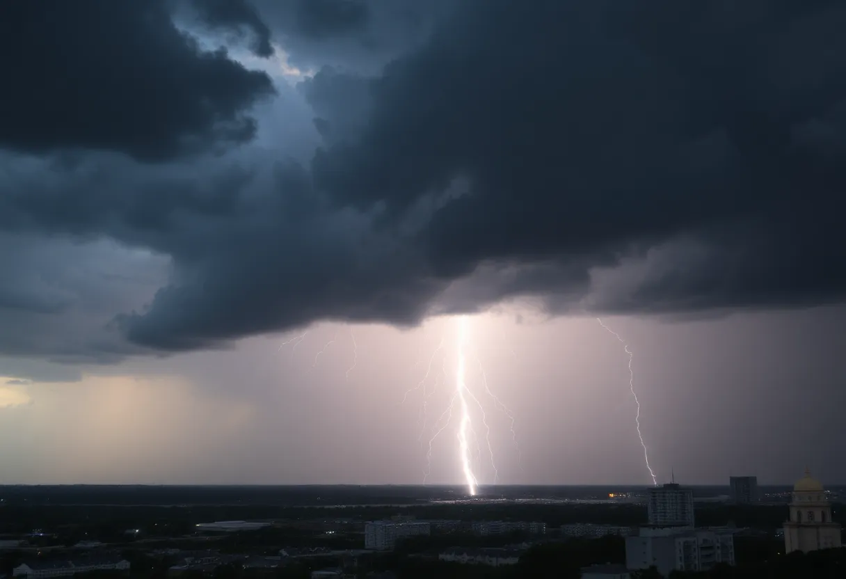
Lightning Strikes—A Thunderous Reality!
Did you know that around 25 million lightning strikes happen each year in the U.S.? Most of these dazzling bolts occur during summer months, bringing with them a shocking truth: they result in about 20 fatalities annually! As those thunderstorms approach, the chances of lightning strikes increase, peaking when the storm is right overhead. It’s true, once the storm moves on, the risk begins to fade away! Remember, safety comes first, so when you hear thunder, it’s time to find indoor shelter.
A Frightening Friday Follow-Up
The storm was spotted from Sullivan’s Island all the way south to Kiawah Island, pushing forward at 25 mph. If you were in North Charleston, Mount Pleasant, Hanahan, Johns Island, James Island, West Ashley, Downtown Charleston, Fort Sumter, or Daniel Island, you undoubtedly felt the storm’s fury. Some stretches of highways I-26 and I-526 were also notably impacted, so drivers had to tread carefully over those roads.
Flash Floods and Hydroplaning Hazards
With torrential rainfall being a significant aspect of these storms, flash flooding became a concerning reality. Drivers were warned against the temptation of driving through flooded roadways and were advised to avoid getting caught in potentially dangerous situations. Don’t forget, hydroplaning is when your vehicle loses contact with the road and starts sliding around uncontrollably—yikes! Keep your precious wheels on solid ground!
Stay Safe, Charleston!
Throughout the storms, continuous cloud-to-ground lightning illuminated the skies, adding an eerie vibe to the thunderous display. The advice remains the same: seek shelter in well-built structures and steer clear of windows. Remember, storms can wreak havoc, so it’s better to be safe than sorry!
So, keep an eye on the sky, Charleston! The storms may rattle your windows, but with the right precautions, we can ride out the thunderous weather together. Stay safe and dry!
Deeper Dive: News & Info About This Topic
HERE Resources
Aiken County Faces Severe Weather with Thunderstorms and Tornadoes
Weather Alert: Strong Thunderstorms Hit Spartanburg and Union Counties
Severe Thunderstorm Alerts Hit Florence County: Stay Safe!
Myrtle Beach Residents Brace for Severe Thunderstorm Warning
Severe Thunderstorm Alert for Marlboro and Dillon Counties
Severe Thunderstorm Warning Issued for Henderson County
Severe Thunderstorm Alert Issued in South Carolina
Severe Thunderstorm & Lightning Warnings for Charleston Area
Severe Weather Alert in Abbeville County
Severe Weather Alert for Chester County and Delaware Valley
Additional Resources
- Live 5 News: Thunderstorm Warning for Lowcountry
- ABC News 4: Severe Thunderstorm Warning for Charleston Area
- Count On 2: Tornado Warning for Lowcountry
- WV Metro News: Severe Thunderstorm Watch for WV
- Myrtle Beach Online: Weather News
- Wikipedia: Thunderstorm
- Google Search: Thunderstorm Safety
- Google Scholar: Thunderstorm Warnings
- Encyclopedia Britannica: Thunderstorm
- Google News: Thunderstorm Alerts