News Summary
Severe thunderstorms are hitting the Greenville-Spartanburg area, with winds up to 60 mph and potential for significant hail. Residents are warned to take cover and stay alert as conditions worsen. The National Weather Service has issued alerts, advising people to seek shelter indoors and remain cautious on the roads due to risks like hydroplaning. Reports of damaging winds, hail, or flooding should be communicated to authorities. Stay safe and prepared as these storms move through the region.
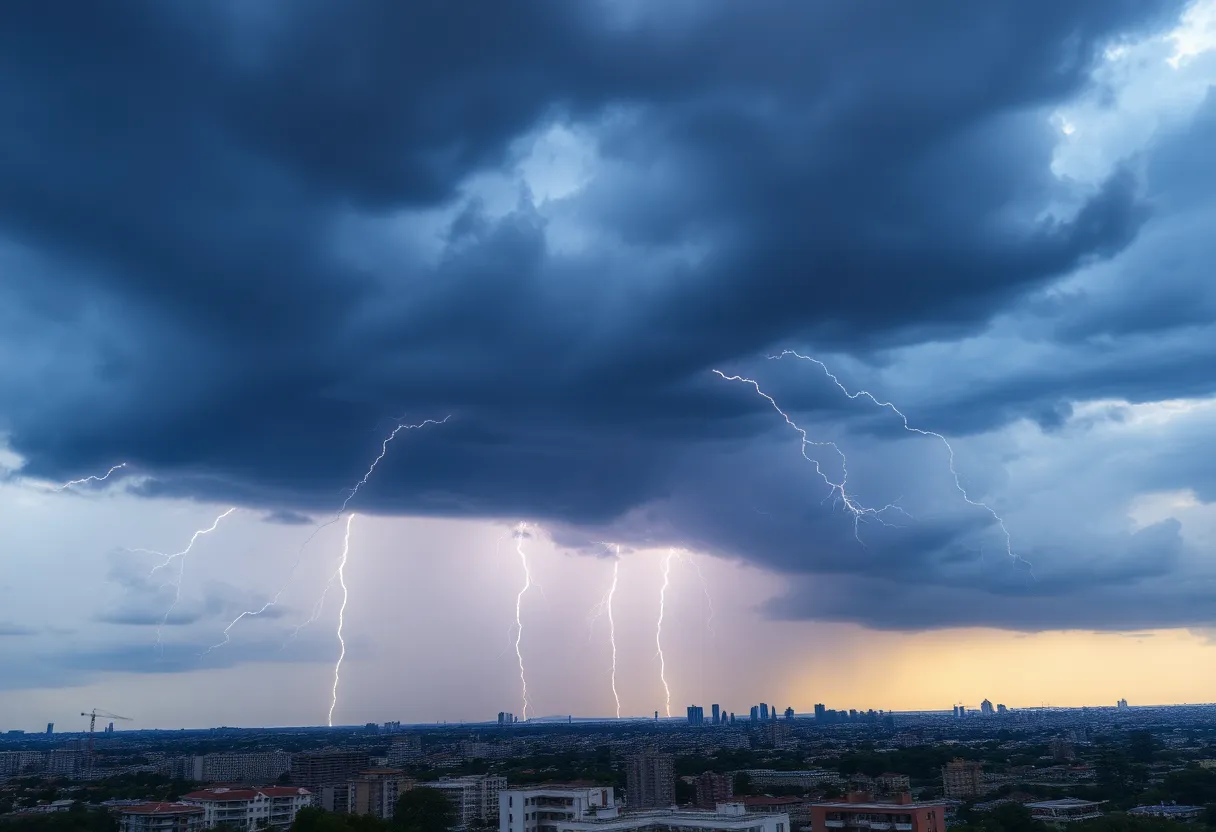
Severe Thunderstorm Warnings Sweep Through Greenville-Spartanburg Area
As dark clouds gather over the Greenville-Spartanburg area, residents are being urged to take cover as severe thunderstorms roll in, with warnings activated for multiple counties. The National Weather Service sent out alerts at 6:20 p.m. on Wednesday, March 30, which are in effect until 6:45 p.m., signaling an increase in intensity for already raging conditions.
What to Expect?
With winds gusting up to 40 mph and the potential for pea-sized hail (around 0.25 inches), folks in Anderson and Greenville counties may be looking at some strong weather moments. The initial reading from Doppler radar showed a robust thunderstorm just 5 miles southwest of Greenville Downtown, specifically around Welcome, and at that time, it appeared to be nearly stationary. It means that what you see now might stay for a bit longer, so stay alert!
The safety concerns don’t stop there. Just picture it: gusty winds strong enough to bring down tree limbs and toss around unsecured items in your yard. Outdoor decorations might also feel the heat, with a chance of minor hail damage, so it could be a good time to bring anything of value inside.
Areas Under Watch
If you live in or around Greenville Downtown, West Greenville, Welcome, Powdersville, Donaldson Center, or Piedmont, keep an ear to the ground for updates. The NWS recommends seeking shelter indoors if you’re caught outside when the storm hits. Taking cover in a sturdy building is always a safe bet during rough weather.
Lightning and Hydroplaning Risks
Severe thunderstorms come with their own set of risks. Annually, the U.S. sees roughly 25 million lightning strikes, resulting in about 20 fatalities each year. The likelihood of a lightning strike grows as thunderstorms near and peaks when the storm is directly overhead. So, if you hear thunder rumbling, it’s best to stay indoors.
And for those hitting the roads tonight, be cautious—hydroplaning is a real concern! That’s when vehicles slide uncontrollably on wet roads because water accumulates too quickly for the tires to displace. If you’re driving, make sure to keep a safe distance from the car ahead and slow down to minimize this risk.
More Severe Warnings on the Horizon
Residents are encouraged to move to an interior room on the lowest floor for safety during severe storms. It’s better to be overprepared than caught off guard. Keep your families safe and brace yourselves, because thunderstorms are moving northeast at speeds of about 50 mph.
Report Severe Weather
Deeper Dive: News & Info About This Topic
HERE Resources
Brace Yourselves, Sioux Falls – A Derecho is Coming!
Severe Heat and Thunderstorms Expected in Maryland and New York
Heat Advisory Issued for Upstate South Carolina
Extreme Heat Wave Hits the Northeastern U.S.
Severe Thunderstorm Alert Issued for Barnwell County
Strong Thunderstorm Warning Issued for South Carolina and Georgia
Severe Thunderstorms Lead to Widespread Power Outages in Lowcountry
Tragic Motorcycle Accident Claims Life in Rock Hill
Motorcyclist Dies in York County Crash
Rock Hill Motorcyclist Dies in Fatal Crash
Additional Resources
- Greenville Online
- Wikipedia: Thunderstorm
- WYFF4
- Google Search: Severe Thunderstorm Greenville
- Delaware Online
- Encyclopedia Britannica: Weather
- Independent Mail
- Google News: Greenville Severe Thunderstorm