News Summary
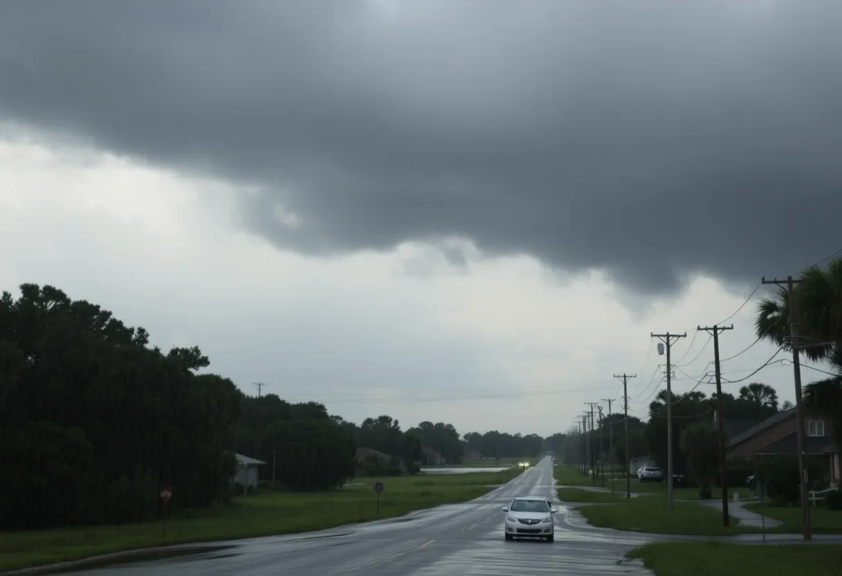
A flash flood warning has been issued for Beaufort County due to heavy rainfall, with 2-4 inches already fallen and an additional 1-3 inches expected. Areas like Hilton Head Island and Sea Pines are particularly at risk. Residents are advised to avoid flooded roads and consider evacuation if in a flood-prone area. The National Weather Service emphasizes safety by urging individuals to turn around rather than attempt to drive through flooded areas. Prepare for a soggy weekend ahead with the possibility of thunderstorms and gusty winds.
Beaufort County Faces Flash Flood Warning This Weekend
Hey everyone in Beaufort County! If you woke up this morning and saw that gloomy weather, you’re not alone. As of 4:38 a.m. today, a flash flood warning has been issued for our area, effective until 6:45 a.m. This warning comes directly from the National Weather Service and is due to some heavy rainfall sweeping through the region.
Heavy Rainfall on the Radar
So here’s the scoop: Doppler radar has picked up some intense thunderstorms dumping between 2 to 4 inches of rain already! Yikes! And hold onto your raincoats because an additional 1 to 3 inches are expected to fall in the coming hours. This isn’t just a minor drizzle; we’re looking at some serious weather.
Potential for Flash Flooding
Flash flooding is currently happening—or is about to happen—across Beaufort County. Areas like Hilton Head Island, Forest Beach, Lawton, Calibogue Cay, Sea Pines, and Harbortown are under the gun. If you’re in or near these spots, it’s a good time to keep an eye on the sky and prepare yourself.
Important Safety Tips
Now, let’s talk safety. The National Weather Service is stressing the importance of a very simple motto: “turn around, don’t drown.” It might sound cliché, but most flood-related deaths occur in vehicles. If you see water covering the road, the best option is to find an alternate route. No need to take that risk!
If you happen to live in a flood-prone area or a spot that usually gets hit hard with rain, you should consider moving to higher ground. If you’re given evacuation orders, please take them seriously! When evacuating, remember to lock up your home and disconnect any utilities if you have the time. Safety first!
What to Avoid During a Flood
One important thing to keep in mind: avoid basements or any rooms where water could potentially cause an electrical hazard. If you start to see any sparks or hear unusual noises, don’t wait around—get out immediately.
Hydroplaning Risks
Driving during heavy rain can be treacherous. Just 6 inches of moving water can knock a person right off their feet, and it only takes about 12 inches to sweep away most vehicles. Hydroplaning is a huge risk, too—water can build up in front of your tires, causing your vehicle to slide around uncontrollably. Be cautious on those wet roads!
Weekend Weather Forecast
Looking ahead, the heavy rain won’t just stop here. In total, we could see between 4 to 6 inches of rain from Friday through Monday evening, and some regions might even exceed that. Talk about a soggy weekend! Along with the rain, expect thunderstorms potentially bringing gusty winds up to 60 mph.
New Flood Alert System
On a quick note about flood alerts: the National Weather Service has updated their warning system. There’s now a “Base Flash Flood Warning” to give you a heads-up about minor flooding situations even before they escalate. In short, it’s more vital than ever to stay informed.
Conclusion
To sum it all up, stay alert out there, folks! Flash floods can be sneaky and dangerous. Keep an eye on local updates, stay safe, and remember—when it comes to flooded roads, it’s always better to be safe than sorry.
Deeper Dive: News & Info About This Topic
HERE Resources
Severe Thunderstorm Warnings Hit Charleston, SC
Severe Thunderstorm Warning Hits South Carolina
Severe Thunderstorms Hit Lowcountry of South Carolina
Severe Thunderstorms and Flooding Warnings Hit Charleston
Severe Thunderstorms Alert for Coastal South Carolina
Severe Thunderstorms Brewing in Upstate South Carolina
Severe Thunderstorm Warnings in South Carolina and Georgia
Thunderstorm Warnings Light Up Lowcountry Night Sky
Thunderstorm Alert Hits Beaufort and Jasper Counties!
Severe Thunderstorm Warnings Roll into Charleston
Additional Resources
- AOL: Extreme Heat Exits Beaufort County
- Wikipedia: Flash Flood
- MSN: Beaufort County Heat Advisory Extended
- Google Search: Beaufort County weather
- WJCL: Beaufort County Water Main Break
- Encyclopedia Britannica: Weather
- The State: Weather News in Beaufort County
- Google News: Beaufort County flooding
Author: STAFF HERE ROCK HILL
The ROCK HILL STAFF WRITER represents the experienced team at HERERockHill.com, your go-to source for actionable local news and information in Rock Hill, York County, and beyond. Specializing in "news you can use," we cover essential topics like product reviews for personal and business needs, local business directories, politics, real estate trends, neighborhood insights, and state news affecting the area—with deep expertise drawn from years of dedicated reporting and strong community input, including local press releases and business updates. We deliver top reporting on high-value events such as the Come-See-Me Festival, Rock Hill Arts Festival, and motorsport events at the Rock Hill Velodrome. Our coverage extends to key organizations like the Rock Hill Chamber of Commerce and the Culture & Heritage Museums, plus leading businesses in manufacturing and technology that power the local economy such as 3D Systems and Comporium. As part of the broader HERE network, including HEREAiken.com, HEREBeaufort.com, HEREChapin.com, HERECharleston.com, HEREClinton.com, HEREColumbia.com, HEREGeorgetown.com, HEREGreenwood.com, HEREGreenville.com, HEREHiltonHead.com, HEREIrmo.com, HEREMyrtleBeach.com, HERENewberry.com, HERERockHill.com, and HERESpartanburg.com, we provide comprehensive, credible insights into South Carolina's dynamic landscape.


