News Summary
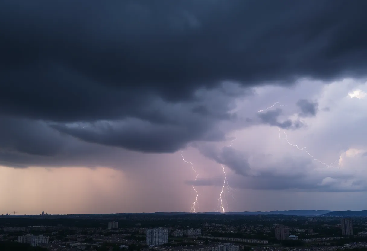
Residents of Charleston, North Charleston, and Mount Pleasant are urged to stay alert as the National Weather Service has issued a severe thunderstorm warning. The warning is effective until 2 PM today, with storms moving southwest at 15 mph. Hazards include gusty winds, potential lightning strikes, and damaging winds. Safety precautions are advised, especially for those near Lake Moultrie. Stay informed about weather updates and seek shelter when necessary.
Severe Thunderstorm Warning in Charleston Area: Stay Alert!
Hey there, folks in Charleston and nearby areas! If you plan to enjoy a nice Sunday outdoors, it looks like Mother Nature has other ideas. The National Weather Service (NWS) has issued a severe thunderstorm warning for our lovely city, including North Charleston, Mount Pleasant, and the local beaches. You might want to take cover and pay attention!
What’s Happening?
This warning is set to stay in effect until 2 PM today. Just this morning at around 6:12 AM, strong thunderstorms were observed near Eadytown, making their way southwest at a speed of 15 mph. Just imagine those storm clouds rolling in!
Potential Hazards
As these storms sweep through, brace for gusty winds that could knock down tree limbs and send loose items flying. Let’s face it; no one wants to deal with a pesky trash can that’s decided to take a little joy ride down the street.
Here are some of the areas likely to feel the storm’s fury: Eadytown, Northern Lake Moultrie, Cross, Eastern Lake Marion, Pineville, Judge Town, and Prioleau. So, if you’re in or around these neighborhoods, it’s smart to be prepared!
Safety Advice
If you’re out on or near Lake Moultrie, it’s crucial to get out of the water and head to a safe indoor location or jump in your vehicle. Lightning can strike from as far as 10 miles away from a thunderstorm, meaning if you hear thunder, you’re in risk territory. Safety first!
Earlier today, a strong line of storms was tracked moving swiftly from 6 miles south of Cross to Kiawah Island at a brisk 45 mph. Although the severe thunderstorm warning for Charleston, Berkeley, Dorchester, and Colleton Counties expired around 10:45 AM, the threat of isolated severe thunderstorms still looms. Keep that in mind if you have plans today!
What to Watch Out For
The NWS points out that damaging winds are the primary threat during these stormy spells. Expect potential damage to roofs, siding, and trees. Don’t leave your outdoor belongings unsecured, as hail could wreak havoc on anything left unprotected!
Oh, and if you’re driving, take it easy. Risk of hydroplaning increases significantly when roads get slick. Keep both hands on the wheel and slow down to avoid sliding out of control!
Lightning Risks
Here’s a shocking stat: the NWS reveals that the United States experiences about 25 million lightning strikes each year, primarily in summer. Sadly, these strikes lead to approximately 20 fatalities annually. So if you hear thunder, you need to act fast!
Bottom Line
In conclusion, if you’re in the Charleston area today, it’s wise to keep an eye on the weather updates. Stay informed via local news, TV, or your NOAA Weather Radio All Hazards for the latest information. Your safety is the priority, so find shelter whenever thunderstorms rumble your way. Stay safe and dry, everyone!
Deeper Dive: News & Info About This Topic
HERE Resources
20 Swimmers Struck by Lightning in South Carolina Beach Park
Severe Thunderstorm Warnings Issued for Southeastern Orangeburg
Devastating Tornado Outbreak in North Dakota Claims Three Lives
Thunderstorm Alerts Spark Caution in Southeastern North Carolina
Strong Thunderstorms Expected in Charleston and Berkeley Counties
Severe Thunderstorm Alerts Issued for Upstate South Carolina Counties
Severe Thunderstorm Warnings Issued for South and North Carolina
Devastating Fire Destroys Rustic Roots Warehouse in York County
Severe Thunderstorms Hit Upstate South Carolina and Georgia
Severe Thunderstorms and Tornado Warnings in South Carolina
Additional Resources
- ABC News 4
- Wikipedia: Thunderstorm
- Count on 2
- Google Search: thunderstorm warning Charleston
- Post and Courier
Author: STAFF HERE ROCK HILL
The ROCK HILL STAFF WRITER represents the experienced team at HERERockHill.com, your go-to source for actionable local news and information in Rock Hill, York County, and beyond. Specializing in "news you can use," we cover essential topics like product reviews for personal and business needs, local business directories, politics, real estate trends, neighborhood insights, and state news affecting the area—with deep expertise drawn from years of dedicated reporting and strong community input, including local press releases and business updates. We deliver top reporting on high-value events such as the Come-See-Me Festival, Rock Hill Arts Festival, and motorsport events at the Rock Hill Velodrome. Our coverage extends to key organizations like the Rock Hill Chamber of Commerce and the Culture & Heritage Museums, plus leading businesses in manufacturing and technology that power the local economy such as 3D Systems and Comporium. As part of the broader HERE network, including HEREAiken.com, HEREBeaufort.com, HEREChapin.com, HERECharleston.com, HEREClinton.com, HEREColumbia.com, HEREGeorgetown.com, HEREGreenwood.com, HEREGreenville.com, HEREHiltonHead.com, HEREIrmo.com, HEREMyrtleBeach.com, HERENewberry.com, HERERockHill.com, and HERESpartanburg.com, we provide comprehensive, credible insights into South Carolina's dynamic landscape.

