News Summary
Residents of Sioux Falls and nearby areas are being alerted to prepare for a powerful derecho that will sweep through the Northern Plains this week. This severe weather event, characterized by high winds exceeding 74 mph, poses serious risks including potential tornadoes and large hail. Key areas at risk include South Dakota, southern Minnesota, and northern Iowa, with residents urged to secure safe shelters and stay informed through the National Weather Service. Following a summer filled with extreme weather, preparation is vital to ensure safety as conditions escalate.
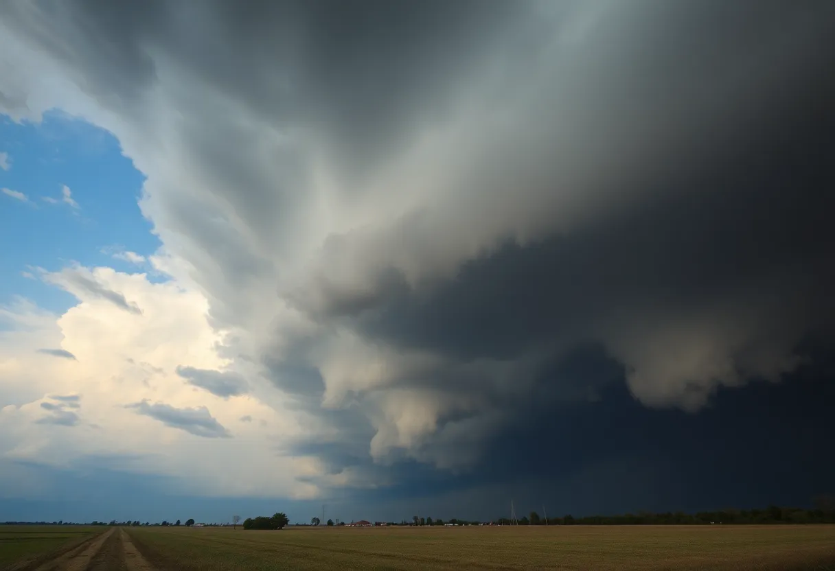
Brace Yourselves, Sioux Falls – A Derecho is Coming!
Residents of Sioux Falls and the surrounding areas are being urged to prepare for serious weather as a powerful derecho is set to rove through the Northern Plains at the start of the week. Yes, you heard it right! It looks like some strong storms are on the horizon, and they’re not your average thunderstorms. This is the real deal, and damage could be extensive.
What’s a Derecho Anyway?
If you’re scratching your head wondering what a derecho actually is, don’t worry, you’re not alone. A derecho is a kind of thunderstorm event that unleashes incredibly high winds, typically exceeding 74 mph, and stretches across at least 250 miles. These storms can wreak havoc in their path, and they tend to be more common during late spring and summer, particularly in regions like the Great Plains and the Midwest.
Here Come the Winds!
This week’s impending storms are forming as a result of a clockwise flow around a heat dome, which is raising temperatures across much of the central U.S. So, what can residents expect? Cities like Aberdeen, Watertown, and, of course, Sioux Falls are likely to see wind gusts that could surpass an eye-popping 75 mph. And if that weren’t enough, there’s a chance we could also see some tornadoes and large hail!
Where Will the Damage Be Most Severe?
The areas that are currently flagged as being at the highest risk for this severe weather include South Dakota, southern Minnesota, and northern Iowa. It’s crucial for folks in these areas to stay alert—particularly since some severe weather could extend into the upper Mississippi Valley, possibly impacting the cities of Minneapolis and St. Paul overnight.
A Repeat of Nature’s Wrath
This upcoming derecho marks the second time this summer that the Northern Plains will be hit by such storms. Just last month, severe storms brought wind gusts that reached as high as 106 mph, along with numerous tornadoes. It’s been quite a summer for weather enthusiasts—and for anyone who enjoys watching the dramatic forces of nature at work!
What Can We Do to Prepare?
Preparation is key when it comes to severe weather. Residents should plan ahead by knowing where their safest shelter options are, as well as ensuring they have multiple devices to receive updates from the National Weather Service. It’s always a good idea to have an emergency kit ready to go, just in case.
Special Caution for Mobile Home Occupants
Those living in mobile homes should take particular heed of the warnings, given the potentially catastrophic winds expected with this derecho. The risks are higher, and it’s incredibly important to seek sturdy shelter during severe storms.
Hail: The Unwelcome Visitor
Weather isn’t just about wind; it can also mean hail! In fact, a recent storm left an impressive hail scar in southwestern North Dakota back on July 10, 2025, stretching about 42 miles long. Hail damage has been linked to substantial financial losses in agriculture, with estimates ranging from $8 billion to $10 billion annually in the Dakotas alone. That’s no small change!
Final Thoughts
As this derecho approaches, staying informed and prepared becomes ever so crucial. Remember to keep an eye on the weather, and don’t hesitate to take appropriate precautions to ensure your safety. Stay tuned to updates and let’s hope this one passes through without causing too much trouble!
Deeper Dive: News & Info About This Topic
HERE Resources
Devastating Tornado Outbreak in North Dakota Claims Three Lives
Powerful Derecho and Tornadoes Devastate North Dakota and Minnesota
Additional Resources
- Weather.com: Derecho Forecast in Northern Plains
- Wikipedia: Derecho
- Weather.com: Hail Scar from North Dakota Tornado
- Google Search: Hail Scar North Dakota
- Weather.com: Severe Weather Outbreak in Midwest
- Google Scholar: Severe Weather Outbreaks
- Weather.com: Current Weather in Cumming, GA
- Encyclopedia Britannica: Weather
Author: STAFF HERE ROCK HILL
The ROCK HILL STAFF WRITER represents the experienced team at HERERockHill.com, your go-to source for actionable local news and information in Rock Hill, York County, and beyond. Specializing in "news you can use," we cover essential topics like product reviews for personal and business needs, local business directories, politics, real estate trends, neighborhood insights, and state news affecting the area—with deep expertise drawn from years of dedicated reporting and strong community input, including local press releases and business updates. We deliver top reporting on high-value events such as the Come-See-Me Festival, Rock Hill Arts Festival, and motorsport events at the Rock Hill Velodrome. Our coverage extends to key organizations like the Rock Hill Chamber of Commerce and the Culture & Heritage Museums, plus leading businesses in manufacturing and technology that power the local economy such as 3D Systems and Comporium. As part of the broader HERE network, including HEREAiken.com, HEREBeaufort.com, HEREChapin.com, HERECharleston.com, HEREClinton.com, HEREColumbia.com, HEREGeorgetown.com, HEREGreenwood.com, HEREGreenville.com, HEREHiltonHead.com, HEREIrmo.com, HEREMyrtleBeach.com, HERENewberry.com, HERERockHill.com, and HERESpartanburg.com, we provide comprehensive, credible insights into South Carolina's dynamic landscape.


