News Summary
Florence County is under significant weather alerts due to strong thunderstorms predicted to bring wind gusts up to 50 mph and pea-sized hail. Areas affected include Florence, Timmonsville, and Hartsville. Residents are advised to stay indoors and take safety precautions as Doppler radar reports intense storm activity. The National Weather Service issued these alerts to inform the public about potential dangers, including uprooted trees and flying debris. Safety is the priority as the storms approach, and travelers are urged to stay alert.
Severe Thunderstorm Alerts Hit Florence County: Stay Safe!
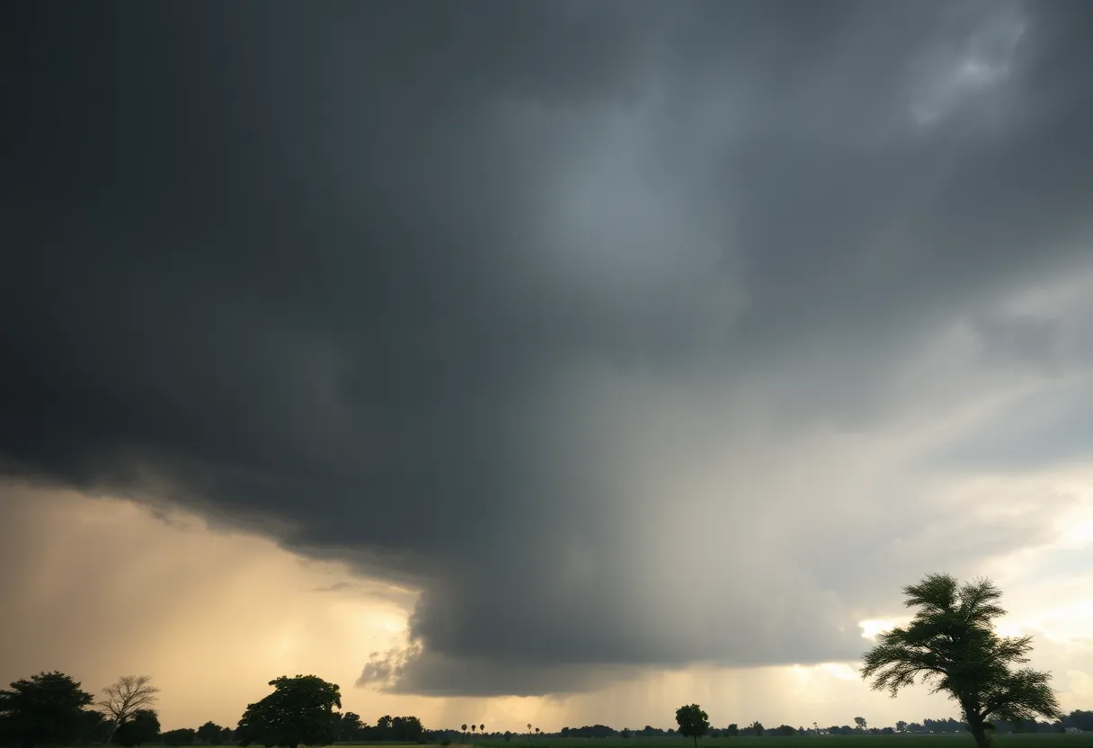
Florence County is bracing for some intense weather as the National Weather Service has issued a weather alert that’s causing quite a stir. The alert was rolled out at around 1:54 p.m. on Friday and will remain effective until 2:45 p.m. Strong thunderstorms are on the horizon, bringing with them forecasts of wind gusts reaching up to 40 mph and, believe it or not, some pea-sized hail!
What’s in the Forecast?
Doppler radar is already picking up on some serious activity, with a strong thunderstorm evident just southwest of Florence, specifically over the Sardis area. This storm is moving east at a speed of about 10 mph. Curious about the potential damage? The National Weather Service warned that these gusty winds could easily knock down tree limbs and blow around unsecured objects. If you’re a gardener, keep a close eye on your plants as minor hail damage is also a possibility.
Where is the Alert Targeting?
Several locations in Florence County are included in this alert, and they’re not just limited to the city itself. If you’re in or around these areas, keep your guard up:
- Florence
- Timmonsville
- Sardis
- Effingham
- Friendfield
- New Hope
- Evergreen
- Coward
- Olanta
- Carolinas Hospital System
- Carolinas Hospital System – Cedar Tower
And if you’re traveling, especially along Interstate 95 between mile markers 147 and 156, you’re also under this threat. So make sure to keep those hands on the wheel and an eye on the sky!
Storm Stats and Safety Tips
It’s worth noting that every year, lightning strikes the United States about 25 million times, and summer storms are notoriously the worst culprits. While these storms can be exhilarating to watch, they also bring dangers like potential fatalities, so safety should be your primary concern. When storms approach, the chance of lightning increases, peaking when the storm is directly overhead.
During thunderstorms, the best practice is to take shelter indoors. If you happen to be outdoors when these storms hit, it’s crucial that you find a sturdy building to protect yourself.
New Alerts Followed Closely
Tracking the New Storms
The Doppler radar is once again on the lookout, currently monitoring a robust thunderstorm near Lydia, which is close to Hartsville and moving east at a quicker pace of 20 mph. Similar to the earlier alerts, hazards include gusty winds capable of uprooting tree limbs and stirring up loose objects.
The Affected Areas in the Latest Alert
This most recent alert affects several additional locations, particularly:
- Hartsville
- Darlington
- Lamar
- Mont Clare
- Lydia
- Auburn
- Darlington Raceway
- Swift Creek
- Florence Darlington Technical College Main Campus
- Oats
- Floyd
- Kellytown
- Carolina Pines Regional Medical Center
Interstate 20 also falls within this alert zone between mile markers 126 and 141, alongside concerns for travelers along Interstate 95 near mile marker 146 and between mile markers 156 to 163.
Final Thoughts
Given the unpredictability of thunderstorms, it’s wise to stay tuned to the latest updates and take precautionary measures. With severe thunderstorm warnings, the primary concerns are winds gusting over 58 mph or hail that measures an inch in diameter or more, so make sure you stay inside, stay safe, and keep an eye on your surroundings until this weather passes! Remember, your safety is the most important thing—even when storms get rocky!
Deeper Dive: News & Info About This Topic
HERE Resources
Severe Thunderstorm Alert for Marlboro and Dillon Counties
Severe Thunderstorm & Lightning Warnings for Charleston Area
Thunderstorm Alerts Sweep Through South Carolina
Thunderstorm Alert Hits Kershaw, Lee, and Sumter Counties
Severe Thunderstorm Warning Issued for South Carolina
Severe Thunderstorm Warnings Impact Bamberg, Calhoun, and Orangeburg Counties
Severe Weather Alert for Chester County and Delaware Valley
Severe Thunderstorms Strike Calhoun and Surrounding Counties
Severe Thunderstorm Warnings Issued for Chester, York, and Aiken Counties
Severe Thunderstorm Warning for Pickens County
Additional Resources
- JSONline: Florence County Severe Thunderstorm Warning
- Island Packet: Weather News
- Myrtle Beach Online: Weather News
- Times Daily: Colbert County Severe Thunderstorm Warning
- Google Search: Florence County Severe Thunderstorm
Author: STAFF HERE ROCK HILL
The ROCK HILL STAFF WRITER represents the experienced team at HERERockHill.com, your go-to source for actionable local news and information in Rock Hill, York County, and beyond. Specializing in "news you can use," we cover essential topics like product reviews for personal and business needs, local business directories, politics, real estate trends, neighborhood insights, and state news affecting the area—with deep expertise drawn from years of dedicated reporting and strong community input, including local press releases and business updates. We deliver top reporting on high-value events such as the Come-See-Me Festival, Rock Hill Arts Festival, and motorsport events at the Rock Hill Velodrome. Our coverage extends to key organizations like the Rock Hill Chamber of Commerce and the Culture & Heritage Museums, plus leading businesses in manufacturing and technology that power the local economy such as 3D Systems and Comporium. As part of the broader HERE network, including HEREAiken.com, HEREBeaufort.com, HEREChapin.com, HERECharleston.com, HEREClinton.com, HEREColumbia.com, HEREGeorgetown.com, HEREGreenwood.com, HEREGreenville.com, HEREHiltonHead.com, HEREIrmo.com, HEREMyrtleBeach.com, HERENewberry.com, HERERockHill.com, and HERESpartanburg.com, we provide comprehensive, credible insights into South Carolina's dynamic landscape.

