News Summary
Lancaster County residents are alerted to strong thunderstorms expected to hit both Northern and Southern areas, as issued by the National Weather Service. The storm, predicted to last until 7:30 p.m., will bring heavy wind gusts of up to 50 mph and a risk of hydroplaning on wet roads. Flood advisories are also in effect due to expected heavy rains. The community is urged to stay indoors and keep emergency kits ready as storm conditions develop. Remain updated to ensure safety during this weather event.
Weather Alert for Lancaster County: Strong Thunderstorms on the Horizon!
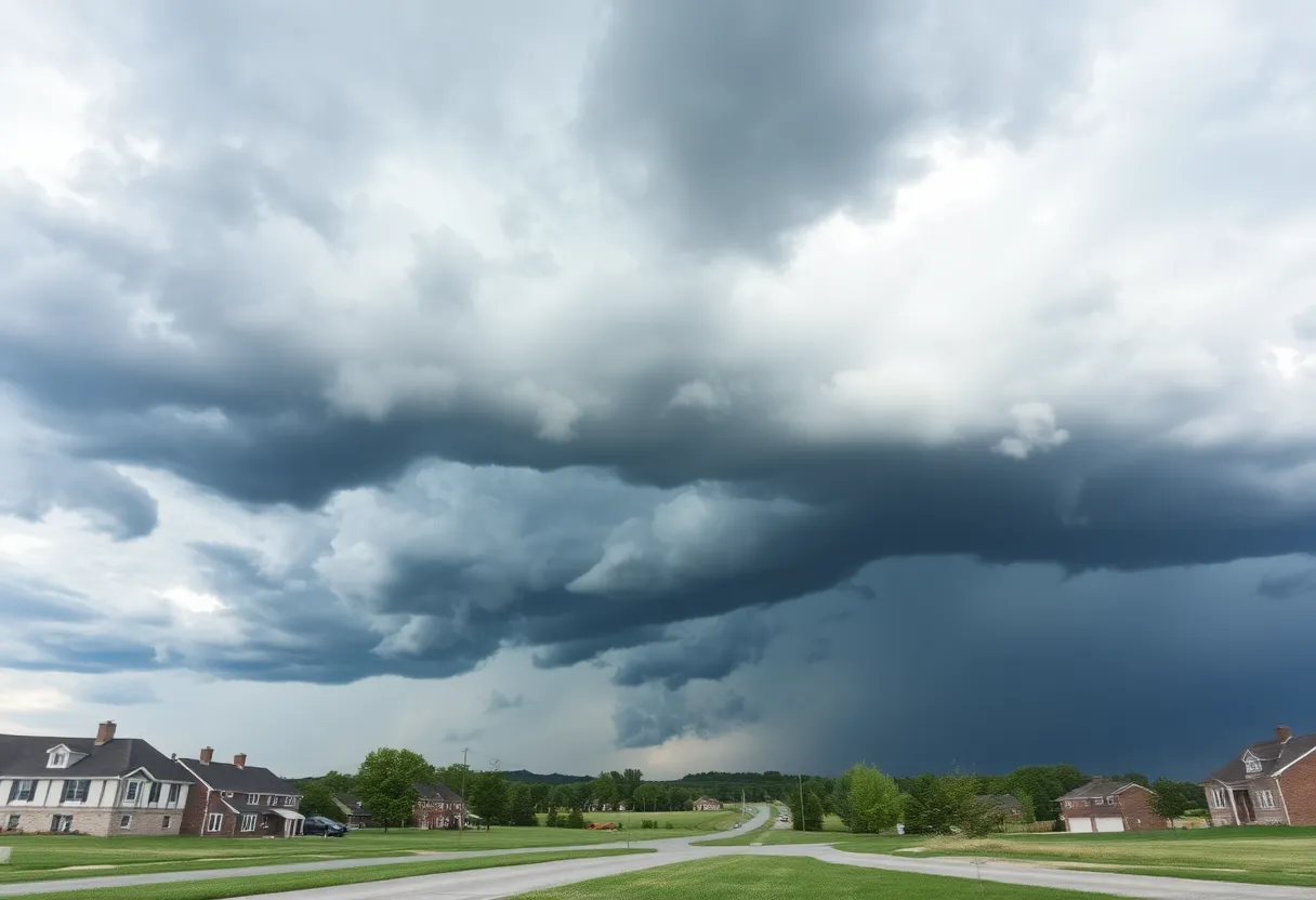
Attention, folks in Lancaster County! A serious weather alert has just come in, and it’s time to batten down the hatches. The National Weather Service (NWS) in Columbia, SC, issued this alert Monday evening at 6:46 p.m. as strong thunderstorms roll through both Northern and Southern Lancaster County, along with Chesterfield County. This storm is expected to be a bit of a wild ride, so let’s get you prepped for what’s ahead!
Stormy Conditions Until 7:30 PM
The alert is set to last until 7:30 p.m., with some hefty wind gusts predicted to reach up to 50 mph. That’s right, strong winds are on their way to shake things up, and Doppler radar has already spotted a significant storm over Indian Land, moving east at about 20 mph. Those winds can cause all sorts of ruckus, potentially knocking down tree limbs and tossing around anything that isn’t secured.
The Areas Affected
Various locations around our community are set to feel the impacts of this storm, including:
- Indian Land
- Waxhaw
- Andrew Jackson State Park
- Van Wyck
- Carolina Commons Shopping Center
- The Community of Almond Glen
If you find yourself outdoors during this storm, it’s a smart move to seek shelter indoors. Stay safe, stay cozy!
Hydroplaning: A Safety Concern
As if the strong winds weren’t enough, there’s also a risk of hydroplaning. This happens when vehicles begin to slide uncontrollably on wet roads due to the water building up in front of the tires. Essentially, it creates a slippery, dangerous layer between your tires and the road. If you’re driving when the rain starts pouring down, keep your speed in check and your eyes peeled for that shiny, slippery pavement.
Thunderstorms Bring Lightning
Now, let’s talk about lightning. Did you know that lighting strikes the United States around 25 million times every year? It’s crazy to think about, isn’t it? Most strikes happen during the summer months, taking an unfortunate toll of around 20 fatalities each year. The risk of lightning increases as thunderheads build, peaking when a storm is right overhead. So keep that in mind!
Flood Advisory in Effect
On top of everything else, a Flood Advisory is now in effect for Northern Lancaster County around Indian Land through 6:30 a.m. tomorrow. Heavy rains are expected, leading to flooding issues in low-lying areas. If you know you live in a prone spot, be extra cautious and stay updated.
Stay Prepared!
The NWS has provided some solid recommendations to ensure everyone stays safe during these thunderstorms. Make sure your emergency kits are ready, check your flashlights, and keep an eye on local weather updates. That way, you’ll be well-prepared to handle whatever Mother Nature has in store for us.
Finally, while we had some scary tornado activity in South Carolina recently, it’s a relief to report that thankfully, no injuries were reported from that event. Let’s hope for calm and safety during this thunderstorm alert!
So, hang in there, Lancaster County! Keep your loved ones close and prepare for a wet and wild evening!
Deeper Dive: News & Info About This Topic
HERE Resources
York County Faces Thunderstorm Alerts and Tornado Report
Columbia Braces for Severe Thunderstorm Warnings
Rock Hill, South Carolina Reports EF0 Tornado Without Injuries
Rock Hill, SC, Faces Short but Intense EF0 Tornado
Chesterfield County Faces Strong Thunderstorm Warnings
Brief Tornado Strikes Rock Hill, SC, Causes Damage
Severe Thunderstorm Warnings in York County
Rock Hill Tornado Causes Damage and Concern
Severe Weather Alerts Issued for Columbia Residents
South Carolina Faces Severe Thunderstorms and Tornado Watches
Additional Resources
- Fox Carolina: Tornado Touchdown in South Carolina
- Wikipedia: Tornado
- New Indian Express: Rare April Thunderstorm in Chennai
- Google Search: April Thunderstorm in Chennai
- WSOC TV: Weather Forecast – Late Storms Ahead
- Google Scholar: Storm Forecasting
- Gizmodo: Cyclones in Southern Hemisphere
- Encyclopedia Britannica: Cyclones
- Charlotte Observer: Local Weather News
- Google News: Local Weather Updates
Author: STAFF HERE ROCK HILL
The ROCK HILL STAFF WRITER represents the experienced team at HERERockHill.com, your go-to source for actionable local news and information in Rock Hill, York County, and beyond. Specializing in "news you can use," we cover essential topics like product reviews for personal and business needs, local business directories, politics, real estate trends, neighborhood insights, and state news affecting the area—with deep expertise drawn from years of dedicated reporting and strong community input, including local press releases and business updates. We deliver top reporting on high-value events such as the Come-See-Me Festival, Rock Hill Arts Festival, and motorsport events at the Rock Hill Velodrome. Our coverage extends to key organizations like the Rock Hill Chamber of Commerce and the Culture & Heritage Museums, plus leading businesses in manufacturing and technology that power the local economy such as 3D Systems and Comporium. As part of the broader HERE network, including HEREAiken.com, HEREBeaufort.com, HEREChapin.com, HERECharleston.com, HEREClinton.com, HEREColumbia.com, HEREGeorgetown.com, HEREGreenwood.com, HEREGreenville.com, HEREHiltonHead.com, HEREIrmo.com, HEREMyrtleBeach.com, HERENewberry.com, HERERockHill.com, and HERESpartanburg.com, we provide comprehensive, credible insights into South Carolina's dynamic landscape.

