News Summary
A severe thunderstorm warning has been issued for Laurens, Union, and Spartanburg counties. The National Weather Service warns of strong winds, potential hail, and heavy rainfall. Residents should take precautions, securing outdoor items and staying informed about road conditions. Safety is the priority as localized flooding and hazardous driving conditions are possible. Keep updated on weather developments and seek indoor shelter if necessary during this storm.
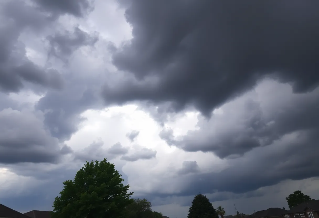
Severe Thunderstorm Alert for Laurens, Union, and Spartanburg!
Attention, folks in Laurens, Union, and Spartanburg counties! Get ready to batten down the hatches because a severe thunderstorm warning has officially been issued. It came rolling in from the National Weather Service in Greenville-Spartanburg at precisely 6:06 PM, and it’s in effect until 6:45 PM. So, what should you know?
What’s Happening?
Imagine this: At 6:05 PM, Doppler radar picked up a strong thunderstorm lurking just 7 miles east of Laurens, around Clinton. This storm is moving northwest at a brisk pace of 25 mph. It’s not just your typical summer rain — forecasts expect gusty winds of up to 40 mph and even penny-sized hail measuring around 0.75 inches.
Winds this strong can knock down tree limbs, flip over lawn chairs, and send unsecured objects flying. So, it’s a good time to check that everything is safely stashed away. We’re also looking at the potential for some minor damage from hail to outdoor items.
Who Needs to Pay Attention?
If you’re in the areas of Laurens, Clinton, Joanna, Buffalo, Gray Court, Rose Hill State Park, Cross Keys, Cross Anchor, Sedalia, or Enoree, this alert is especially important for you. Make sure you’re staying tuned into the weather updates!
Buckle Up for Some Rain
Don’t say we didn’t warn you! This storm is dumping torrential rainfall, which can lead to localized flooding in various areas. So, if you see flooded roadways, it’s best not to try and drive through. Obey the warning signs and find alternative routes. Your safety is the priority!
Stay Safe and Smart!
While storms can be exhilarating to watch, safety should always come first. Did you know that around 25 million lightning strikes zap across the United States each year, mostly during the summer months? Scary, right? Sadly, these strikes cause around 20 fatalities annually. The risk spikes as a storm approaches, especially right when it’s above you, but gradually decreases as it moves away.
To keep yourself safe during thunderstorms, try to seek indoor shelter whenever possible. If you’re out driving and the roads get slick, be cautious! Hydroplaning can easily happen if you’re not careful. It occurs when water builds up in front of your vehicle’s tires, causing it to slide uncontrollably. The main culprits behind hydroplaning include speeding, worn tires, and wet surfaces. If you find yourself hydroplaning, stay calm, avoid sudden movements, and gently steer in the direction you want to go.
Wrap Up and Stay Informed
This storm is currently active, and it’s necessary to stay updated as it progresses. Secure your belongings, avoid travel if possible, and stay indoors until it clears up. Keep your loved ones informed and stay safe out there as we ride out this storm!
Remember, severe weather can change quickly, so it’s always best to stay vigilant. Hold tight as the thunder rolls and hope for calmer skies!
Deeper Dive: News & Info About This Topic
HERE Resources
Tragic Shooting Claims Lives of Three Police Officers in North Codorus Township
Boil Water Notice Issued for Rock Hill, Texas Residents
Apartments Rock Hill SC Near Winthrop University: Best Student Picks
Rock Hill SC Weather Forecast Today: Hourly, Radar & 7-Day Outlook
Rock Hill Farms Horseback Riding Lessons: Schedule, Prices & What to Expect
Best Family Activities in Rock Hill SC This Weekend
Weather Rock Hill SC Today: Hourly Forecast and Radar
Rock Hill Weather Today: 10-Day Forecast and Hourly Updates
Thunderstorms and Tornado Warnings Hit South Carolina
Severe Thunderstorm Warnings Issued for South Carolina and New Jersey
Additional Resources
- Herald Online: Severe Thunderstorm Alert
- Wikipedia: Severe thunderstorm
- The State: Weather News
- Google Search: Severe thunderstorm warning
- Greenville Online: Greenville County Severe Thunderstorm Warning
- Google Scholar: Thunderstorm warnings
- Island Packet: Weather News
- Encyclopedia Britannica: Thunderstorm
- WBTV: Severe Thunderstorm Warning
- Google News: Severe thunderstorm
Author: STAFF HERE ROCK HILL
The ROCK HILL STAFF WRITER represents the experienced team at HERERockHill.com, your go-to source for actionable local news and information in Rock Hill, York County, and beyond. Specializing in "news you can use," we cover essential topics like product reviews for personal and business needs, local business directories, politics, real estate trends, neighborhood insights, and state news affecting the area—with deep expertise drawn from years of dedicated reporting and strong community input, including local press releases and business updates. We deliver top reporting on high-value events such as the Come-See-Me Festival, Rock Hill Arts Festival, and motorsport events at the Rock Hill Velodrome. Our coverage extends to key organizations like the Rock Hill Chamber of Commerce and the Culture & Heritage Museums, plus leading businesses in manufacturing and technology that power the local economy such as 3D Systems and Comporium. As part of the broader HERE network, including HEREAiken.com, HEREBeaufort.com, HEREChapin.com, HERECharleston.com, HEREClinton.com, HEREColumbia.com, HEREGeorgetown.com, HEREGreenwood.com, HEREGreenville.com, HEREHiltonHead.com, HEREIrmo.com, HEREMyrtleBeach.com, HERENewberry.com, HERERockHill.com, and HERESpartanburg.com, we provide comprehensive, credible insights into South Carolina's dynamic landscape.

