News Summary
Residents of Upstate South Carolina and Northeastern Georgia are advised to take cover as severe thunderstorms approach. Thunderstorms, capable of producing winds up to 60 mph and hail, are projected to hit areas including Cherokee, York, and Spartanburg counties. The National Weather Service has issued multiple alerts, urging locals to seek shelter and be cautious of hydroplaning while driving. With potential damages from high winds and lightning strikes, staying informed and safe is essential during this hazardous weather.
Severe Thunderstorm Alerts Sweep Through Upstate South Carolina and Northeastern Georgia
Attention, residents of Upstate South Carolina and Northeastern Georgia! If you haven’t already battened down the hatches, now is the time to take cover as a series of severe thunderstorms make their way through the region. The skies are angry, and the National Weather Service is on high alert!
What’s Happening?
On Saturday, June 7, 2025, strong thunderstorms were forecasted to hit at around 8:54 p.m., and the alerts will be valid until 9:45 p.m. This particular warning covers a handful of counties, including Cherokee, York, Union, Chester, and Spartanburg. So if you live in these areas, keep your eyes peeled!
Doppler radar reports show thunderstorms stretching from 11 miles south of Forest City to as far as 8 miles southwest of Gaffney and even 12 miles north of Newberry. These storms are moving northeast at a brisk pace of 40 mph!
What Can You Expect?
The storm brings potential winds gusting up to 40 mph. Think about that — that’s strong enough to send tree limbs flying and scatter anything that isn’t secured. Safeguarding your outdoor furniture might just save you a trip to the local hardware store!
The affected locations include Shelby, Gaffney, Union, Chester, York, Kings Mountain, Boiling Springs NC, Pacolet, Cowpens, and Monarch Mill. If you’re in one of those places, it’s time to think about heading indoors!
More Thunderstorms on Bay
And it doesn’t stop there! Just before the 8:54 p.m. warning, another alert went out at 7:42 p.m. covering Anderson, Greenville, Laurens, Pickens, and more. This warning, valid until 8:30 p.m., had some pretty alarming figures attached to it, including winds up to 60 mph and hail as large as 0.75 inches.
Impacted areas included Greenville Downtown, Easley, Pickens, Greer, and several others. This isn’t just your average summer storm, folks!
Earlier in the evening, another alert rang out at 7:09 p.m., warning of thunderstorms for Elbert, Franklin, Hart, and Abbeville counties in Georgia, as well as Anderson County in South Carolina. These storms were clocking in at 55 mph and carrying winds up to 60 mph. Talk about fast-moving weather!
Safety First!
With such wild weather rolling in, priority number one is safety! The NWS is advising everyone to seek indoor shelter if you find yourself outdoors. And if you’re driving, remember to be cautious of hydroplaning. It’s no fun to lose control on slick roads!
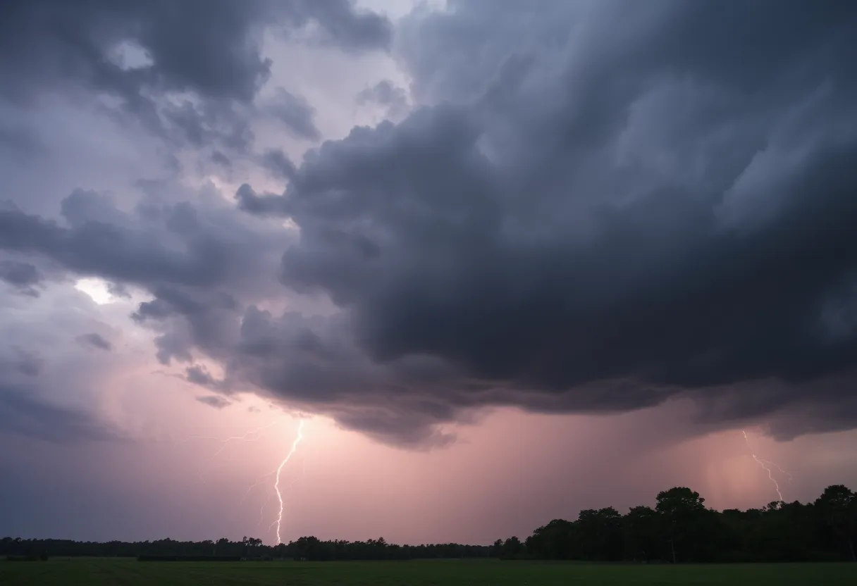
Speaking of safety, did you know that about 25 million lightning strikes happen each year in the U.S.? It’s the summer months that really see most of the action, resulting in about 20 fatalities annually. So, when you hear thunder rumbling in the distance, it’s definitely a signal to head inside.
Report Any Damage
If you encounter any serious weather-related issues like damaging winds, hail, or flooding, don’t hesitate to report it! The NWS has made it easy for everyone to reach them via a toll-free number or those social media platforms we all love. Just remember to use the hashtag #nwsgsp to help them track the information.
Stay safe, Upstate South Carolina and Northeastern Georgia! Keep those weather alerts handy, and remember: storms come and go, but safety is always in season!
Deeper Dive: News & Info About This Topic
HERE Resources
Severe Thunderstorm Warning for Greater Pickens and Greenville County
Severe Thunderstorm Warnings Impact Greenville and Spartanburg
Thunderstorm Chaos Strikes Myrtle Beach
Former Football Player Sentenced for Stabbing Girlfriend
Rock Hill, South Carolina Reports EF0 Tornado Without Injuries
Rock Hill, SC, Faces Short but Intense EF0 Tornado
Air Quality Alert Issued in South Carolina Due to Wildfire Smoke
Chesterfield County Faces Strong Thunderstorm Warnings
Severe Thunderstorm Alert Hits Coastal Georgia and South Carolina!
Severe Thunderstorm Warnings in York County
Additional Resources
- Greenville Online: Severe Thunderstorm Warning for Greenville County
- Independent Mail: Severe Thunderstorm Warning for Anderson County
- Island Packet: Weather News
- Encyclopedia Britannica: Severe Thunderstorms
- Herald Online: Weather News
- Google Search: Thunderstorm Safety
Author: STAFF HERE ROCK HILL
The ROCK HILL STAFF WRITER represents the experienced team at HERERockHill.com, your go-to source for actionable local news and information in Rock Hill, York County, and beyond. Specializing in "news you can use," we cover essential topics like product reviews for personal and business needs, local business directories, politics, real estate trends, neighborhood insights, and state news affecting the area—with deep expertise drawn from years of dedicated reporting and strong community input, including local press releases and business updates. We deliver top reporting on high-value events such as the Come-See-Me Festival, Rock Hill Arts Festival, and motorsport events at the Rock Hill Velodrome. Our coverage extends to key organizations like the Rock Hill Chamber of Commerce and the Culture & Heritage Museums, plus leading businesses in manufacturing and technology that power the local economy such as 3D Systems and Comporium. As part of the broader HERE network, including HEREAiken.com, HEREBeaufort.com, HEREChapin.com, HERECharleston.com, HEREClinton.com, HEREColumbia.com, HEREGeorgetown.com, HEREGreenwood.com, HEREGreenville.com, HEREHiltonHead.com, HEREIrmo.com, HEREMyrtleBeach.com, HERENewberry.com, HERERockHill.com, and HERESpartanburg.com, we provide comprehensive, credible insights into South Carolina's dynamic landscape.


