News Summary
Residents in Greater Pickens and Greenville County are advised to take cover as the National Weather Service issues a Severe Thunderstorm Warning until 8:30 PM. The storm may bring pea-sized hail and winds of up to 50 mph. Key areas affected include Travelers Rest, Slater-Marietta, and others. Safety measures are crucial as lightning and hydroplaning risks rise. Stay indoors and keep safe during this severe weather event.
Watch Out, Greater Pickens and Greenville County Residents!
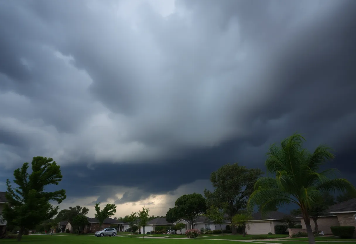
If you’re in the greater Pickens and Greenville County area, it’s time to take cover! As of 7:47 PM on Friday, the National Weather Service (NWS) in Greenville-Spartanburg has issued a Severe Thunderstorm Warning that’s expected to last until 8:30 PM. So no matter what you’re doing—whether you’re enjoying a picnic or just lounging at home—now is the time to pay attention to the skies!
Weather Trouble Ahead
This thunderstorm isn’t just an ordinary summer shower. The forecast suggests that we might see some pea-sized hail (which measures about 0.25 inches) along with windy conditions that could gust up to 50 mph. That’s enough wind to send your garden décor flying or maybe even bring down a few tree limbs!
At the time of the warning, Doppler radar caught a glimpse of a strong thunderstorm brewing about 12 miles north-west of Greenville Downtown near Slater-Marietta. This storm is moving east at a brisk pace of 25 mph, so you won’t want to dawdle if you’re outdoors!
Where Should You Be?
Let’s talk about the towns that might be affected by this weather chaos: Travelers Rest, Slater-Marietta, Tigerville, Lake Robinson, Pleasant Ridge State Park, Greer, Paris Mountain State Park, Caesars Head State Park, Gowensville, and Cleveland, you are all in the direct path of this storm. If you’re in any of these areas, the best thing you can do is find a safe spot indoors.
Take Shelter!
The NWS highly recommends that you seek shelter indoors if you’re outside. Thunderstorms can be unpredictable with lightning strikes. In fact, lightning hits the United States about 25 million times every year. For those who might not know, summer is peak season for these strikes, resulting in roughly 20 fatalities annually due to lightning incidents. So, it’s not just about the rain and wind; the danger is real!
Stay Safe in the Storm
As these thunderstorms roll in, it’s crucial to remember that lightning risks rise dramatically as storms approach. This danger peaks when the storm is right overhead and tends to decrease as it moves away. So, really, indoor safety is the name of the game tonight!
Also, while we’re on the subject of storm-related safety, let’s talk about hydroplaning. This happens when water pressure builds up in front of your tires, causing your vehicle to slide uncontrollably on wet roads; it’s a serious risk during storms with heavy rainfall. The NWS points out three key factors leading to hydroplaning: driving at high speeds, having under-inflated tires, and obviously, those slippery wet roads we often talk about.
Keep Cozy!
So, what’s the moral of the story? If you’re in the greater Pickens and Greenville County area, grab a movie or your favorite book, make yourself a cozy spot indoors, and wait out the storm. Prepare for some possible hail and winds, but most importantly, stay safe!
Don’t forget, this warning is valid until 8:30 PM tonight, so hang tight and keep an eye on the weather as it develops! Your safety is the top priority!
Deeper Dive: News & Info About This Topic
HERE Resources
Severe Thunderstorm Warnings Impact Greenville and Spartanburg
Thunderstorms Hit Anderson and Abbeville: Important Updates
Winthrop University Poll Reveals South Carolina Voter Opinions
Thunderstorm Chaos Strikes Myrtle Beach
Rock Hill, South Carolina Reports EF0 Tornado Without Injuries
Rock Hill, SC, Faces Short but Intense EF0 Tornado
Chesterfield County Faces Strong Thunderstorm Warnings
Brief Tornado Strikes Rock Hill, SC, Causes Damage
Severe Thunderstorm Alert Hits Coastal Georgia and South Carolina!
Severe Thunderstorm Warnings in York County
Additional Resources
- Myrtle Beach Online
- Wikipedia: Thunderstorm
- The State
- Google Search: Severe Thunderstorm
- Independent Mail
- Google Scholar: Severe Weather Alerts
- Herald Online
- Encyclopedia Britannica: Lightning
- AOL News
- Google News: Storm Safety
Author: STAFF HERE ROCK HILL
The ROCK HILL STAFF WRITER represents the experienced team at HERERockHill.com, your go-to source for actionable local news and information in Rock Hill, York County, and beyond. Specializing in "news you can use," we cover essential topics like product reviews for personal and business needs, local business directories, politics, real estate trends, neighborhood insights, and state news affecting the area—with deep expertise drawn from years of dedicated reporting and strong community input, including local press releases and business updates. We deliver top reporting on high-value events such as the Come-See-Me Festival, Rock Hill Arts Festival, and motorsport events at the Rock Hill Velodrome. Our coverage extends to key organizations like the Rock Hill Chamber of Commerce and the Culture & Heritage Museums, plus leading businesses in manufacturing and technology that power the local economy such as 3D Systems and Comporium. As part of the broader HERE network, including HEREAiken.com, HEREBeaufort.com, HEREChapin.com, HERECharleston.com, HEREClinton.com, HEREColumbia.com, HEREGeorgetown.com, HEREGreenwood.com, HEREGreenville.com, HEREHiltonHead.com, HEREIrmo.com, HEREMyrtleBeach.com, HERENewberry.com, HERERockHill.com, and HERESpartanburg.com, we provide comprehensive, credible insights into South Carolina's dynamic landscape.


