News Summary
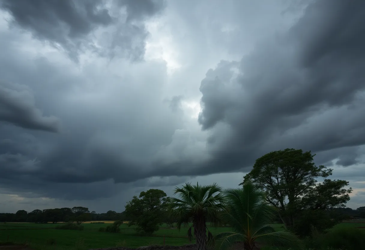
Residents of Southeastern Orangeburg, along with areas in Clarendon and Sumter counties, are on high alert due to severe thunderstorm warnings issued by the National Weather Service. Wind gusts could reach up to 60 mph, with warnings affecting multiple towns and major routes. Residents are advised to seek shelter and prepare for potential power outages and hazardous conditions. Emergency management officials emphasize the need for preparedness and caution as storms approach.
Severe Thunderstorm Warnings Across Southeastern Orangeburg, Clarendon, and Sumter Counties
Residents in Southeastern Orangeburg, as well as surrounding areas in Clarendon and Sumter counties, have been put on high alert as severe thunderstorm warnings have been issued. This announcement came from the National Weather Service (NWS) on Tuesday at around 6:31 p.m., putting everyone on their toes until 7:15 p.m. this evening.
The storm front is no joke, with predictions showing wind gusts reaching up to 50 mph. That’s enough to make anyone’s hair stand on end! Doppler radar pinpointed strong thunderstorms barreling in from the west at approximately 15 mph, situated about 8 miles west of Hebron and moving toward Cross.
Many towns will experience the brunt of these storms, including Manning, Summerton, Alcolu, Santee State Park, and various others. Even major routes like Interstate 95—between mile markers 95 to 133—are included in the warning. So, if you had plans for a drive, it might be wise to rethink that!
Brace for Impact!
With the storms coming in hot, you can expect gusty winds playing havoc with tree limbs and potentially blowing around anything that’s not secured. Some of the specific locations to keep an eye on include:
- Manning
- Summerton
- Alcolu
- Santee State Park
- Santee Cooper Regional Airport
- Santee
- Eutawville
- Paxville
- Vance
- St. Paul
- Rocks Pond Campground
- Marina
- Foreston
- Eautaw Springs
- Indian Bluff Recreation Park
- Gable
- Davis Station
- Blounts Landing
- Mill Creek Marina and Campground
Residents of these areas are encouraged to seek shelter inside a building if they’re outdoors. With thunderstorms comes the risk of frequent cloud-to-ground lightning, which can strike far away from where the storm is actually located. In fact, it can travel up to 10 miles away from the storm center!
Current Warnings and Safety Measures
After the first alert, the NWS issued a subsequent severe thunderstorm warning the following day, Wednesday at 3:21 p.m., effective until 3:45 p.m. for the same regions—Clarendon and Orangeburg counties. This second warning heightens the stakes, with forecasted wind gusts peaking at 60 mph and the possibility of quarter-sized hail, measuring around 1 inch. Did someone say damage control?
Areas affected by the second warning also include Vance, St. Paul, and bits of Interstate 95, particularly between mile markers 100 and 106. If you find yourself near Lake Marion, it’s a good idea to move away from the water and seek reliable shelter.
Getting Prepared
Emergency management officials in Orangeburg County are speaking loudly about the importance of preparing for potential power outages caused by fallen trees and downed power lines. Residents have already begun taking proactive steps by stocking up on essential supplies and planning to stay indoors to avoid the storm.
Also noteworthy is the statewide burn ban currently in effect due to the combination of low humidity and high winds, meaning outdoor burning is off-limits.
For those wondering about local services, Orangeburg County offices will open at 12:30 p.m. on Wednesday, but be advised that all convenience sites will be closed as a precaution.
Throughout this week, power outages have already been reported in several counties, making this storm one that inspires caution. Stay safe, everyone!
Deeper Dive: News & Info About This Topic
HERE Resources
Devastating Tornado Outbreak in North Dakota Claims Three Lives
Thunderstorm Alerts Spark Caution in Southeastern North Carolina
Strong Thunderstorms Expected in Charleston and Berkeley Counties
Severe Thunderstorm Alerts Issued for Upstate South Carolina Counties
Severe Thunderstorm Warnings Issued for South and North Carolina
Devastating Fire Destroys Rustic Roots Warehouse in York County
Severe Thunderstorms Hit Upstate South Carolina and Georgia
Severe Thunderstorms and Tornado Warnings in South Carolina
Severe Thunderstorm Warnings Rattle York and Chester Counties
The Storm That Won’t Quit: Severe Weather Alerts Issued
Additional Resources
- Live 5 News
- Wikipedia: Severe thunderstorm warning
- The State
- Encyclopedia Britannica: Thunderstorm
- WLTX
- Google News: Severe thunderstorm Orangeburg
- Live 5 News
- Google Search: Thunderstorm warnings weather news
- The State
- Google Scholar: Severe thunderstorm
Author: STAFF HERE ROCK HILL
The ROCK HILL STAFF WRITER represents the experienced team at HERERockHill.com, your go-to source for actionable local news and information in Rock Hill, York County, and beyond. Specializing in "news you can use," we cover essential topics like product reviews for personal and business needs, local business directories, politics, real estate trends, neighborhood insights, and state news affecting the area—with deep expertise drawn from years of dedicated reporting and strong community input, including local press releases and business updates. We deliver top reporting on high-value events such as the Come-See-Me Festival, Rock Hill Arts Festival, and motorsport events at the Rock Hill Velodrome. Our coverage extends to key organizations like the Rock Hill Chamber of Commerce and the Culture & Heritage Museums, plus leading businesses in manufacturing and technology that power the local economy such as 3D Systems and Comporium. As part of the broader HERE network, including HEREAiken.com, HEREBeaufort.com, HEREChapin.com, HERECharleston.com, HEREClinton.com, HEREColumbia.com, HEREGeorgetown.com, HEREGreenwood.com, HEREGreenville.com, HEREHiltonHead.com, HEREIrmo.com, HEREMyrtleBeach.com, HERENewberry.com, HERERockHill.com, and HERESpartanburg.com, we provide comprehensive, credible insights into South Carolina's dynamic landscape.

