News Summary
Residents in South Carolina are urged to remain vigilant as severe thunderstorm warnings have been issued for several counties, including Cherokee, York, Union, and Chester. The National Weather Service forecasts wind gusts up to 60 mph and the potential for quarter-sized hail. Local communities are advised to seek shelter, as dangerous thunderstorms pose significant risks. The warnings have prompted safety measures and alertness among residents as they prepare for the storms expected to continue in the area.
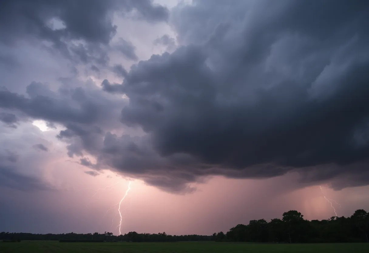
Severe Thunderstorm Warnings Impact South Carolina Communities
Residents of South Carolina, particularly in and around the cities of Lockhart, Sharon, McConnells, and more, are urged to remain vigilant as the National Weather Service (NWS) has issued severe thunderstorm warnings for multiple counties in the region. The alerts started rolling in at 6:41 p.m. on Monday and are expected to last until 7:15 p.m. This storm is primarily affecting Cherokee, York, Union, and Chester counties.
What to Expect During the Storm
The NWS report indicates that residents could face wind gusts reaching up to 40 mph during this storm. The latest updates show Doppler radar has tracked a fierce thunderstorm just 13 miles northeast of Union, or a mere 5 miles north of Lockhart, moving eastward at about 25 mph. Such conditions can lead to hazardous situations, as gusty winds might knock down tree limbs and cause lighter, unsecured items to be blown around.
The storm is making its way toward various locations, including Saratt, Adamsburg, and Bullock Creek, all of which are advised to take precautionary measures. If you’re outside when the storm hits, the NWS strongly recommends seeking shelter indoors. Remember, lightning is unpredictable and can strike up to 10 miles away from the storm itself. With summer storms producing around 25 million lightning strikes across the U.S. annually, safety is paramount; they result in an average of 20 fatalities each year.
Stay Safe: Thunderstorm Safety Tips
As the thunderstorm approaches, the likelihood of lightning increases and peaks when it’s directly overhead. To stay safe during these severe thunderstorms, residents should:
- Seek indoor shelter immediately
- Stay away from windows and doors
- Move to an interior room on the lowest floor of a building
These safety tips might seem simple, but they can make all the difference when dangerous weather hits. Staying proactive can literally save lives!
Expanding Storm Alerts
As if that wasn’t enough, a severe thunderstorm warning was issued shortly after at 7:14 p.m. for Mecklenburg County, an area that is now under a warning until 8 p.m. This storm is particularly fierce, predicted to produce gusts of wind up to 60 mph and quarter-sized hail (about 1 inch in diameter). The storm is moving northeast at 20 mph and is anticipated to cause minor hail damage to vehicles, along with wind damage to trees and power lines.
Communities impacted by the latest warning include York, Tega Cay, Clover, and Steele Creek, among others. Residents in these areas are also advised to transition indoors and take cover.
Previous Warnings Also Affecting the Region
Interestingly, another warning had been issued earlier on Sunday, June 1, for both Greenville and Spartanburg counties. This previous alert came at 5:53 p.m., forecasting strong winds up to 60 mph and hail up to 1 inch. That storm was moving southeast at 15 mph, posing threats to locations like Reidville, Lake Robinson, and Greer.
As communities throughout South Carolina brace for continued storms, it’s vital for residents to stay informed and prepared. Don’t take these warnings lightly; safety should be your number one priority when adverse weather strikes. Keep your family safe and sheltered as these storms roll through, and stay tuned for more updates.
Deeper Dive: News & Info About This Topic
HERE Resources
Thousands Rally in Columbia Against Trump Administration
Tragic Motorcycle Accident Claims Life in Rock Hill
York County Faces Thunderstorm Alerts and Tornado Report
Severe Thunderstorm Warnings Issued for Southeastern North Carolina
Thunderstorm Watch in Greenville and Spartanburg: Prepare Now!
Woman Arrested in Hit-and-Run Death of Bicyclist in York
Severe Thunderstorm Alert in South Carolina
Severe Weather Wreaks Havoc in Columbia, South Carolina
Anderson, South Carolina Faces Severe Thunderstorm Warning
Severe Thunderstorm Alerts Issued for South Carolina
Additional Resources
- The State
- Wikipedia: Thunderstorm
- News & Observer
- Google Search: Severe Thunderstorm Safety Tips
- Herald Online
- Google Scholar: Thunderstorm Warnings
- Charlotte Observer
- Encyclopedia Britannica: Thunderstorm
- Greenville Online
- Google News: Severe Thunderstorm Alerts
Author: STAFF HERE ROCK HILL
The ROCK HILL STAFF WRITER represents the experienced team at HERERockHill.com, your go-to source for actionable local news and information in Rock Hill, York County, and beyond. Specializing in "news you can use," we cover essential topics like product reviews for personal and business needs, local business directories, politics, real estate trends, neighborhood insights, and state news affecting the area—with deep expertise drawn from years of dedicated reporting and strong community input, including local press releases and business updates. We deliver top reporting on high-value events such as the Come-See-Me Festival, Rock Hill Arts Festival, and motorsport events at the Rock Hill Velodrome. Our coverage extends to key organizations like the Rock Hill Chamber of Commerce and the Culture & Heritage Museums, plus leading businesses in manufacturing and technology that power the local economy such as 3D Systems and Comporium. As part of the broader HERE network, including HEREAiken.com, HEREBeaufort.com, HEREChapin.com, HERECharleston.com, HEREClinton.com, HEREColumbia.com, HEREGeorgetown.com, HEREGreenwood.com, HEREGreenville.com, HEREHiltonHead.com, HEREIrmo.com, HEREMyrtleBeach.com, HERENewberry.com, HERERockHill.com, and HERESpartanburg.com, we provide comprehensive, credible insights into South Carolina's dynamic landscape.


