News Summary
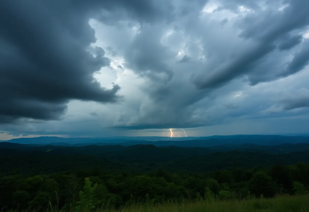
On Thursday night, severe thunderstorms impacted Upstate South Carolina and North Georgia, leading to wind gusts of 40 mph and localized flooding concerns. Residents were advised to seek shelter as the storms moved quickly through areas like Clemson, Seneca, and Walhalla. With rainfall projected to reach 1-2 inches, flash flood warnings were issued. Emergency management in North Georgia reported significant storm damage, affecting thousands and causing blocked roads. Tornado watches were previously in place but have since been canceled as the weather event progresses.
Severe Thunderstorms Hit Upstate South Carolina and North Georgia
As the clock struck 10:08 p.m. on Thursday, residents of Upstate South Carolina and North Georgia received an urgent heads-up from the National Weather Service. A storm system was brewing with strong thunderstorms expected to linger until around 10:45 p.m. The affected areas include the scenic Oconee Mountains, along with the vibrant towns of Clemson, Seneca, and Walhalla, among others.
What to Expect?
Weather radar was lighting up with activity as storms rolled in from 13 miles north of Seneca down to near Walhalla and 9 miles northeast of Toccoa. These storms are moving southeast at a brisk pace of about 25 mph, which means they can pack quite a punch! Residents should brace for wind gusts reaching up to 40 mph. Such strong winds can easily become troublesome, knocking down tree limbs and sending unsecured outdoor items flying.
Stay Safe: Seek Shelter
If you happen to be outside when these storms approach, the National Weather Service strongly encourages seeking shelter indoors. With torrential rainfall already drenching the areas, localized flooding is becoming a real concern. If you see a flooded road, it’s best to turn around rather than risk driving through it. Remember, it only takes a tiny amount of water to create dangerous driving conditions.
Lightning Dangers
A particular caution for those by the water: if you are on or near Lake Keowee, it’s wise to exit the water immediately. The reason? Lightning! It can strike up to 10 miles from the parent thunderstorm, and if you hear thunder, you’re close enough to be in danger. Stay safe and stay informed!
Rainfall and Flooding Concerns
In terms of rainfall, some areas in Upstate South Carolina and North Georgia could see anywhere between 1 and 2 inches of rain. A Flash Flood Warning is currently in effect, so keeping an eye on the weather updates is essential. Flood water can lead to hydroplaning, which is when a vehicle loses traction due to the buildup of water in front of tires, increasing the likelihood of accidents.
Don’t Ignore the Thunder
The chances of lightning strikes increase as storms roll in and peak when a storm is overhead. It’s noteworthy that across the United States, lightning strikes occur about 25 million times each year and tragically result in around 20 fatalities annually, predominantly during the summer. So, when storms are expected, take them seriously!
Timeline of the Storms
For those wondering when to expect the thunderous activity, the weather timeline indicates that:
- Oconee and Anderson counties: Expect storms around 7 p.m.
- Greenville area: Storms will roll in at 8 p.m.
- Spartanburg area: Storms expected by 9 p.m.
Recovering in North Georgia
In North Georgia, cleanup efforts are ongoing after overnight storms caused significant damage. Reports indicate strong winds have downed trees and left many without power, with at least 10,000 customers affected. Emergency management has reported numerous blocked roads in places like Butts County, hampering travel. Flash Flood Warnings and Severe Thunderstorm Warnings continue to be in effect throughout the night and into the early morning hours.
Tornado Watches and Warnings
For some during this stormy weather, there were even tornado watches and warnings issued, although these have since been canceled. Keep an ear out on local radio stations or television for any updates and advisories from the National Weather Service as the night progresses. Be safe, stay informed, and come through this storm ready for brighter days ahead!
Deeper Dive: News & Info About This Topic
HERE Resources
Tragic Multi-Vehicle Crash Claims Lives in Fort Mill
Tropical Storm Fernand Weakens, No Threat to Bermuda
Massive Haboob Dust Storm Hits Arizona – Visibility Reduced
Weather Alert: Strong Thunderstorms Impacting Conway and Myrtle Beach
Severe Thunderstorm Warnings Affecting South Carolina and California
Thunderstorm Warnings Issued for Upstate South Carolina
Severe Thunderstorm Warning for Henderson County: Prepare Now
Severe Storms Rip Through Pickens County, SC
Severe Weather Alert: Thunderstorms Impact Oconee and Anderson County
Severe Thunderstorm Warnings Issued for Pickens County, SC
Additional Resources
- Island Packet
- Wikipedia: Severe thunderstorm
- Myrtle Beach Online
- Google Search: Severe weather in South Carolina
- Fox 5 Atlanta