News Summary
Residents in Wichita, Garden City, and Dodge City are facing severe weather threats with damaging winds, heavy rain, and potential tornadoes. The National Weather Service has issued alerts, rating the threat level at 4 out of 5. As storms progress eastward, cities like Chicago and St. Louis are warned to remain vigilant. Recent tornado sightings and damage across the Midwest highlight the urgency of being prepared. It is crucial to heed local warnings and stay informed during this dangerous weather period.
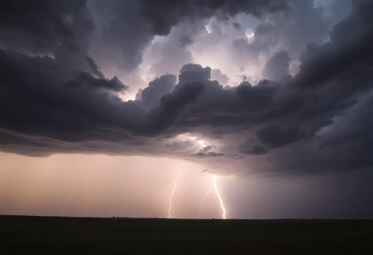
The Storm That Won’t Quit: Severe Weather Alerts for the Central Plains and Midwest!
As residents in Wichita, Garden City, and Dodge City brace themselves for wild weather, it’s important to be prepared. The National Weather Service has raised the alerts, placing the severe weather threat at a troubling level 4 out of 5 across the Central Plains this Tuesday. What does that mean for you? Expect some serious storms rolling in!
What’s Coming Your Way
Those living in the areas marked as high risk should be on the lookout for damaging winds that could surpass 75 mph. That’s strong enough to take down trees and cause significant property damage. And it doesn’t stop there! You might also see very large hail, which could pack a punch with sizes reaching up to 4.5 inches in diameter. To cap it all off, there’s also the potential for a few tornadoes to touch down!
The next wave of severe weather is expected to hit Tuesday evening, extending into the early hours of Wednesday. That could mean locally heavy rain, leading to the risk of flash flooding in some areas. This definitely isn’t the time for complacency—keep an eye on alerts and heed warnings from local authorities.
What Areas Should Be Extra Cautious?
While places like Wichita and Garden City are in the line of fire, the severe weather threat will shift eastward on Wednesday, posing risks to Chicago, Indianapolis, and St. Louis. As the storms roll on, expect updates and stay tuned for any emergency announcements.
Tornado Activity Report
As if that weren’t enough, downed trees caused by thunderstorm winds have been reported in Marshall County, Mississippi, and Hardin County, Tennessee. Tornado touchdowns also caused havoc near Jackson, Tennessee, and across multiple locations in northern Alabama. Just last week, a significant EF2 tornado left its mark in northwest Wisconsin, and an EF3 tornado struck St. Louis, leaving damage in its wake.
Ongoing Severe Weather Across Multiple States
But hang on—there’s more! An EF4 tornado wreaked havoc in Marion, Illinois, and London, Kentucky, recently, reminding us all how fierce these storms can be. A variety of tornadoes have also hit states across the Central Plains including Colorado, Kansas, Oklahoma, and Nebraska. The severe weather activity doesn’t just stop there; ongoing storms are expected to affect the Mississippi, Ohio, and Tennessee valleys for the foreseeable future.
Looking Ahead
As we move through the week, the severe weather trend is expected to ease later in the week after the current storms pass through. But don’t let your guard down just yet! Stay alert and prepare for what nature has in store. Remember to keep your loved ones informed and safe.
With nature’s furious temperament on full display, it’s essential for everyone to take precautions. Make sure you have a plan in place, and listen for updates from authorities. We are all in this together—we wish you safety and good luck!
Deeper Dive: News & Info About This Topic
HERE Resources
Severe Thunderstorm Alerts Issued for Greenwood Area
Weather Alert for Lancaster County: Strong Thunderstorms Ahead
Severe Flash Flooding Devastates Wheeling Community
Severe Thunderstorm Alerts Hit Upstate South Carolina
Severe Thunderstorm Warnings Impact South Carolina Communities
York County Faces Thunderstorm Alerts and Tornado Report
Severe Thunderstorm Warnings Issued for Southeastern North Carolina
Thunderstorm Watch in Greenville and Spartanburg: Prepare Now!
Severe Thunderstorm Alert in South Carolina
Severe Weather Wreaks Havoc in Columbia, South Carolina
Additional Resources
- Weather.com: Severe Weather Threat Takes Aim at Midwest Plains
- Wikipedia: Tornado
- Weather.com: Large Shape-Shifting Nebraska Tornado
- Google Search: Severe Weather Central Plains Midwest
- Weather.com: Severe Weather Outbreak in Midwest and Plains
- Encyclopedia Britannica: Severe Weather
Author: STAFF HERE ROCK HILL
The ROCK HILL STAFF WRITER represents the experienced team at HERERockHill.com, your go-to source for actionable local news and information in Rock Hill, York County, and beyond. Specializing in "news you can use," we cover essential topics like product reviews for personal and business needs, local business directories, politics, real estate trends, neighborhood insights, and state news affecting the area—with deep expertise drawn from years of dedicated reporting and strong community input, including local press releases and business updates. We deliver top reporting on high-value events such as the Come-See-Me Festival, Rock Hill Arts Festival, and motorsport events at the Rock Hill Velodrome. Our coverage extends to key organizations like the Rock Hill Chamber of Commerce and the Culture & Heritage Museums, plus leading businesses in manufacturing and technology that power the local economy such as 3D Systems and Comporium. As part of the broader HERE network, including HEREAiken.com, HEREBeaufort.com, HEREChapin.com, HERECharleston.com, HEREClinton.com, HEREColumbia.com, HEREGeorgetown.com, HEREGreenwood.com, HEREGreenville.com, HEREHiltonHead.com, HEREIrmo.com, HEREMyrtleBeach.com, HERENewberry.com, HERERockHill.com, and HERESpartanburg.com, we provide comprehensive, credible insights into South Carolina's dynamic landscape.


