News Summary
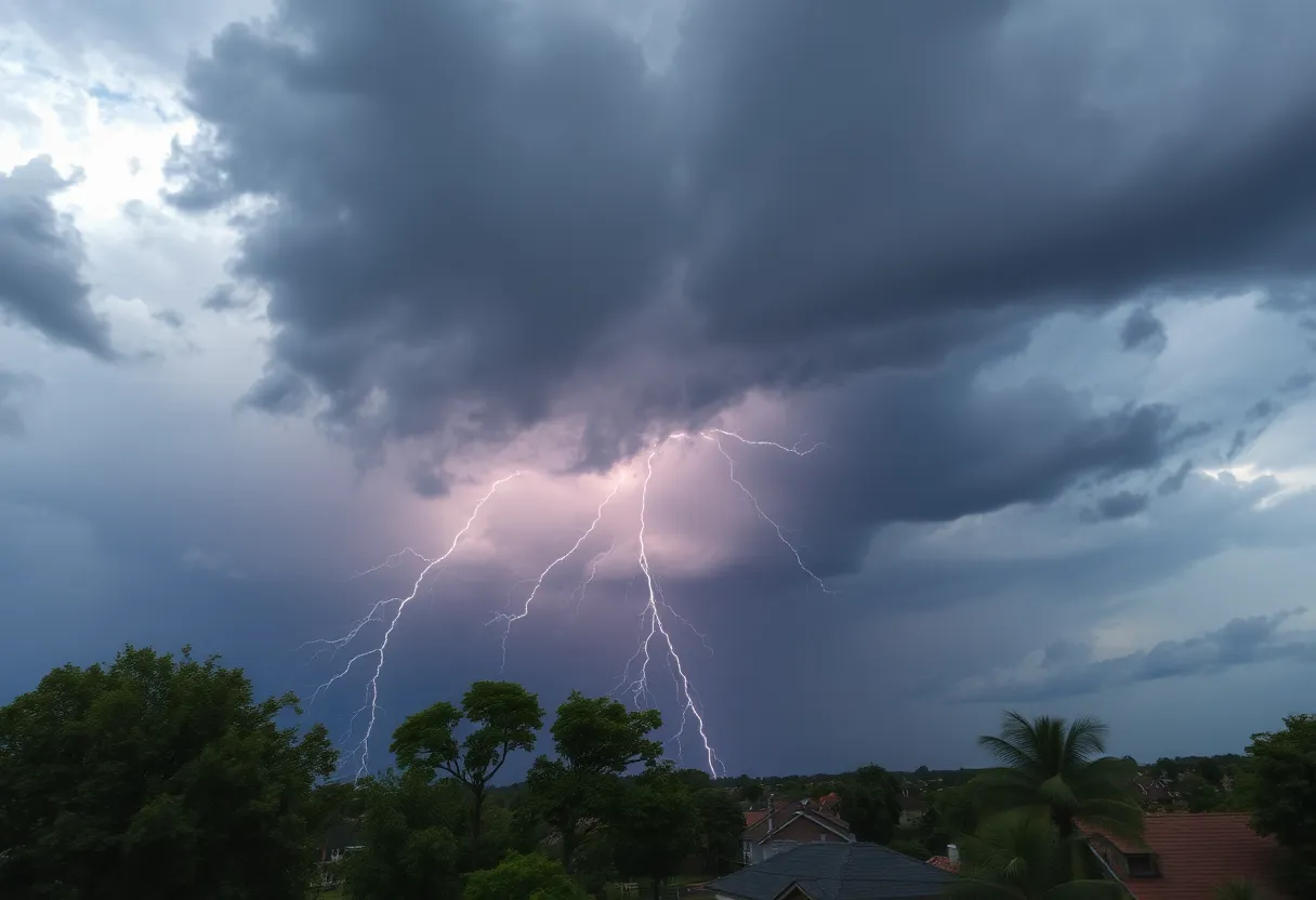
A series of thunderstorms have been reported in the Upstate, prompting the National Weather Service to issue warnings for the Greater Oconee and Pickens areas. The storms, which feature gusty winds up to 40 mph and the potential for pea-sized hail, have already been detected near Clemson. Residents are advised to take precautions as storm conditions may lead to downed tree limbs and hail damage. Additional warnings have been announced for surrounding counties, urging all to stay safe indoors during this severe weather.
Thunderstorm Warnings Hit Greenville-Spartanburg Area!
It’s been a wild evening in the Upstate as the National Weather Service (NWS) has been keeping a close eye on the brewing storms rolling through. Just after 7 p.m. on Sunday night, a weather alert was sent out for areas in Greater Oconee and Greater Pickens, warning folks about some strong thunderstorms packing quite a punch.
Storm Activity
According to the NWS, the storms are expected to last until around 7:45 p.m., and boy, are they ready to make an impression! Doppler radar has spotted a particularly strong thunderstorm near Clemson, which is moving northwest at a leisurely pace of 5 mph. As these storms pass through, residents can expect gusty winds that might reach up to 40 mph and maybe even some pea-sized hail — that’s about 0.25 inches! Sounds like it’s time to secure your patio furniture if it’s still outside!
Possible Damage
This kind of weather can get tricky, with those gusty winds potentially knocking down tree limbs and blowing around unsecured items. Minor hail damage could also hit outdoor objects, so it’s best to stay prepared. Some of the spots under the weather alert include Clemson, Pickens, Central, Liberty, Norris, Six Mile, and the beautiful Lake Keowee. If you happen to be outdoors, it’s highly recommended to find shelter as the storm brings along frequent cloud-to-ground lightning, a real danger which can strike up to 10 miles away!
Severe Thunderstorms Nearby
Meanwhile, over in Elbert, Franklin, Hart, Abbeville, and Anderson counties, a separate severe thunderstorm warning was issued just before the earlier alert at 7:09 p.m. This storm was cruising east at 55 mph and packing winds as strong as 60 mph along with larger hail measuring up to 0.75 inches! That can certainly lead to some tricky conditions if you’re caught outside or driving.
Areas particularly at risk from this storm include Anderson, Elberton, Homeland Park, Calhoun Falls, Iva, Lake Secession, and some parts of Russell State Park. This severe weather warning stays in effect until 8:30 p.m. for eastern Anderson and central/eastern Abbeville counties. It’s definitely a good idea to stick close to home until it blows over!
Ready for Rain and Risks
As always, safety comes first during these thunderstorms. The NWS emphasizes the importance of moving to an interior room on the lowest floor of your building, especially if you live in areas prone to flooding. If you’re near lakes or rivers, it’s smart to move away from the water. And an important reminder for drivers: be wary of hydroplaning. This occurs when your vehicle loses control on wet roads due to water buildup in front of the tires. Always keep a safe distance and drive carefully!
What’s Next?
As we look ahead, it seems that by early next week, we’ll be kissing these storms goodbye with highs reaching around 80 degrees and some lovely sunny days ahead. It’s a blend of storms now followed by the calm, and we all relish a little sunshine after the rain!
So, folks, keep an eye on the skies and stay safe out there. When nature comes knocking, it’s always better to be prepared!
Deeper Dive: News & Info About This Topic
HERE Resources
Severe Thunderstorm Warning in Cherokee and Spartanburg Counties
Severe Thunderstorm Warning Issued for Henderson County
Severe Thunderstorm Alert for Laurens County
Severe Thunderstorm Warning Hits Mecklenburg County
Severe Thunderstorm Warnings Issued for York County
Severe Thunderstorm Warnings Hit York County
Severe Thunderstorm Warning Issued for Oconee County
Severe Thunderstorm Warning Issued for Greenville and Spartanburg
Severe Thunderstorm Warning Issued for York County
Thunderstorm Watch Issued for Abbeville and Greenwood Counties
Additional Resources
- Independent Mail: Severe Thunderstorm Warning
- Wikipedia: Thunderstorm
- WYFF4: Severe Weather Timing
- Google Search: Severe Thunderstorm Warnings
- KVUE: Weather Update
- Encyclopedia Britannica: Weather
- Fox Carolina: ACC Settlement
- Google News: Thunderstorm Safety
Author: STAFF HERE ROCK HILL
The ROCK HILL STAFF WRITER represents the experienced team at HERERockHill.com, your go-to source for actionable local news and information in Rock Hill, York County, and beyond. Specializing in "news you can use," we cover essential topics like product reviews for personal and business needs, local business directories, politics, real estate trends, neighborhood insights, and state news affecting the area—with deep expertise drawn from years of dedicated reporting and strong community input, including local press releases and business updates. We deliver top reporting on high-value events such as the Come-See-Me Festival, Rock Hill Arts Festival, and motorsport events at the Rock Hill Velodrome. Our coverage extends to key organizations like the Rock Hill Chamber of Commerce and the Culture & Heritage Museums, plus leading businesses in manufacturing and technology that power the local economy such as 3D Systems and Comporium. As part of the broader HERE network, including HEREAiken.com, HEREBeaufort.com, HEREChapin.com, HERECharleston.com, HEREClinton.com, HEREColumbia.com, HEREGeorgetown.com, HEREGreenwood.com, HEREGreenville.com, HEREHiltonHead.com, HEREIrmo.com, HEREMyrtleBeach.com, HERENewberry.com, HERERockHill.com, and HERESpartanburg.com, we provide comprehensive, credible insights into South Carolina's dynamic landscape.


