News Summary
Residents in Abbeville, Laurens, and Greenwood Counties are bracing for strong thunderstorms this Wednesday evening. The storms, featuring wind gusts of up to 40 mph and possible penny-sized hail, are expected to last until 8:30 PM. Doppler radar indicates intense activity moving northeast, prompting warnings to take precautions and find shelter. As the weekend approaches, further severe weather, including the potential for tornadoes, is forecasted across parts of the Upstate. Stay safe and informed during this stormy weather.
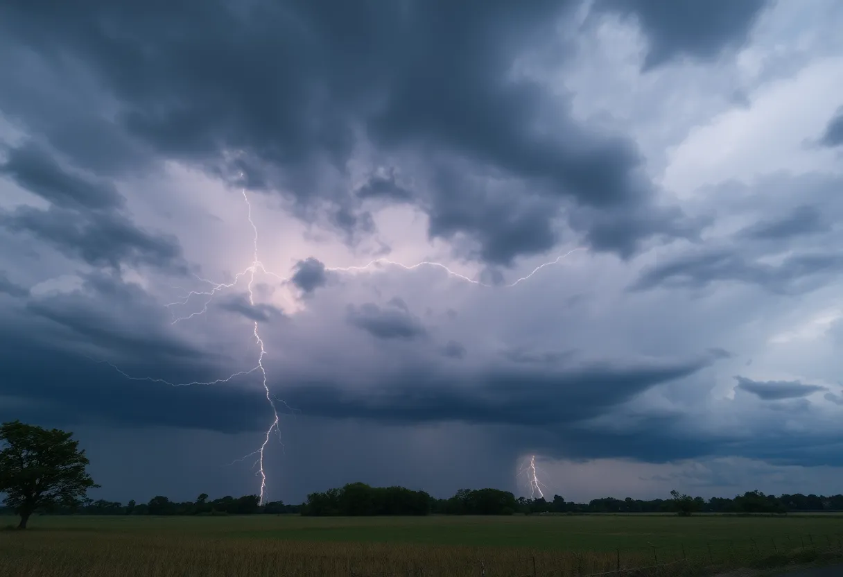
Thunderstorms Brewing Over Abbeville, Laurens, and Greenwood Counties!
This Wednesday evening, residents in Abbeville, Laurens, and Greenwood Counties should brace themselves for some serious weather action! An alert has been issued for strong thunderstorms that are expected to roll through the area until 8:30 PM. These thunderstorms pack a punch, with wind gusts reaching up to 40 mph and penny-sized hail (that’s about 0.75 inches in size!) potentially coming down.
What’s Happening Right Now?
As of 8:01 PM, Doppler radar has picked up some intense thunderstorm activity stretching from about 12 miles northeast of Greenwood all the way to 11 miles northwest of Abbeville. It’s moving northeast at a brisk 25 mph so you may want to keep an eye on the skies!
These storms can cause gusty winds that might just knock down tree limbs or blow around any unsecured objects. So, if you’ve got decorations or furniture on your porch, you might want to bring them inside! The hail could also cause some minor damage to what’s outdoors, so taking precautions is key.
Where Will the Thunderstorms Hit?
If you live in any of these areas, you’re in the path of the storm:
- Coronaca
- Cross Hill
- Ware Shoals
- Lake Greenwood
- Cokesbury
- Mountville
- Kinards
- Waterloo
- Hodges
- Donalds
Stay Safe and Seek Shelter!
For those outdoors, the weather service highly recommends finding shelter inside a building until the storm passes. It’s always better to be safe than sorry when lightning is in the mix! Did you know that there are around 25 million lightning strikes annually in the U.S. alone? Summer storms are infamous for being active during this time, so keep this in mind.
Here’s a quick tip: as a storm approaches, the chance of lightning strikes increases sharply, peaking during the storm and then tapering off as the storm moves out. It’s worth keeping your weather radio handy if you live in the area.
What’s Coming Up This Weekend?
As we look to the rest of the week, be prepared for more wild weather ahead! A warning has been put in place regarding the potential for even more severe storms, possibly including tornadoes, this weekend. This weather alert stretches across parts of the Upstate and covers Anderson, Greenville, Spartanburg counties, and beyond.
Forecasts suggest strong winds, the possibility of large hail, and even tornado threats later on. For those visiting or heading into the North Carolina mountains, gusty winds from 35-50 mph are expected, while everywhere else can brace for gusts between 25-35 mph.
The Weekend Forecast
Looking at the specifics, Saturday’s high will hover around a warm 77°F with potential rain showers on the horizon. Sunday is likely to cool off a bit, with highs around 73°F and chances of thunderstorms popping up. Keep your umbrellas at the ready, as rainfall amounts of about half to three-quarters of an inch are projected.
With these types of conditions, there’s a chance for isolated flooding in certain areas, so be mindful if you’re out driving!
Final Thoughts
So there you have it, folks! It’s going to be a stormy evening, and the weather isn’t slowing down anytime soon. Stay safe, follow the alerts, and don’t hesitate to take cover if needed. Remember, being weather-aware is key to staying safe during these unpredictable storms!
Deeper Dive: News & Info About This Topic
HERE Resources
Additional Resources
- Herald Online: Latest Weather News
- Wikipedia: Thunderstorm
- WYFF4: Greenville Weather Update
- Google Search: Severe Weather Alerts
- Fox Carolina: Hail Reports Across Upstate
- Google Scholar: Weather Forecasting
- Greenville Online: Tornadoes Possible in Upstate SC
- Encyclopedia Britannica: Tornado
- WYFF4: Severe Weather Timing
- Google News: Weather Forecast
Author: STAFF HERE ROCK HILL
The ROCK HILL STAFF WRITER represents the experienced team at HERERockHill.com, your go-to source for actionable local news and information in Rock Hill, York County, and beyond. Specializing in "news you can use," we cover essential topics like product reviews for personal and business needs, local business directories, politics, real estate trends, neighborhood insights, and state news affecting the area—with deep expertise drawn from years of dedicated reporting and strong community input, including local press releases and business updates. We deliver top reporting on high-value events such as the Come-See-Me Festival, Rock Hill Arts Festival, and motorsport events at the Rock Hill Velodrome. Our coverage extends to key organizations like the Rock Hill Chamber of Commerce and the Culture & Heritage Museums, plus leading businesses in manufacturing and technology that power the local economy such as 3D Systems and Comporium. As part of the broader HERE network, including HEREAiken.com, HEREBeaufort.com, HEREChapin.com, HERECharleston.com, HEREClinton.com, HEREColumbia.com, HEREGeorgetown.com, HEREGreenwood.com, HEREGreenville.com, HEREHiltonHead.com, HEREIrmo.com, HEREMyrtleBeach.com, HERENewberry.com, HERERockHill.com, and HERESpartanburg.com, we provide comprehensive, credible insights into South Carolina's dynamic landscape.

