News Summary
As strong thunderstorms pass through the Lowcountry, residents are urged to prepare for gusty winds and possible severe weather. Doppler radar indicates robust storms moving through areas like Jasper County, Pooler, and other local towns. A severe thunderstorm watch is in effect, with risks including high winds, hail, and isolated tornadoes. Residents are advised to stay informed and secure their belongings. Coastal residents should be aware of the storm’s impact despite its weakening as it approaches the shore.
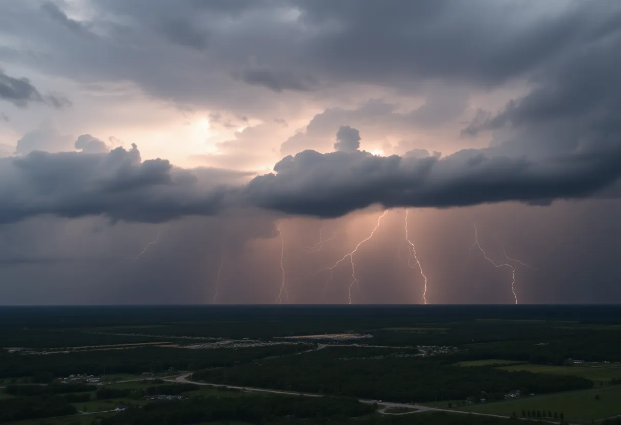
Thunderstorm Warnings Light Up Lowcountry Night Sky
Charleston, SC – As the clock ticked past 11:28 p.m. on Saturday, residents in the Lowcountry were alerted to a stormy situation brewing as the National Weather Service updated its report. Strong thunderstorms are passing through the area until midnight on Sunday, especially hitting inland Jasper County the hardest.
What’s Happening?
Doppler radar has been keeping a watchful eye, picking up a robust thunderstorm near Marlow that’s on the move, heading northward at a brisk pace of 25 mph. With it, we can expect gusty winds that risk toppling tree limbs and scattering unsecured items like lawn chairs and gardening tools across backyards.
Local towns are bracing for the storm’s impact. If you live in or around Pooler, Springfield, Godley Station, Savannah International Airport, Rincon, Garden City, Port Wentworth, Hardeeville, Bloomingdale, or Guyton, you’re right in the path of this tempest. Highways are not immune either! Expect some activity on roads like I-16 between mile markers 148 and 150, and I-95 in Georgia between mile markers 102 and 112. South Carolinians should also watch for conditions on I-95 between mile markers 2 and 4.
Staying Informed
It’s a good idea to keep an ear out for updates. Residents are advised to turn to NOAA Weather Radio All Hazards, television, or local news sources to catch the latest information about these stormy developments.
A Closer Look at Lightning
Did you know that lightning strikes the United States about 25 million times each year, mostly during our summer months? Unfortunately, it takes the lives of around 20 people annually! The risk of lightning strikes skyrockets as storms approach and peaks when the storm is directly overhead. Be aware that simply being outside during this time could be dangerous.
Hydroplaning Threat
Wet roads can bring about their own challenges as well. Hydroplaning can occur when a vehicle loses contact with the road by gliding on a layer of water in front of its tires. It leads to a loss of control—something nobody wants when racing against the clock to find shelter!
Thunderstorms on the Horizon
As we look ahead, a severe thunderstorm watch has been declared for several counties, including Charleston County, lasting until 9 p.m. tonight. Reports noted severe thunderstorms moving southeast at whopping speeds of 45 mph, punctuated by possible wind gusts hitting up to 60 mph and even small hail. For those in northwest Colleton, Dorchester, Berkeley, and Beaufort Counties, brace yourselves between 3 p.m. and 8 p.m. for rough weather!
A Level Three Threat
According to weather experts, the threat level has been rated a respectable three out of five for inland areas of South Carolina. Strong winds along with small hail could wreak havoc on roofs, siding, and even trees. Keep an eye out for hail that could measure up to an inch in diameter, and don’t forget that isolated tornadoes might be thrown into the mix!
Head’s Up, Coastal Residents!
While the storm is expected to lose some of its strength as it nears the coast, don’t let your guard down just yet. In particular, remain extra cautious when driving on bridges, as high winds can significantly affect vehicle stability.
So, gear up and stay safe, Lowcountry! The storm may just be a passing squall, but it’s always better to be prepared.
Deeper Dive: News & Info About This Topic
HERE Resources
Severe Thunderstorm Warning Hits Chester County
Madison Welcomes New Faces and Projects
Severe Thunderstorm Alert Issued for York County
Thunderstorm Alert Hits Beaufort and Jasper Counties!
South Carolina Faces Severe Thunderstorms and Tornado Watches
Severe Thunderstorm Warnings Roll into Charleston
Severe Thunderstorm Warnings Across South Carolina and Arkansas
Myrtle Beach on Alert: Strong Thunderstorms Bring Hail and High Winds
Severe Thunderstorm and Flood Watch for Upstate South Carolina
Severe Thunderstorms and Winds Hit Mecklenburg County
Additional Resources
- Live 5 News
- Wikipedia: Thunderstorm
- Count on 2 News
- Encyclopedia Britannica: Thunderstorm
- Charleston Gazette-Mail
Author: STAFF HERE ROCK HILL
The ROCK HILL STAFF WRITER represents the experienced team at HERERockHill.com, your go-to source for actionable local news and information in Rock Hill, York County, and beyond. Specializing in "news you can use," we cover essential topics like product reviews for personal and business needs, local business directories, politics, real estate trends, neighborhood insights, and state news affecting the area—with deep expertise drawn from years of dedicated reporting and strong community input, including local press releases and business updates. We deliver top reporting on high-value events such as the Come-See-Me Festival, Rock Hill Arts Festival, and motorsport events at the Rock Hill Velodrome. Our coverage extends to key organizations like the Rock Hill Chamber of Commerce and the Culture & Heritage Museums, plus leading businesses in manufacturing and technology that power the local economy such as 3D Systems and Comporium. As part of the broader HERE network, including HEREAiken.com, HEREBeaufort.com, HEREChapin.com, HERECharleston.com, HEREClinton.com, HEREColumbia.com, HEREGeorgetown.com, HEREGreenwood.com, HEREGreenville.com, HEREHiltonHead.com, HEREIrmo.com, HEREMyrtleBeach.com, HERENewberry.com, HERERockHill.com, and HERESpartanburg.com, we provide comprehensive, credible insights into South Carolina's dynamic landscape.


