News Summary
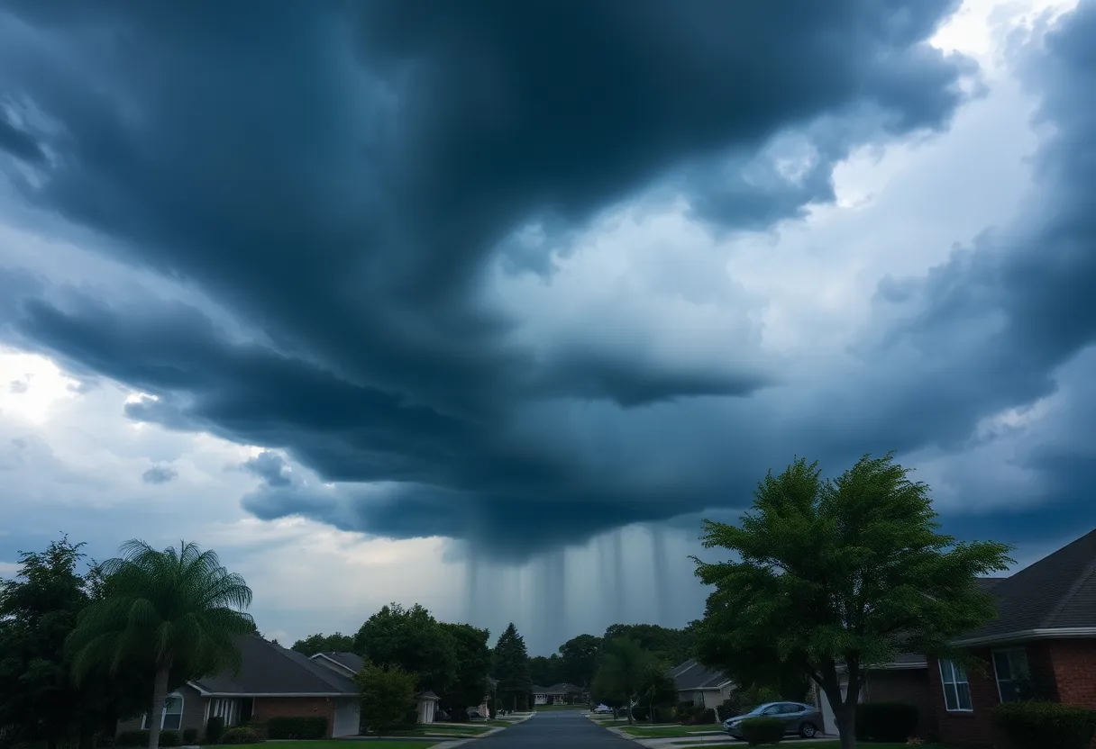
A severe thunderstorm warning has been issued for Berkeley and Dorchester County effective from 5:30 PM today. Doppler radar indicates a robust storm with strong winds, posing risks like downed tree limbs and flying debris. Residents in the path should seek shelter and stay updated through local news sources. Tonight’s forecast includes heavy rain and potential hail, lasting until 11 PM, with temperatures soaring around the 100° heat index. After the storm, isolated afternoon storms are expected later this week. Stay safe and plan accordingly!
Severe Thunderstorm Warning in Berkeley and Dorchester County
Attention residents of Berkeley and Dorchester County! A severe thunderstorm warning has just been issued by the National Weather Service, effective from 5:30 PM until 6 PM today. This storm is moving in fast and strong, so it’s time to take precautions!
What’s Happening?
Doppler radar has picked up on a robust, stationary thunderstorm making its way toward Dorchester. This means you could experience some serious weather conditions shortly. The strong winds associated with the storm may be powerful enough to knock down tree limbs and send unsecured objects flying around. Talk about a wild ride!
Who’s in the Path?
If you’re in any of the following locations, take heed: Dorchester, Ridgeville, Harleyville, Pringletown, Francis Beidler Forest, Spring Hill, Ebenezer, Sandridge, Hussertown, or Giant. You might want to secure your gardens and hold on tight indoors!
The storm is also affecting I-26 between mile markers 178 and 191. So, if you had plans to hit the road, it might be best to wait until this storm passes.
Keep Updated!
It’s always a wise move to stay connected when severe weather strikes. Tune into your NOAA Weather Radio All Hazards, TV, or local news for the latest updates. The NWS has mentioned that this storm could intensify, so don’t let your guard down.
Lightning Alert!
Did you know that lightning strikes the United States about 25 million times each year? Summer is peak season for these strikes, leading to about 20 fatalities annually. As this thunderstorm approaches, keep in mind that it significantly increases the likelihood of lightning in your area. It’s usually strongest when the storm is right over you and starts to fade as it moves away. So, it’s best to stay indoors and avoid unnecessary risks!
Safety First!
What should you do during a thunderstorm to stay safe? First, seek indoor shelter if you can. It’s not just about avoiding the rain; it’s about keeping away from those harmful lightning strikes and strong winds. If you’re driving, be on the lookout for hydroplaning. This sneaky condition occurs when water builds up in front of your tires, preventing contact with the road. If you feel your car starting to weave, ease off the gas and let the vehicle slow down.
Tonight’s Weather Forecast
As we look ahead, be prepared for gusty winds, heavy rain, and potentially damaging hail that could last until about 11 PM. Temperatures will be floating in the low to mid-90s, with the heat index climbing around the 100° mark. Make sure you’re hydrated and take care of yourself as the heat and storms combine.
What Comes Next?
Once this storm passes, rain chances will decrease throughout the rest of the week. However, don’t let your guard down just yet—there are isolated afternoon storms expected from Thursday through Sunday. So, while this week’s weather is a bit of a rollercoaster ride, it looks like relief is on the way after today’s storm.
Stay safe out there, Berkeley and Dorchester County! Plan accordingly, and keep your eyes on the sky!
Deeper Dive: News & Info About This Topic
HERE Resources
Severe Thunderstorm Warning Issued in South Carolina
South Carolina Prepares for Rainy Independence Day Weekend
Severe Storms Alert for South Carolina Residents
Severe Thunderstorm Warnings Hit Charleston Area
Severe Thunderstorms and Flash Flooding Alert for York and Lancaster Counties
Oconee on Alert for Incoming Severe Thunderstorms
Severe Thunderstorm Alerts Issued for South Carolina Regions
Rock Hill First Responders Collect Cereal for Local Charity
Severe Thunderstorm Caution Issued for Chester and York Counties
Thunderstorm Warnings Issued for Greenville-Spartanburg Area
Additional Resources
- Live 5 News
- Wikipedia: Severe Thunderstorm Warning
- ABC News 4
- Google Search: Thunderstorm Safety Tips
- Count on 2
- Encyclopedia Britannica: Thunderstorm
- Myrtle Beach Online
- Google News: Severe Weather Alerts