News Summary
Severe thunderstorm warnings have been issued by the National Weather Service for Laurens, Union, and Spartanburg counties in South Carolina. The storm, detected by Doppler radar, is expected to bring wind gusts up to 40 mph and heavy rainfall, potentially leading to localized flooding. Residents are advised to seek shelter, avoid flooded roadways, and report any damages observed. Additional severe thunderstorms are anticipated in the coming days, emphasizing the need for preparedness and caution during summer storms.
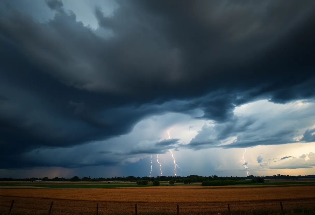
Severe Thunderstorm Warnings Hit Upstate South Carolina and Western North Carolina
As we cozy up for another summer evening in Upstate South Carolina and Western North Carolina, it’s important to keep an eye on the weather because Mother Nature might just have some plans of her own!
Weather Alert Issued!
The National Weather Service (NWS) has rolled out a severe thunderstorm warning for residents in Laurens, Union, and Spartanburg counties. The alert was issued on Thursday at 4:23 p.m. and is expected to last until 5:30 p.m. So, what’s brewing? Strong thunderstorms have been detected by the trusty Doppler radar, forming a line that stretches from 17 miles south of Spartanburg all the way to 3 miles northeast of Laurens. These storms are moving east at a brisk speed of 25 mph.
What to Expect
Hold onto your hats, folks! Wind gusts from this storm could reach up to 40 mph. Be prepared for the possibility of falling tree limbs and flying projectiles, as the winds might have plans to send unsecured items tumbling about your yard. The NWS has pinpointed several locations in the path of these storms, such as Laurens, Clinton, Woodruff, Joanna, Buffalo, Waterloo, Rose Hill State Park, Mountville, Kinards, and Enoree.
Flooding and Safety Precautions
It’s not just windy up there; heavy rainfall is accompanying these storms, which could lead to localized flooding. Residents are strongly advised to steer clear of flooded roadways. Remember, it may look safe, but water can hide deep dangers!
When thunderstorms roll in, they bring more than just wind and rain. Did you know that lightning strikes the U.S. approximately 25 million times a year? Most of those strikes happen during the summer months and are responsible for about 20 fatalities annually. So, if you hear thunder, seek shelter indoors!
Driving Tips
If you are out and about in your car, be aware of the risks associated with hydroplaning. This occurs when water builds up in front of your tires faster than you can move through it, creating a slick layer between your tires and the road. Factors like speed, tire tread wear, and water depth play a role here. Slow down, and take it easy on those wet roads!
More Thunderstorms on the Horizon
Looking back, similar severe thunderstorm warnings were issued on previous days as well. Just this Monday, July 28, another warning highlighted the threat in Spartanburg County until 4:45 p.m. The storm back then was clocking in at 15 mph, meaning the weather was no joke. Those winds tipped the scales at a staggering 60 mph, and there was even hail expected to reach an inch in size.
What To Do During a Thunderstorm
If you’re in one of these storms’ paths, head for an interior room on the lowest floor of your building. It’s all about staying safe until the storm passes. Always keep away from windows, and if you can’t resist the urge to check your phone or computer, hold off! Avoid wired electronics during storms to stay safe from unexpected jolts of lightning.
Stay Informed!
As always, the NWS encourages residents to report any damaging winds, hail, or flooding they observe. Use their toll-free number or social media to communicate updates. Your information can help keep the whole community informed and safe!
So there you have it, folks! Keep your eyes on the sky, stay safe, and let’s hope this storm passes quickly!
Deeper Dive: News & Info About This Topic
HERE Resources
Severe Thunderstorm Warnings Sweep Through Greenville-Spartanburg Area
Rock Hill Man Critically Injured in Train Incident
Brace Yourselves, Sioux Falls – A Derecho is Coming!
Severe Heat and Thunderstorms Expected in Maryland and New York
Heat Advisory Issued for Upstate South Carolina
Extreme Heat Wave Hits the Northeastern U.S.
Rock Hill Schools Boosts Staffing for Upcoming School Year
Rock Hill Schools Welcomes New Educators Ahead of School Year
Rock Hill Schools Welcomes 100 New Educators Amid Community Initiatives
Severe Thunderstorm Alert Issued for Barnwell County
Additional Resources
- Island Packet: Severe Thunderstorm Warnings
- Wikipedia: Thunderstorm
- Go Upstate: Spartanburg County Severe Thunderstorm Warning
- Google Search: Severe Thunderstorm Warnings Upstate South Carolina
- Myrtle Beach Online: Weather News
- Encyclopedia Britannica: Lightning
- The State: Weather News
- Google News: Severe Thunderstorm Warnings