News Summary
Charleston is currently under a Severe Thunderstorm Warning issued by the National Weather Service. The warning impacts several areas, including Charleston, Dorchester, and Colleton counties. Residents are advised to prepare for strong winds, the potential for hail, and flooding. As safety is paramount, drivers are urged to exercise caution on the roads, and homeowners should secure property to prevent damage. Stay informed through local news sources and follow safety recommendations to weather the storm safely.
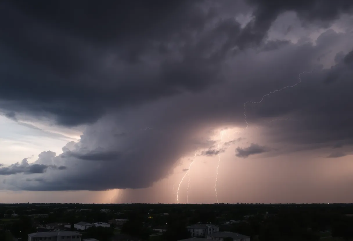
Severe Thunderstorm Hits Charleston and Surrounding Areas
Good evening, Charleston! Things are heating up—literally! The National Weather Service (NWS) just issued a Severe Thunderstorm Warning that’s shaking things up in our lovely southern region. The alert was officially put out at 6:53 p.m. and is set to hang around until 7:45 p.m. today, so it’s a good time to make sure you have your rain gear and plans ready!
Areas Impacted
Now, let’s break down where this storm is doing its thing. The NWS has identified that the affected areas include Inland Colleton, Coastal Colleton, Dorchester, and, of course, Charleston counties. If you live in towns like Summerville, Edisto Beach, Johns Island, West Ashley, Hollywood, Folly Beach, Ravenel, Seabrook Island, Kiawah Island, or Meggett, you’re definitely in the storm’s path!
What to Expect
So, what’s coming your way? Well, Doppler radar has been busy tracking a strong thunderstorm near Adams Run. It’s moving northeast at about 20 mph. This storm is no joke; it’s got the potential to unleash some gusty winds that could knock over tree limbs and send unsecured items sailing through the air. Remember to secure your patio furniture and anything else that might dance in the wind!
On top of that, the possibility of hail is in the forecast. So, if you have any delicate outdoor decorations or potted plants, you may want to bring them inside!
Stay Informed
While enjoying the southern charm, it’s important to stay informed about the weather. The NWS recommends tuning into your NOAA Weather Radio All Hazards, local TV stations, or news sources for real-time updates. Knowing what’s coming can help you prepare and stay safe!
Lightning Safety
Speaking of safety, let’s talk about lightning. Did you know that lightning strikes the U.S. about 25 million times a year? Most of these strikes happen during the summer months, and they result in around 20 fatalities annually. As these thunderstorms roll in, lightning becomes more likely, especially when the storm is right overhead. So, avoid standing under trees or in open fields as the skies darken!
Driving Precautions
And if you’re planning to hit the road tonight, please take extra precautions. Hydroplaning is a real concern when waters pool on the roads. Factors like water depth, tire tread, and speed can all contribute to this slippery hazard. If you encounter flooded roads, turn around; it’s always better to be safe than sorry.
Potential Damage
Let’s not forget the risk of property damage. The storm could create significant issues, like damaging roofs and siding, toppling trees, and downing power lines. Power outages could become a reality for some, so make sure you’re prepared with flashlights and any necessities you might need!
Wider Effects of the Weather
Earlier today, a tornado warning was lifted for Charleston, Colleton, and Beaufort Counties, making this current severe thunderstorm outlook all the more concerning. Additionally, there was a flash flood warning issued for parts of Charleston County, particularly in North Charleston and Downtown Charleston. Keep your eye out for rising water and stay alert!
So, Charleston residents, stay safe out there! Keep an eye on the skies, stay connected for weather updates, and make sure you’re taking the necessary precautions to ride out this storm. Here’s to hoping everyone stays dry and is ready to bounce back when the sun shines again!
Deeper Dive: News & Info About This Topic
HERE Resources
Beaufort County Faces Flash Flood Warning This Weekend
Thunderstorm Warnings Hit Charleston County: Stay Safe!
Severe Thunderstorms Strike South Carolina and Missouri
Severe Heat and Thunderstorms Expected in Maryland and New York
Strong Thunderstorm Warning Issued for South Carolina and Georgia
Severe Thunderstorm Warnings Hit Charleston, SC
Aiken County Faces Severe Weather with Thunderstorms and Tornadoes
Weather Alert: Strong Thunderstorms Hit Spartanburg and Union Counties
Severe Thunderstorm Alerts Hit Florence County: Stay Safe!
Myrtle Beach Residents Brace for Severe Thunderstorm Warning
Additional Resources
- Count On 2 News
- Wikipedia: Weather Warning
- Island Packet
- Google Search: Severe Thunderstorm Charleston
- ABC News 4
- Google Scholar: Severe Thunderstorm Warnings
- WHSV Weather
- Encyclopedia Britannica: Thunderstorm
- Live 5 News
- Google News: Thunderstorm South Carolina