News Summary
Myrtle Beach faces a severe flash flood warning as intense thunderstorms bring heavy rainfall. With between 1.5 to 3 inches of rain expected, residents are urged to be vigilant and seek higher ground if necessary. The National Weather Service warns of potential flooding dangers, especially at night. Precautions should be taken to stay safe from electrical hazards and avoid driving through flooded roads. Community members are reminded to stay informed and prioritize safety during this challenging weather event.
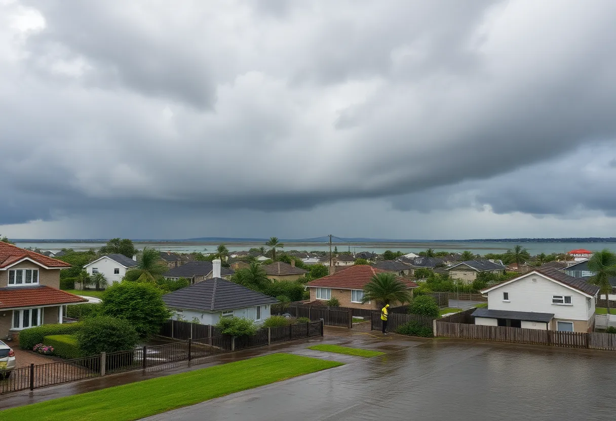
Severe Flash Flood Warning Hits Myrtle Beach: Residents Urged to Stay Safe
This Wednesday evening, the beautiful coastal town of Myrtle Beach found itself in the crosshairs of nature’s fury as the National Weather Service (NWS) issued an updated flash flood warning. The alert is in effect until 9:15 PM, and residents are being advised to stay vigilant as intense thunderstorms unleash their fury across the area.
According to Doppler radar, these storms are bringing along some serious rainfall, with between 1.5 and 2.5 inches already recorded within just one hour. To top it off, there are reports of isolated pockets receiving as much as 3 inches. And it doesn’t seem to be over yet, as an additional inch of rain could fall before the night is done.
What to Expect
Flash flooding is either happening now or is on the horizon, so it’s critical to know where the risks lie. Areas that are particularly vulnerable include:
- Myrtle Beach
- Red Hill
- Myrtle Beach Airport
- Socastee
- Longs
- Wampee
- Dulah
- Goretown
- Pireway
- Hammond
- Hand
- Bughill
- Barefoot Landing Area of North Myrtle Beach
- Nakina
- Nixonville
- Longwood
- Ash
- Freeland
- Old Dock
- Crusoe Island
Be Prepared
The NWS has highlighted the danger posed by flooding, especially in areas with poor drainage. This threat becomes even more significant at night when visibility is low, making it tough to gauge flooding hazards. Residents are reminded that the majority of flood deaths happen in vehicles; therefore, the mantra remains clear: “Turn around, don’t drown.”
For those who find themselves in flood-prone zones or are camping in low-lying areas, it’s time to seek higher ground immediately. If you receive an evacuation order, don’t hesitate—leave right away! Before heading out, make sure to securely lock your home, and if time allows, disconnect utilities and appliances to prevent any hazards.
Safety First!
While you should definitely take precautions for flooding, also be wary of electrical hazards. Keep away from basements or rooms that have submerged electrical outlets or cords. If you notice any strange sounds like buzzing or snapping, it’s an indicator that it’s time to exit the area.
Remember, never enter water that could carry an electric current! Even as little as 6 inches of moving water can knock you off your feet. Should you find yourself trapped by fast-moving water, climb to the highest point available and alert emergency services by calling 911.
Driving Dangers
As the rain pours down, the risks associated with driving also increase dramatically. Attempting to drive through flooded roads can be a recipe for disaster, as just 12 inches of rushing water can sweep away most vehicles. Additionally, slippery roads due to hydroplaning can lead to uncontrollable slides, so it’s crucial to stay alert and drive carefully in such conditions.
This flash flood warning serves as a serious reminder for the Myrtle Beach community to prioritize safety during tonight’s storms. Stay informed, heed the warnings, and above all, look out for one another. Here’s hoping everyone in Myrtle Beach holds tight, stays safe, and weathers this storm without any trouble.
Deeper Dive: News & Info About This Topic
HERE Resources
Severe Thunderstorms Cause Disruption in South Carolina and Alabama
Severe Thunderstorm Hits Charleston and Surrounding Areas
Thunderstorm Warnings Hit Charleston County: Stay Safe!
Severe Thunderstorm Warnings Issued for Upstate SC Counties
Books on Main Receives 4,000 DVDs to Support Local Libraries
Severe Thunderstorm Warnings for Upstate South Carolina and Western North Carolina
Southeast U.S. Faces Scorching Heat Wave
Severe Thunderstorm Warnings Hit Charleston, SC
Severe Weather Impacts Millions Across the U.S. This Weekend
Severe Thunderstorm Warning Lifted for Orangeburg County
Additional Resources
- Myrtle Beach Online
- Wikipedia: Flash Flood
- Herald Online
- Google Search: Flash Flood Warnings
- AccuWeather
- Encyclopedia Britannica: Flood
- Post and Courier
- Google News: Myrtle Beach Weather News