News Summary
The National Weather Service has issued an updated flash flood warning for Charleston, predicting heavy rainfall between 3 to 5.5 inches due to thunderstorms. Residents are urged to stay alert and avoid flooded roads, especially in low-lying areas. Changes in flood advisory criteria are also being implemented to increase public safety awareness. A briefing on these updates will take place on August 1, highlighting the importance of preparedness as flooding events have increased significantly in recent years.
Charleston Prepares for Heavy Rainfall and New Flood Warning Criteria
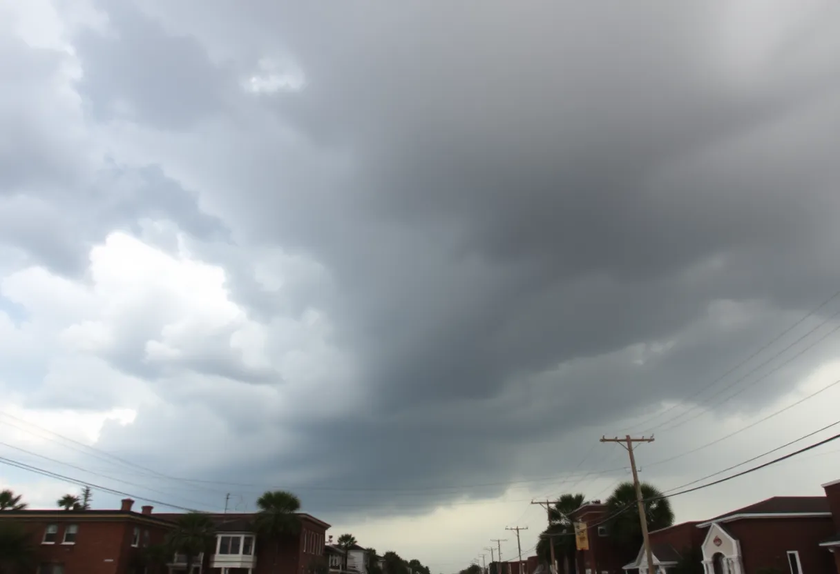
Charleston residents need to pay attention as the National Weather Service has issued an updated flash flood warning for the area. This notice came in at 10:14 p.m. on Saturday and is effective until midnight on Sunday. The rain is really starting to come down, with thunderstorms expected to bring heavy rainfall of between 3 and 5.5 inches in parts of Charleston County.
But don’t pack your umbrellas just yet! The forecast suggests that we might see an additional 0.2 to 0.4 inches of rain. It’s important for everyone to be aware that flash flooding is either ongoing or likely to start shortly. Several weather stations around Folly Beach, Johns Island, and Wadmalaw Island have already recorded rainfall amounts between 4.00 and 5.50 inches.
Staying Safe on the Roads
Now, if you’re planning to drive, you might want to reconsider your routes. Roads that are likely to be affected by flooding include Main Road, Maybank Highway, River Road, Plow Ground Road, and Savannah Highway. The locations affected by this warning cover a wide area, from Johns Island to West Ashley, James Island, and even out to areas like Folly Beach and Kiawah Island.
The NWS warns specifically about flash flooding in places like small creeks, streams, urban areas, highways, streets, and other low-lying areas. So if you’re thinking about driving through any flooded road, remember: turn around! Most flood-related deaths happen in vehicles. It’s just not worth the risk.
If You’re in a Flood-Prone Area
For those living in areas that are prone to flooding or who might be camping in lower-lying spots, it’s wise to think about moving to higher ground. And if conditions worsen and you need to evacuate, make sure to lock your home and disconnect utilities if time permits. Remember to stay away from places where water has submerged electrical outlets or cords. Safety is paramount!
If you find yourself trapped by moving water, seek the highest point nearby and contact emergency services. Hydroplaning is also a key concern during these heavy rains. This occurs when a vehicle slides uncontrollably on wet roads—an alarming situation for anyone on the road!
Changes in Flood Advisory and Warning Criteria
Now, let’s talk about some important changes the NWS is implementing in how flood advisories and warnings are communicated. These changes aim to enhance public safety by aligning Charleston’s warning system with national standards. Over the past 30 years, Charleston has seen a staggering four-fold increase in flooding events, so these updates are sincerely needed.
The adjustments mean that lower-end flooding events, which might have previously led to a simple flood advisory, could now result in a base-level Flash Flood Warning. This shift will help residents better understand the risk of flooding they may face. In the last year alone, around 95 flood advisories and 19 flash flood warnings were issued, so these changes could significantly alter how we respond going forward.
It’s important to note that while the criteria for the most serious Flash Flood Emergency warning will remain the same, the changes are primarily focused on improving communication. It’s not about increasing flood risk—just making it clearer.
A Briefing is on the Horizon
Emergency management will be holding a briefing starting on August 1 to dive deeper into these new flash flood event criteria. Residents will want to keep an eye out for updates as these systems are set to improve the public’s understanding and response to flooding in the area.
So, Charleston, stay safe, stay informed, and don’t let the rain catch you unaware!
Deeper Dive: News & Info About This Topic
HERE Resources
Tom S. Gettys Center to Remain Open in Rock Hill
Severe Flash Flood Warning Hits Myrtle Beach: Residents Urged to Stay Safe
Severe Thunderstorms Cause Disruption in South Carolina and Alabama
Severe Thunderstorm Hits Charleston and Surrounding Areas
Beaufort County Faces Flash Flood Warning This Weekend
Thunderstorm Warnings Hit Charleston County: Stay Safe!
Severe Thunderstorms Strike South Carolina and Missouri
Southeast U.S. Faces Scorching Heat Wave
Strong Thunderstorm Warning Issued for South Carolina and Georgia
Severe Thunderstorm Warnings Hit Charleston, SC