News Summary
A severe thunderstorm warning has been issued for Greenville and Spartanburg counties in Upstate South Carolina, with expected strong winds, hail, and localized flooding. Residents are advised to take precautions, seek shelter, and stay updated on weather conditions. The storm is moving east quickly, bringing challenges for those in affected areas. The NWS has warned about possible damages from strong winds and hail, and motorists should avoid driving through flooded areas. Stay safe and keep an eye on updates for additional thunderstorms expected over the weekend.
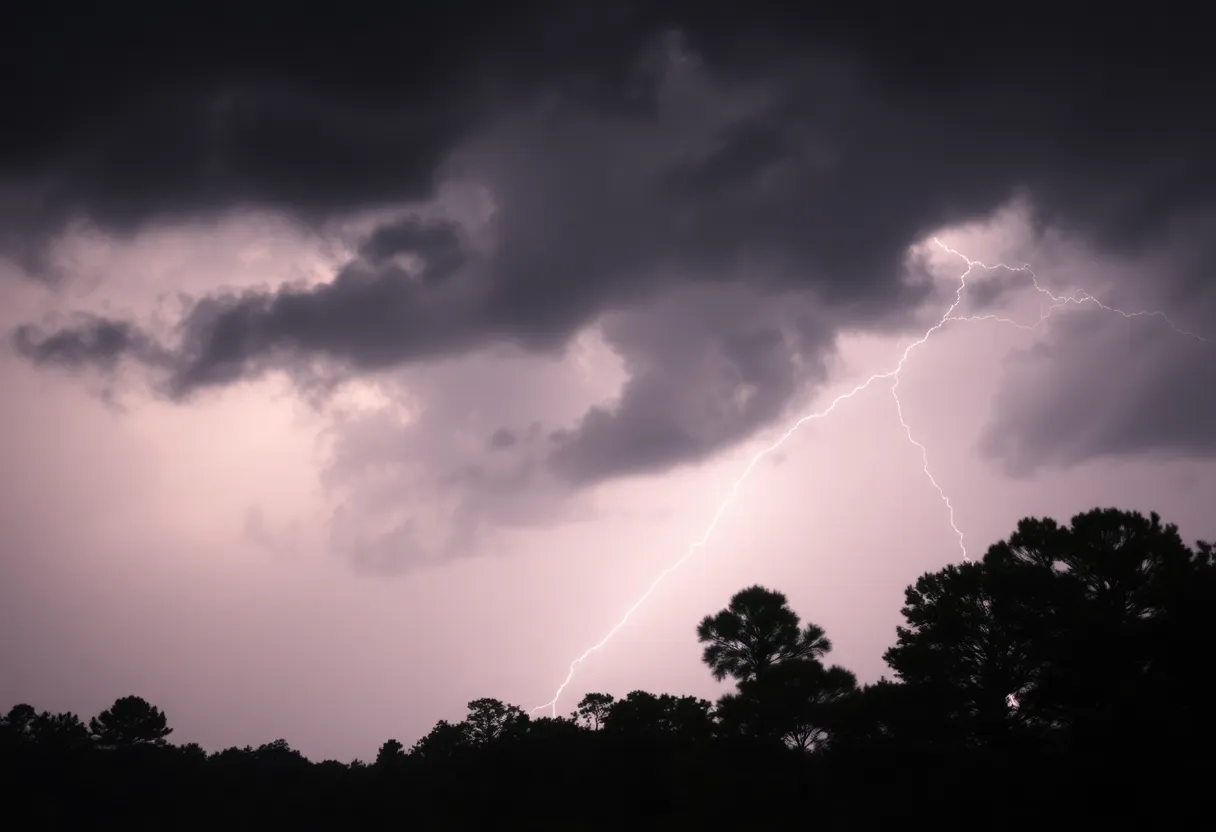
Severe Thunderstorm Hits Upstate South Carolina!
Hey there, Upstate South Carolina! Brace yourselves, as the weather is going to be quite the ride today. A severe thunderstorm warning has been issued by the National Weather Service (NWS) for the Greenville and Spartanburg counties, starting at 3:52 p.m. and keeping folks on their toes until 4:15 p.m.
What to Expect
As the storm rolls in, prepare for some strong winds with gusts reaching up to 50 mph and even some penny-sized hail – that’s right, hail measuring about 0.75 inches! This isn’t just your everyday drizzle; it’s the kind of weather that can make you double-check if the patio furniture is securely stowed away!
The NWS reported that just before the warning, a strong thunderstorm was detected on Doppler radar, located about 7 miles south of Columbus, near Landrum. The storm is moving east at a speedy 20 mph. It looks like it has its own agenda, and it’s not planning to slow down!
Areas Affected
Those of you in the following areas need to be particularly alert:
- Landrum
- Inman
- Campobello
- Lake Bowen
- Boiling Springs, SC
- Gowensville
- Fingerville
Yes, it’s going to be a bumpy ride for a lot of folks in our great state!
Stay Safe!
If you’re out and about, the best advice is to seek shelter indoors. Those gusty winds might snap off tree limbs or toss around anything that isn’t tied down. And let’s not forget about that hail – it could inflict minor damage to your outdoor belongings. Keep your car tucked away if you can; it’s always better to be safe than sorry!
The storm is also bringing a good amount of rainfall, which can lead to localized flooding. So, if you’re driving, please heed the warning: don’t attempt to drive through flooded areas. It’s simply not worth the risk!
The Thunderstorm and Lightning Factor
Did you know that the U.S. sees approximately 25 million lightning strikes each year? Most of these fiery displays occur during summer. As thunderstorms approach, the chance of lightning just skyrockets – it peaks when you’re directly under the storm and lessens as it moves away. Always keep your eye on the sky!
If you find yourself driving in the rain, be cautious of hydroplaning, which is when your vehicle starts to slide uncontrollably on wet roads. If you sense your car starting to slip, gently ease off the gas, steer into the skid, and don’t slam on the brakes!
Looking Ahead
As we gaze toward the weekend, Upstate is looking at partly cloudy conditions with further chances of thunderstorms on August 1 and 2. Those storms could provide some much-needed relief for our ongoing dry spell. And guess what? A ridge of high pressure is building, leading to cooler temps with highs expected to hit around 80 degrees this Saturday. So, while we ride out today’s storm, it looks like there’s a silver lining ahead!
Lastly, keep those eyes peeled for updates, and if you encounter any damaging winds, hail, or flooding, don’t hesitate to report it to the NWS. Stay safe and make sure to check in with friends and neighbors to ensure everyone is alright!
Deeper Dive: News & Info About This Topic
HERE Resources
Severe Thunderstorm Warning Issued for South Carolina
Severe Thunderstorms Strike Upstate South Carolina and East Tennessee
Severe Thunderstorm Warnings Sweep Through Charleston
Charleston Prepares for Heavy Rainfall and Flood Warnings
Tom S. Gettys Center to Remain Open in Rock Hill
Severe Flash Flood Warning Hits Myrtle Beach: Residents Urged to Stay Safe
Severe Thunderstorms Cause Disruption in South Carolina and Alabama
Severe Thunderstorm Hits Charleston and Surrounding Areas
Beaufort County Faces Flash Flood Warning This Weekend
Fatal Motorcycle Crash in York County Raises Safety Concerns
Additional Resources
- Island Packet
- Wikipedia: Thunderstorm
- Herald Online
- Google Search: Severe Thunderstorm Forecast
- Greenville Online
- Encyclopedia Britannica: Weather
- Go Upstate
- Google News: Thunderstorm South Carolina