News Summary
Residents in South Carolina’s Aiken, Barnwell, and Bamberg counties are advised of severe thunderstorms and potential flooding. The National Weather Service issued an urgent alert forecasting strong winds and heavy rain. Residents are urged to stay indoors due to lightning risks and heed flood warnings in urban and low-lying areas. Motorists are cautioned about hydroplaning on wet roads. Stay safe and stay informed as these storms move across the region.
Severe Thunderstorm Alerts and Flood Advisories Hit South Carolina
In South Carolina, particularly in the bustling areas of Aiken, Barnwell, and Bamberg counties, residents should brace themselves for some serious weather this afternoon. An urgent thunderstorm alert was issued by the National Weather Service (NWS) as of 2:45 p.m., warning that strong thunderstorms are expected to roll through until about 3:30 p.m. With wind gusts that could reach up to 50 mph, it’s shaping up to be an eventful afternoon!
Thunderstorms on the Move
At the time of the alert, radar was tracking a potent thunderstorm near Jackson, close to the Savannah River Site, which was shifting southeast at a steady pace of 15 mph. Residents in the affected areas, including Barnwell, New Ellenton, and Snelling, need to stay attentive as these storms can bring more than just a bit of drama in the sky. Winds strong enough to knock down tree limbs and toss around loose objects are no joke!
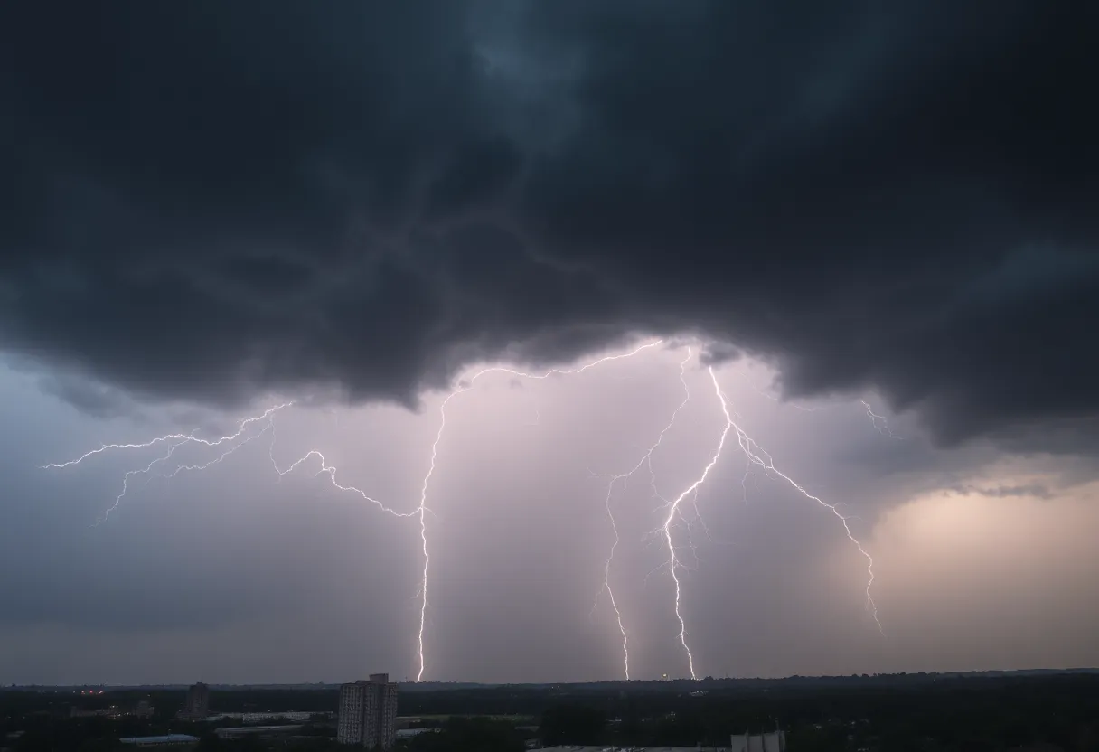
Lightning: A Quick Reminder
For those thinking about standing outside to watch the show, hold that thought! The NWS is advising individuals outdoors to seek shelter inside buildings. With frequent cloud-to-ground lightning in the forecast, the threat remains real even from a distance—lightning can strike up to 10 miles away from a thunderstorm. In fact, the United States experiences about 25 million lightning strikes each year, often leading to fatalities. Just remember, when thunder roars, go indoors!
Previous Alerts and Ongoing Cautions
This isn’t a stand-alone event either. Earlier this week, on Wednesday night, a similar alert rang out around 11:11 p.m. for Edgefield, Saluda, and Lexington counties. That warning was packed with strong thunderstorms and wind gusts of up to 50 mph, along with heavy rainfall that could cause localized flooding. Just imagine the downpours as they drenched towns along Interstate 20—some areas received between 1.5 to a whopping 4 inches of rain!
Flood Advisories: What You Need to Know
As a result of the downpour, several flood advisories have been issued for these regions. Aiken, Edgefield, Saluda, and Lexington counties are now under scrutiny for excessive rainfall, with flash flood warnings indicating possible flooding—especially in urban zones, highways, and low-lying areas. It’s crucial to remember: turn around, don’t drown! Keep safe by avoiding flooded roadways, as most flood-related fatalities occur in vehicles.
Drive Safely and Stay Alert
If you must travel, be extra cautious. Hydroplaning, which occurs when a vehicle glides across a wet surface, is a major concern during these storms. It can lead to loss of control of your vehicle, so make sure to stay alert and drive at a safe speed. Wet roads can be unpredictable, and it’s always better to err on the side of caution.
Summing It Up
So, here’s the takeaway: if you’re in the Aiken, Barnwell, or Bamberg areas, stay informed, stay inside, and keep an eye on the sky. The weather may be a bit surly today, but by following safety precautions and being mindful of your surroundings, you can weather the storm with a grin. Keep your loved ones close, stay safe, and let’s hope for clearer skies soon!
Deeper Dive: News & Info About This Topic
HERE Resources
Severe Thunderstorm Alerts Impact Greenville and Spartanburg
Severe Thunderstorm Warning Issued for South Carolina
Severe Thunderstorms Strike Upstate South Carolina and East Tennessee
Charleston Prepares for Heavy Rainfall and Flood Warnings
Severe Thunderstorms Cause Disruption in South Carolina and Alabama
Severe Thunderstorm Hits Charleston and Surrounding Areas
Beaufort County Faces Flash Flood Warning This Weekend
Severe Thunderstorms and Tornado Warnings in Kentucky
Thunderstorm Warnings Hit Charleston County: Stay Safe!
Severe Thunderstorms Strike South Carolina and Missouri
Additional Resources
- Weather.com: Aiken, SC
- HeraldOnline: Severe Weather Updates
- Fox Weather: Thunderstorms in Southeast
- Wikipedia: Thunderstorm
- Encyclopedia Britannica: Flood