News Summary
Residents in the Greater Oconee area, including Walhalla, Seneca, and Westminster, are under a severe thunderstorm alert until 8:15 p.m. This update from the National Weather Service warns of strong winds reaching 40 mph and potential pea-sized hail. Localized flooding is a concern, and residents are advised to steer clear of flooded areas. As lightning strikes can increase, safety is paramount. Stay indoors and secure outdoor belongings as the storm approaches.
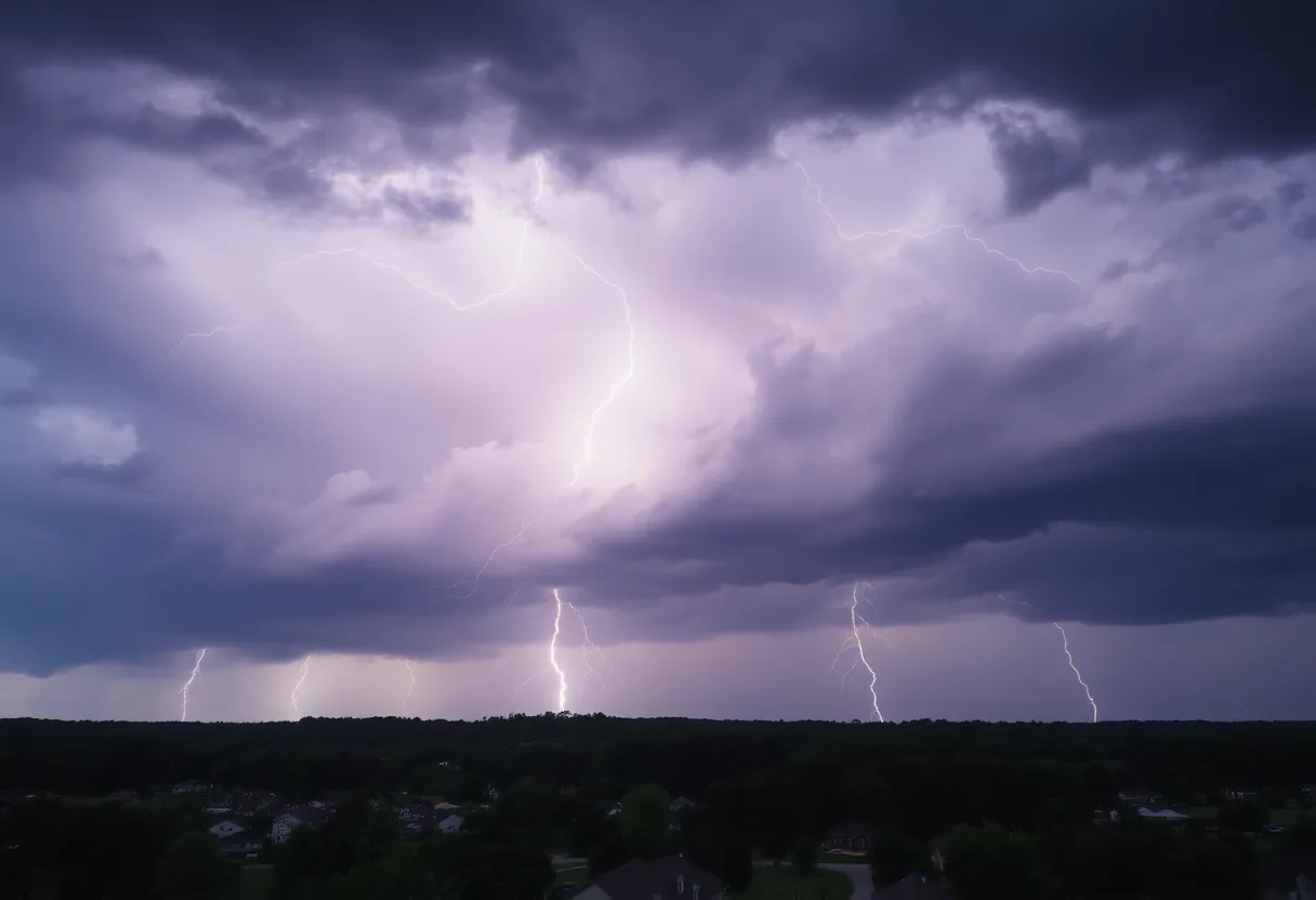
Severe Thunderstorm Alerts in Oconee: Brace for Impact
If you’re in the Greater Oconee area, including Walhalla, Seneca, and Westminster, it’s time to pay attention! An updated weather alert was issued at 7:39 p.m. on Friday by the National Weather Service (NWS) in Greenville-Spartanburg, SC. This alert is in effect until 8:15 p.m. and warns of strong thunderstorms headed your way.
What to Expect
Ready your umbrellas because this storm is packing some punch! Wind gusts could reach up to 40 mph, and if you’re thinking of heading outside, you might want to reconsider. The NWS is predicting pea-sized hail measuring 0.25 inches as part of the weather mayhem. Just as a heads up, you might see some minor hail damage to your outdoor belongings.
At the time the alert was issued, Doppler radar picked up a strong thunderstorm just 8 miles south of Walhalla, near Westminster, steadily moving northeast at about 10 mph. That’s right, folks! It’s not just raindrops we need to worry about; this storm comes with gusty winds that could snap tree limbs and toss unsecured items around. Is that lawn chair of yours secure enough? Now might be a good time to double-check!
Stay Safe from Flash Floods!
Along with those fierce winds and hail, the storm is also expected to drop heavy rain, which could lead to localized flooding. The NWS advises everyone to steer clear of flooded roadways. Remember, it’s better to turn around than to take the plunge into uncertain waters. Flash floods can be deceptive and come on quickly, so use caution while navigating those roads!
Here’s a fun fact for you: every year, there are around 25 million lightning strikes across the U.S., leading to an average of 20 unfortunate fatalities due to lightning. As this thunderstorm approaches, the chances of lightning strikes will increase dramatically. Once the storm passes overhead, those chances will start to taper off. Stay alert!
Be Prepared for Hydroplaning
If you do need to get behind the wheel during the storm, be aware of the risk of hydroplaning. This occurs when your vehicle loses traction on wet roads, with water accumulating faster than your tires can push it away. Typically, hydroplaning happens when a thin layer of water forms between the tires and the road surface.
If you find yourself hydroplaning, here’s a tip: avoid making sudden movements with the steering wheel and take your foot off the gas pedal. This will help regain control of your vehicle until you get back to solid ground.
Seek Shelter!
As the storm rolls in, it’s crucial to prioritize safety. If possible, seek shelter indoors while the storm rages outside. Your safety is the most important thing during this turbulent weather. Don’t take unnecessary risks, and keep your family and pets safe as well!
In Conclusion
With the thunderstorms approaching, prepare yourself and your loved ones. It’s vital to stay informed about weather updates and heed the advice from local authorities. Keep those emergency kits stocked and make sure your property is as secure as possible. Keep an eye out for any updates, and let’s hope for calmer skies soon!
Deeper Dive: News & Info About This Topic
HERE Resources
Severe Thunderstorms Threaten the Carolinas
Severe Thunderstorms Strike Upstate South Carolina and North Georgia
Weather Alert: Strong Thunderstorms Impacting Conway and Myrtle Beach
Severe Thunderstorm Warnings Affecting South Carolina and California
Thunderstorm Warnings Issued for Upstate South Carolina
Severe Storms Rip Through Pickens County, SC
Severe Weather Alert: Thunderstorms Impact Oconee and Anderson County
Severe Thunderstorm Warnings Issued for Pickens County, SC
Severe Thunderstorm Warnings Cause Widespread Damage in Spartanburg County
Severe Thunderstorm Alert for York and Chester Counties
Additional Resources
- Anderson County Severe Thunderstorm Warning – Independent Mail
- Wikipedia: Severe Thunderstorm Warning
- Henderson County Severe Thunderstorm Warning – Blue Ridge Now
- Google Search: Thunderstorm Warnings
- Oconee County Severe Thunderstorm Warning – Greenville Online
- Google Scholar: Thunderstorm Alerts
- Thunderstorms with Penny-sized Hail – MLive
- Encyclopedia Britannica: Thunderstorm
- Weather News – Island Packet
- Google News: Thunderstorm Alerts
Author: STAFF HERE ROCK HILL
The ROCK HILL STAFF WRITER represents the experienced team at HERERockHill.com, your go-to source for actionable local news and information in Rock Hill, York County, and beyond. Specializing in "news you can use," we cover essential topics like product reviews for personal and business needs, local business directories, politics, real estate trends, neighborhood insights, and state news affecting the area—with deep expertise drawn from years of dedicated reporting and strong community input, including local press releases and business updates. We deliver top reporting on high-value events such as the Come-See-Me Festival, Rock Hill Arts Festival, and motorsport events at the Rock Hill Velodrome. Our coverage extends to key organizations like the Rock Hill Chamber of Commerce and the Culture & Heritage Museums, plus leading businesses in manufacturing and technology that power the local economy such as 3D Systems and Comporium. As part of the broader HERE network, including HEREAiken.com, HEREBeaufort.com, HEREChapin.com, HERECharleston.com, HEREClinton.com, HEREColumbia.com, HEREGeorgetown.com, HEREGreenwood.com, HEREGreenville.com, HEREHiltonHead.com, HEREIrmo.com, HEREMyrtleBeach.com, HERENewberry.com, HERERockHill.com, and HERESpartanburg.com, we provide comprehensive, credible insights into South Carolina's dynamic landscape.

