News Summary
Severe thunderstorm alerts have been issued for Greenville and Spartanburg counties, warning residents of strong storms, possible hail, and high winds. This warning is effective until 6:45 p.m. as a powerful storm system approaches, threatening localized flooding and hazardous conditions. Residents are advised to stay indoors and be cautious if driving in impacted areas. The weather may not improve soon, as more storms are predicted this week.
Severe Thunderstorm Alerts Rock Greenville and Spartanburg Counties!
Hey there, friends in Greenville and Spartanburg! Hold onto your hats, because it looks like Mother Nature has decided to throw a bit of a tantrum over our neck of the woods. Yes, you heard that right—severe thunderstorm alerts have been issued, and dangerous conditions are expected!
What’s Happening?
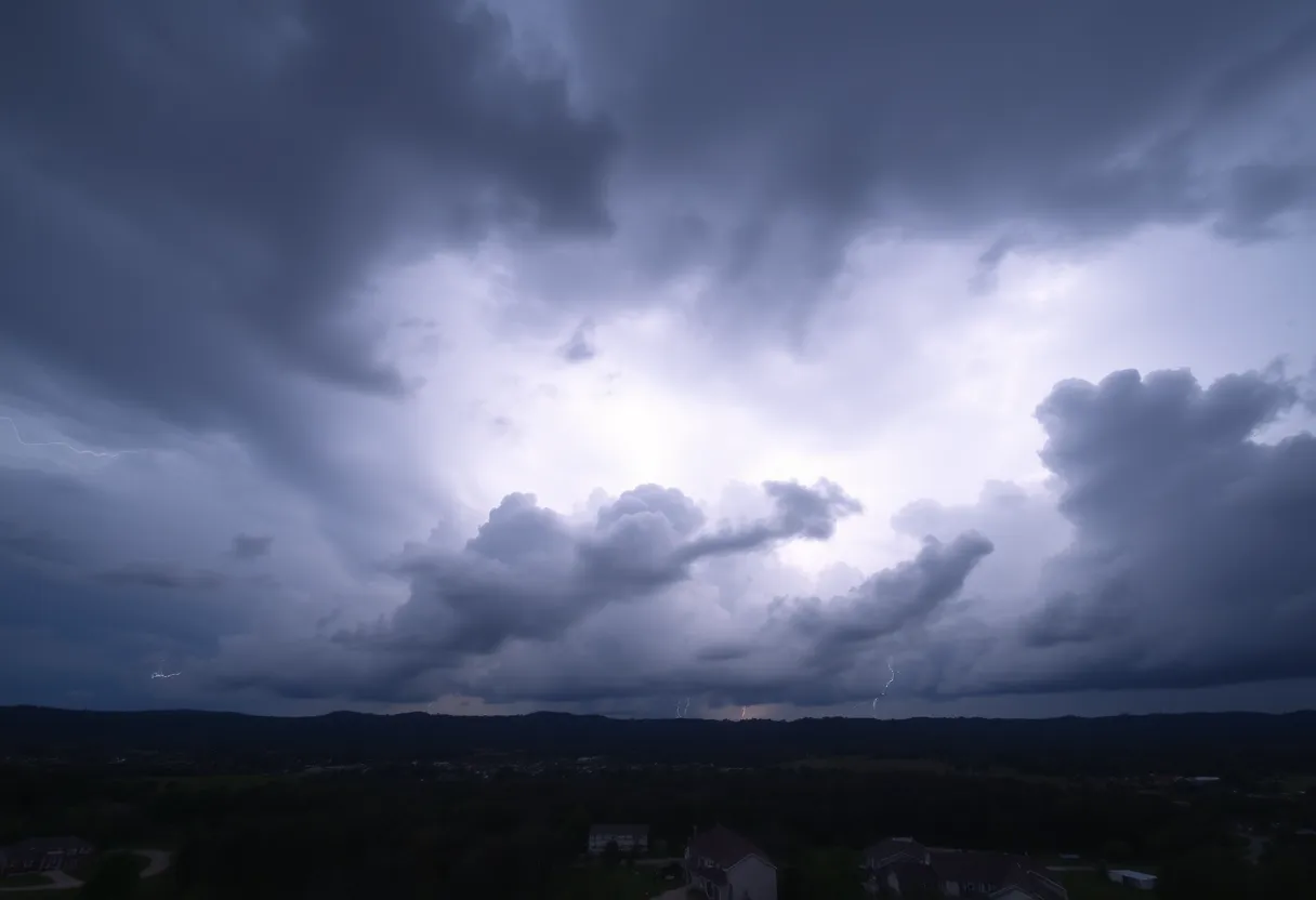
As of Thursday at 6:07 p.m., the National Weather Service (NWS) issued a warning for strong thunderstorms that are forecasted to persist until 6:45 p.m. for Greenville County. If you’re in the area, you’ll want to pay close attention!
What to Expect
According to the NWS, be on the lookout for pea-sized hail (that’s about 0.25 inches for those who like specifics) and wind gusts that could reach up to a staggering 40 mph. Doppler radar currently shows a strong thunderstorm rolling in near Downtown Greenville, moving southeast at about 15 mph.
This storm has the potential to create some unwanted chaos! Expect gusty winds that could easily knock down tree limbs and blow around any unsecured items—so you may want to finally bring in that garden gnome you’ve been procrastinating about!
Areas Warning!
The alert affects several areas, including Greenville Downtown, Greenville Eastside, Mauldin, Donaldson Center, Simpsonville, Five Forks, and West Greenville. If you’re in these locations, it’s best to seek shelter indoors while the storm is passing.
Safety First!
Remember, lightning is no joke! The U.S. experiences about 25 million lightning strikes every year, especially during the summer months, leading to approximately 20 fatalities. As a storm approaches, the likelihood of lightning striking increases. It’s also important to be careful of hydroplaning during storms, which happens when your car starts to slide uncontrollably on wet roads due to water buildup in front of the tires.
Stay Indoors if You Can!
With the NWS emphasizing the importance of staying indoors, please take this advice seriously. If you need to drive during these storms, be cautious and avoid flooded roadways. Torrential rainfall could lead to localized flooding, and it’s better to be safe than sorry!
More Storms Ahead
Just when you thought it was over, there’s more to come! An earlier report on Wednesday warned of strong thunderstorms until 4:15 p.m. for both Greenville and Spartanburg counties. During that alert, wind gusts were predicted to hit up to 50 mph and hail could have been as large as penny-sized (0.75 inches). Areas affected then included Landrum, Inman, Campobello, Lake Bowen, Boiling Springs SC, Gowensville, and Fingerville.
Looking Ahead
Fast forward to the first week of August, and it looks like the weather might not be cutting us a break just yet! With high temperatures hovering around 90 degrees, the potential for severe storms is on the rise again. Expect heavy rain, strong winds, and—surprise, surprise—hail, with a cooling ridge of high pressure likely heading our way shortly after.
So, folks, make sure you check the weather regularly, keep those emergency kits stocked up, and remember that our lovely city is tough enough to weather the storm. Stay safe out there, everyone!
Deeper Dive: News & Info About This Topic
HERE Resources
Thunderstorms Roll into Greater Oconee: Stay Safe!
Severe Thunderstorm Hits Upstate South Carolina
Severe Thunderstorm Warning Issued for South Carolina
Severe Thunderstorms Strike Upstate South Carolina and East Tennessee
Severe Thunderstorm Warnings Sweep Through Charleston
Severe Storms and Record Flooding Hit Wauwatosa, Wisconsin
Charleston Prepares for Heavy Rainfall and Flood Warnings
Tom S. Gettys Center to Remain Open in Rock Hill
Severe Flash Flood Warning Hits Myrtle Beach: Residents Urged to Stay Safe
Severe Thunderstorms Cause Disruption in South Carolina and Alabama
Additional Resources
- Greenville Online
- Wikipedia: Thunderstorm
- Island Packet
- Google Search: thunderstorm alerts
- Fox Carolina
- Google Scholar: thunderstorm warnings
- WYFF4
- Encyclopedia Britannica: severe weather
- Herald Online
- Google News: severe thunderstorm alerts
Author: STAFF HERE ROCK HILL
The ROCK HILL STAFF WRITER represents the experienced team at HERERockHill.com, your go-to source for actionable local news and information in Rock Hill, York County, and beyond. Specializing in "news you can use," we cover essential topics like product reviews for personal and business needs, local business directories, politics, real estate trends, neighborhood insights, and state news affecting the area—with deep expertise drawn from years of dedicated reporting and strong community input, including local press releases and business updates. We deliver top reporting on high-value events such as the Come-See-Me Festival, Rock Hill Arts Festival, and motorsport events at the Rock Hill Velodrome. Our coverage extends to key organizations like the Rock Hill Chamber of Commerce and the Culture & Heritage Museums, plus leading businesses in manufacturing and technology that power the local economy such as 3D Systems and Comporium. As part of the broader HERE network, including HEREAiken.com, HEREBeaufort.com, HEREChapin.com, HERECharleston.com, HEREClinton.com, HEREColumbia.com, HEREGeorgetown.com, HEREGreenwood.com, HEREGreenville.com, HEREHiltonHead.com, HEREIrmo.com, HEREMyrtleBeach.com, HERENewberry.com, HERERockHill.com, and HERESpartanburg.com, we provide comprehensive, credible insights into South Carolina's dynamic landscape.

